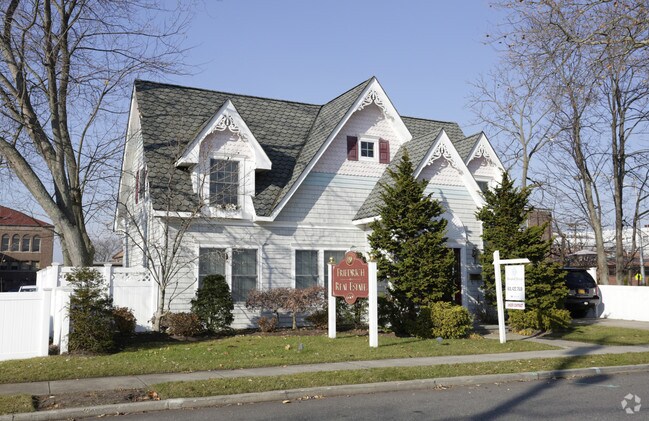
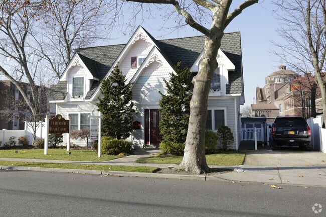
Property Record
60 Oak Pl, Babylon, NY 11702
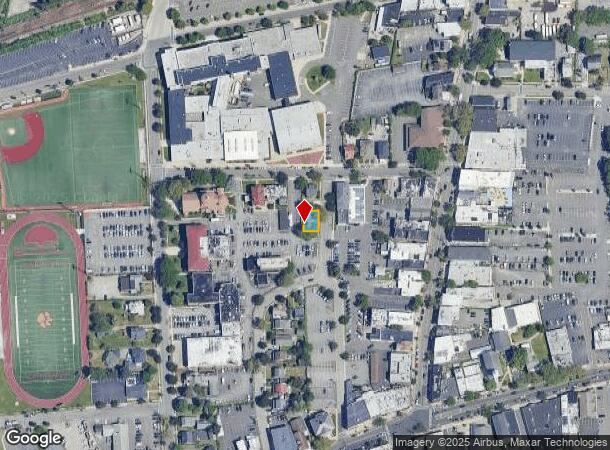
NEARBY LISTINGS FOR SALE OR LEASE
Property Detail
60 Oak Pl
0102-010-00-03-00-023-000
FILED MAP 279 LOT SO. PT 14
Commercialnec
Suffolk
X
New York
36103C0854H
23
2024
0.06 AC
2024
Southwestern Suffolk
158102
Long Island (New York)
1,359 SF
Nassau County-Suffolk County, NY
DEMOGRAPHICS near 60 Oak Pl
1 Mile
3 Mile
5 Mile
2024 Total Population
13,366
104,718
241,239
2029 Population
13,183
102,583
235,731
Pop Growth 2024-2029
(1.37%)
(2.04%)
(2.28%)
Average Age
41
42
40
2024 Total Households
4,867
35,825
77,913
HH Growth 2024-2029
(1.64%)
(2.29%)
(2.47%)
Median Household Inc
$135,767
$120,202
$112,331
Avg Household Size
2.70
2.80
3.00
2024 Avg HH Vehicles
2.00
2.00
2.00
Median Home Value
$634,451
$471,916
$452,258
Median Year Built
1955
1959
1960
Nearby Places
- Restaurants
- Banks
- Shops
- Fitness
- Groceries
PUBLIC TRANSPORTATION
COMMUTER RAIL
Babylon Station (Babylon Branch - Long Island Rail Road, Montauk Branch - Long Island Rail Road)
DRIVE
WALK
Distance
Babylon Station (Babylon Branch - Long Island Rail Road, Montauk Branch - Long Island Rail Road)
1 min
6 min
0.3 mi
Lindenhurst Station (Babylon Branch - Long Island Rail Road)
DRIVE
WALK
Distance
Lindenhurst Station (Babylon Branch - Long Island Rail Road)
5 min
2.8 mi
AIRPORT
Long Island MacArthur
DRIVE
WALK
Distance
Long Island MacArthur
25 min
16.6 mi
John F Kennedy International
DRIVE
WALK
Distance
John F Kennedy International
41 min
28.8 mi
LaGuardia
DRIVE
WALK
Distance
LaGuardia
52 min
35.8 mi
Freight Ports
NY - Red Hook Container Terminal
DRIVE
WALK
Distance
NY - Red Hook Container Terminal
62 min
40.2 mi
SALE & LEASE HISTORY
LISTING DATE
SALE/LEASE

Jun 05, 2017
For Sale
Nearby Properties
Address
Land Use
TOTAL SIZE
Lot Size
Zoning
Address
Land Use
TOTAL SIZE
Lot Size
Zoning
48.97 AC
GSC
Address
Land Use
TOTAL SIZE
Lot Size
Zoning
256 SF
24.20 AC
GSC
Address
Land Use
TOTAL SIZE
Lot Size
Zoning
20 AC
A
Address
Land Use
TOTAL SIZE
Lot Size
Zoning
10.07 AC
Address
Land Use
TOTAL SIZE
Lot Size
Zoning
20.50 AC
B
Address
Land Use
TOTAL SIZE
Lot Size
Zoning
15 AC
A
Address
Land Use
TOTAL SIZE
Lot Size
Zoning
231.30 AC
AAA
Address
Land Use
TOTAL SIZE
Lot Size
Zoning
20.10 AC
A
Address
Land Use
TOTAL SIZE
Lot Size
Zoning
4,290 SF
1.50 AC
VILLA
Address
Land Use
TOTAL SIZE
Lot Size
Zoning
18.70 AC
A
Address
Land Use
TOTAL SIZE
Lot Size
Zoning
6.66 AC
A
Address
Land Use
TOTAL SIZE
Lot Size
Zoning
9.80 AC
AA
Address
Land Use
TOTAL SIZE
Lot Size
Zoning
10.22 AC
IBD
Address
Land Use
TOTAL SIZE
Lot Size
Zoning
14.60 AC
A
Address
Land Use
TOTAL SIZE
Lot Size
Zoning
13.30 AC
A
Address
Land Use
TOTAL SIZE
Lot Size
Zoning
10.90 AC
IND1
Address
Land Use
TOTAL SIZE
Lot Size
Zoning
9.70 AC
B
Address
Land Use
TOTAL SIZE
Lot Size
Zoning
19.40 AC
IND1
Address
Land Use
TOTAL SIZE
Lot Size
Zoning
11 AC
B
Address
Land Use
TOTAL SIZE
Lot Size
Zoning
7.50 AC
B
Address
Land Use
TOTAL SIZE
Lot Size
Zoning
6.37 AC
BUS1
Address
Land Use
TOTAL SIZE
Lot Size
Zoning
6.37 AC
BUS3
Address
Land Use
TOTAL SIZE
Lot Size
Zoning
1.82 AC
Address
Land Use
TOTAL SIZE
Lot Size
Zoning
1.85 AC
BUS3
Address
Land Use
TOTAL SIZE
Lot Size
Zoning
15.60 AC
A
Address
Land Use
TOTAL SIZE
Lot Size
Zoning
3.60 AC
BUS1
Address
Land Use
TOTAL SIZE
Lot Size
Zoning
2.40 AC
A
Address
Land Use
TOTAL SIZE
Lot Size
Zoning
14.40 AC
NULL
Address
Land Use
TOTAL SIZE
Lot Size
Zoning
3.04 AC
BUS1
Address
Land Use
TOTAL SIZE
Lot Size
Zoning
3.91 AC
IND1
The World's #1 Commercial Real Estate Marketplace
Connect with us
© 2025 CoStar Group
The information above has been obtained from sources believed reliable. While we do not doubt its accuracy we have not verified it and make no guarantee, warranty or representation about it. It is your responsibility to independently confirm its accuracy and completeness. Any projections, opinions, assumptions, or estimates used are for example only and do not represent the current or future performance of the property. The value of this transaction to you depends on tax and other factors which should be evaluated by your tax, financial, and legal advisors. You and your advisors should conduct a careful, independent investigation of the property to determine to your satisfaction the suitability of the property for your needs.