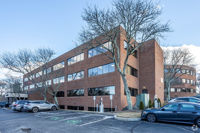
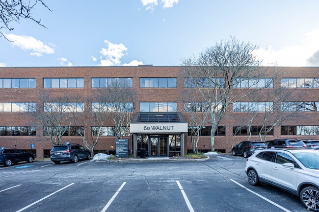
Property Record
60 Walnut St, Wellesley Hills, MA 02481

Current Lease Availabilities
Property Detail
60 Walnut St
WELL-000020-000003
NORFOLK
Officebuilding
Massachusetts
B and X Area of moderate flood hazard, usually the area between the limits of the 100-year and 500-year floods.
0.66 AC
2025
Wellesley/Needham
2025
Boston
404100
Boston-Cambridge-Newton, MA-NH
NEARBY LISTINGS FOR SALE OR LEASE
DEMOGRAPHICS near 60 Walnut St
1 mile
3 mile
5 mile
2025 Total Population
10,189
96,843
261,379
2030 Population
10,628
100,207
269,809
Pop Growth 2025-2030
+ 4.31%
+ 3.47%
+ 3.23%
Average Age
42
41
40
2025 Total Households
3,454
34,785
95,385
HH Growth 2025-2030
+ 4.52%
+ 3.63%
+ 3.45%
Median Household Inc
$239,078
$190,217
$160,222
Avg Household Size
2.70
2.60
2.50
2025 Avg HH Vehicles
2.00
2.00
2.00
Median Home Value
$1,120,360
$1,096,074
$1,044,588
Median Year Built
1951
1951
1953
Nearby Places
Map Layers
Map Styles
 Street
 Aerial
Layers
 Traffic
 Biking
Places
Listings with unknown addresses are not visible on the map
- Restaurants
- Banks
- Shops
- Fitness
- Groceries
PUBLIC TRANSPORTATION
TRANSIT/SUBWAY
Woodland Station (Green Line - D - Massachusetts Bay Transportation Authority Subway (The T))
Drive
Walk
Distance
Woodland Station (Green Line - D - Massachusetts Bay Transportation Authority Subway (The T))
2 min
18 min
0.9 mi
COMMUTER RAIL
Wellesley Farms (Framingham/Worcester Line - Massachusetts Bay Transportation Authority Commuter Rail (Purple Line))
Drive
Walk
Distance
Wellesley Farms (Framingham/Worcester Line - Massachusetts Bay Transportation Authority Commuter Rail (Purple Line))
3 min
1.2 mi
Auburndale (Framingham/Worcester Line - Massachusetts Bay Transportation Authority Commuter Rail (Purple Line))
Drive
Walk
Distance
Auburndale (Framingham/Worcester Line - Massachusetts Bay Transportation Authority Commuter Rail (Purple Line))
13 min
7.9 mi
AIRPORT
General Edward Lawrence Logan International
Drive
Walk
Distance
General Edward Lawrence Logan International
24 min
14.9 mi
Freight Ports
Port of Boston
Drive
Walk
Distance
Port of Boston
22 min
13.3 mi
Nearby Properties
Address
Land Use
TOTAL SIZE
Lot Size
Zoning
Address
Land Use
TOTAL SIZE
Lot Size
Zoning
387,550 SF
7.99 AC
MU1
Address
Land Use
TOTAL SIZE
Lot Size
Zoning
412,208 SF
7.93 AC
I
Address
Land Use
TOTAL SIZE
Lot Size
Zoning
522,600 SF
59.54 AC
A2
Address
Land Use
TOTAL SIZE
Lot Size
Zoning
10.87 AC
SRD 10
Address
Land Use
TOTAL SIZE
Lot Size
Zoning
4.74 AC
NEBC
Address
Land Use
TOTAL SIZE
Lot Size
Zoning
76,800 SF
22.65 AC
MU1
Address
Land Use
TOTAL SIZE
Lot Size
Zoning
220,500 SF
1.96 AC
NEBC
Address
Land Use
TOTAL SIZE
Lot Size
Zoning
293,195 SF
11.55 AC
BU5
Address
Land Use
TOTAL SIZE
Lot Size
Zoning
391,781 SF
8.22 AC
Address
Land Use
TOTAL SIZE
Lot Size
Zoning
208,500 SF
13.98 AC
I
Address
Land Use
TOTAL SIZE
Lot Size
Zoning
6.33 AC
SR10
Address
Land Use
TOTAL SIZE
Lot Size
Zoning
189,858 SF
61.45 AC
A
Address
Land Use
TOTAL SIZE
Lot Size
Zoning
Address
Land Use
TOTAL SIZE
Lot Size
Zoning
Address
Land Use
TOTAL SIZE
Lot Size
Zoning
144,584 SF
4.86 AC
PUB
Address
Land Use
TOTAL SIZE
Lot Size
Zoning
264,014 SF
10.64 AC
NEBC
Address
Land Use
TOTAL SIZE
Lot Size
Zoning
179,963 SF
41.28 AC
A
Address
Land Use
TOTAL SIZE
Lot Size
Zoning
15.60 AC
Address
Land Use
TOTAL SIZE
Lot Size
Zoning
30,027 SF
96.45 AC
ORD
Address
Land Use
TOTAL SIZE
Lot Size
Zoning
170,966 SF
2.84 AC
MU4
Address
Land Use
TOTAL SIZE
Lot Size
Zoning
80,447 SF
6.52 AC
PUB
Address
Land Use
TOTAL SIZE
Lot Size
Zoning
15.08 AC
SR10
Address
Land Use
TOTAL SIZE
Lot Size
Zoning
203,738 SF
6.94 AC
Address
Land Use
TOTAL SIZE
Lot Size
Zoning
84.78 AC
Address
Land Use
TOTAL SIZE
Lot Size
Zoning
2,537 SF
14.43 AC
SR3
Address
Land Use
TOTAL SIZE
Lot Size
Zoning
408,199 SF
23.35 AC
NEBC
Address
Land Use
TOTAL SIZE
Lot Size
Zoning
211,500 SF
12.09 AC
I
Address
Land Use
TOTAL SIZE
Lot Size
Zoning
Address
Land Use
TOTAL SIZE
Lot Size
Zoning
49.88 AC
T
Address
Land Use
TOTAL SIZE
Lot Size
Zoning
224,517 SF
14 AC
B
The World's #1 Commercial Real Estate Marketplace
Connect with us
© 2026 CoStar Group
The information above has been obtained from sources believed reliable. While we do not doubt its accuracy we have not verified it and make no guarantee, warranty or representation about it. It is your responsibility to independently confirm its accuracy and completeness. Any projections, opinions, assumptions, or estimates used are for example only and do not represent the current or future performance of the property. The value of this transaction to you depends on tax and other factors which should be evaluated by your tax, financial, and legal advisors. You and your advisors should conduct a careful, independent investigation of the property to determine to your satisfaction the suitability of the property for your needs.