Property Record
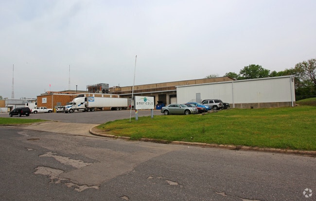
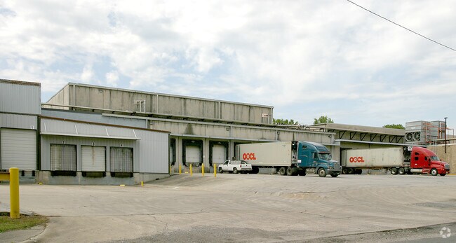
600 25Th Ave W, Birmingham, AL 35204
NEARBY LISTINGS FOR SALE OR LEASE
Property Detail
600 25Th Ave W
Birmingham-Hoover, AL
Southern Rail Re 22-22-3
22-00-28-1-001-002.000
LOT 3 SOUTHERN RAILWAY RESUR OF PART OF WADE TRACT 97/22
Warehouse
Jefferson
X
Alabama
01073C0386G
3
2023
5.01 AC
2024
Fultondale
001200
Birmingham
99,455 SF
DEMOGRAPHICS near 600 25Th Ave W
1 Mile
3 Mile
5 Mile
2024 Total Population
2,434
53,117
149,420
2029 Population
2,476
54,087
150,136
Pop Growth 2024-2029
+ 1.73%
+ 1.83%
+ 0.48%
Average Age
43
41
39
2024 Total Households
1,022
23,020
66,773
HH Growth 2024-2029
+ 1.66%
+ 2.07%
+ 0.56%
Median Household Inc
$30,125
$31,861
$37,876
Avg Household Size
2.20
2.10
2.00
2024 Avg HH Vehicles
2.00
1.00
1.00
Median Home Value
$57,921
$85,381
$104,712
Median Year Built
1954
1964
1965
Nearby Places
Map Layers
Map Styles
 Street
 Aerial
- Restaurants
- Banks
- Shops
- Fitness
- Groceries
PUBLIC TRANSPORTATION
COMMUTER RAIL
DRIVE
WALK
Distance
9 min
4.4 mi
AIRPORT
Birmingham-Shuttlesworth International
DRIVE
WALK
Distance
Birmingham-Shuttlesworth International
15 min
9.2 mi
Nearby Properties
Address
Land Use
TOTAL SIZE
Lot Size
Zoning
Address
Land Use
TOTAL SIZE
Lot Size
Zoning
305,826 SF
3.68 AC
B4
Address
Land Use
TOTAL SIZE
Lot Size
Zoning
224,049 SF
4.33 AC
M1
Address
Land Use
TOTAL SIZE
Lot Size
Zoning
203,878 SF
12.58 AC
B6
Address
Land Use
TOTAL SIZE
Lot Size
Zoning
230,441 SF
10.22 AC
M1
Address
Land Use
TOTAL SIZE
Lot Size
Zoning
183,862 SF
9.66 AC
B4
Address
Land Use
TOTAL SIZE
Lot Size
Zoning
334,463 SF
1.92 AC
B4
Address
Land Use
TOTAL SIZE
Lot Size
Zoning
94,958 SF
4.47 AC
M1
Address
Land Use
TOTAL SIZE
Lot Size
Zoning
106,144 SF
1.09 AC
B4
Address
Land Use
TOTAL SIZE
Lot Size
Zoning
57,066 SF
0.80 AC
B4
Address
Land Use
TOTAL SIZE
Lot Size
Zoning
79,458 SF
1.37 AC
B4
Address
Land Use
TOTAL SIZE
Lot Size
Zoning
344,150 SF
42 AC
R5
Address
Land Use
TOTAL SIZE
Lot Size
Zoning
1.66 AC
M1-B
Address
Land Use
TOTAL SIZE
Lot Size
Zoning
1.54 AC
B4
Address
Land Use
TOTAL SIZE
Lot Size
Zoning
29,136 SF
1.58 AC
B4
Address
Land Use
TOTAL SIZE
Lot Size
Zoning
37,733 SF
0.84 AC
B-4
Address
Land Use
TOTAL SIZE
Lot Size
Zoning
416,477 SF
80 AC
R5
Address
Land Use
TOTAL SIZE
Lot Size
Zoning
109,819 SF
2.91 AC
M2
Address
Land Use
TOTAL SIZE
Lot Size
Zoning
37,640 SF
1.76 AC
B4
Address
Land Use
TOTAL SIZE
Lot Size
Zoning
111,309 SF
1.29 AC
B-4
Address
Land Use
TOTAL SIZE
Lot Size
Zoning
120,768 SF
1.75 AC
B4
Address
Land Use
TOTAL SIZE
Lot Size
Zoning
156,986 SF
1.29 AC
M1
Address
Land Use
TOTAL SIZE
Lot Size
Zoning
1.69 AC
B4
Address
Land Use
TOTAL SIZE
Lot Size
Zoning
97,377 SF
1.63 AC
M1
Address
Land Use
TOTAL SIZE
Lot Size
Zoning
123,136 SF
4.59 AC
M2
Address
Land Use
TOTAL SIZE
Lot Size
Zoning
2.20 AC
M1
Address
Land Use
TOTAL SIZE
Lot Size
Zoning
Address
Land Use
TOTAL SIZE
Lot Size
Zoning
159,822 SF
1.30 AC
M1
Address
Land Use
TOTAL SIZE
Lot Size
Zoning
41,829 SF
0.49 AC
B-4
Address
Land Use
TOTAL SIZE
Lot Size
Zoning
113,107 SF
2.18 AC
B4
Address
Land Use
TOTAL SIZE
Lot Size
Zoning
2,017,741 SF
37.70 AC
M2M1
The World's #1 Commercial Real Estate Marketplace
Connect with us
© 2026 CoStar Group
The information above has been obtained from sources believed reliable. While we do not doubt its accuracy we have not verified it and make no guarantee, warranty or representation about it. It is your responsibility to independently confirm its accuracy and completeness. Any projections, opinions, assumptions, or estimates used are for example only and do not represent the current or future performance of the property. The value of this transaction to you depends on tax and other factors which should be evaluated by your tax, financial, and legal advisors. You and your advisors should conduct a careful, independent investigation of the property to determine to your satisfaction the suitability of the property for your needs.