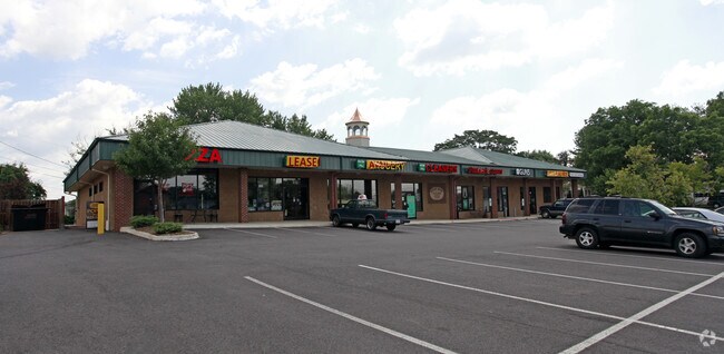
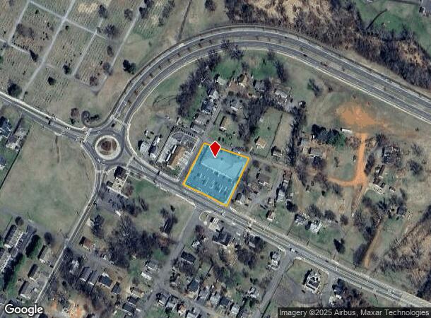
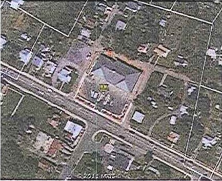
Property Record
600 Sperryville Pike, Culpeper, VA 22701
NEARBY LISTINGS FOR SALE OR LEASE
Property Detail
600 Sperryville Pike
40-A-5-19
Consolidation M Corbin, L
Commercialnec
OPP TRIPLETT MILLS PF 1/118; PF 4/807
X
Culpeper
51047C0207D
Virginia
2024
0.98 AC
2025
Suburban Virginia Area
930204
Other Market Areas
11,400 SF
Washington-Arlington-Alexandria, DC-VA-MD-WV
DEMOGRAPHICS near 600 Sperryville Pike
1 Mile
3 Mile
5 Mile
2024 Total Population
9,449
27,256
34,660
2029 Population
10,341
29,823
37,922
Pop Growth 2024-2029
+ 9.44%
+ 9.42%
+ 9.41%
Average Age
37
38
39
2024 Total Households
3,245
9,447
11,972
HH Growth 2024-2029
+ 9.74%
+ 9.62%
+ 9.60%
Median Household Inc
$78,485
$82,640
$86,176
Avg Household Size
2.80
2.80
2.80
2024 Avg HH Vehicles
2.00
2.00
2.00
Median Home Value
$322,773
$325,756
$335,525
Median Year Built
1993
1993
1993
Nearby Places
Map Layers
Map Styles
 Street
 Aerial
- Restaurants
- Banks
- Shops
- Fitness
- Groceries
PUBLIC TRANSPORTATION
COMMUTER RAIL
Culpeper Amtrak Station (Cardinal - Amtrak, Crescent - Amtrak, Northeast Regional - Amtrak)
DRIVE
WALK
Distance
Culpeper Amtrak Station (Cardinal - Amtrak, Crescent - Amtrak, Northeast Regional - Amtrak)
2 min
16 min
0.9 mi
Freight Ports
Virginia Port Authority - Richmond
DRIVE
WALK
Distance
Virginia Port Authority - Richmond
125 min
95.1 mi
SALE & LEASE HISTORY
LISTING DATE
SALE/LEASE

Sep 25, 2016
For Lease
Nearby Properties
Address
Land Use
TOTAL SIZE
Lot Size
Zoning
Address
Land Use
TOTAL SIZE
Lot Size
Zoning
377,903 SF
30.12 AC
LI
Address
Land Use
TOTAL SIZE
Lot Size
Zoning
386,833 SF
15.80 AC
R1
Address
Land Use
TOTAL SIZE
Lot Size
Zoning
165,275 SF
78.67 AC
R1
Address
Land Use
TOTAL SIZE
Lot Size
Zoning
147,265 SF
29.61 AC
M1
Address
Land Use
TOTAL SIZE
Lot Size
Zoning
166,825 SF
11.09 AC
R2
Address
Land Use
TOTAL SIZE
Lot Size
Zoning
135,497 SF
108.90 AC
R2
Address
Land Use
TOTAL SIZE
Lot Size
Zoning
220,403 SF
8.91 AC
R1
Address
Land Use
TOTAL SIZE
Lot Size
Zoning
58.15 AC
M2
Address
Land Use
TOTAL SIZE
Lot Size
Zoning
58.15 AC
M2
Address
Land Use
TOTAL SIZE
Lot Size
Zoning
54.85 AC
LI
Address
Land Use
TOTAL SIZE
Lot Size
Zoning
49.54 AC
LI
Address
Land Use
TOTAL SIZE
Lot Size
Zoning
48.41 AC
LI
Address
Land Use
TOTAL SIZE
Lot Size
Zoning
43.71 AC
LI
Address
Land Use
TOTAL SIZE
Lot Size
Zoning
41.97 AC
LI
Address
Land Use
TOTAL SIZE
Lot Size
Zoning
43,800 SF
13.28 AC
C3
Address
Land Use
TOTAL SIZE
Lot Size
Zoning
19,602 SF
10.32 AC
M1
Address
Land Use
TOTAL SIZE
Lot Size
Zoning
35.27 AC
M2
Address
Land Use
TOTAL SIZE
Lot Size
Zoning
34.64 AC
M2
Address
Land Use
TOTAL SIZE
Lot Size
Zoning
66,558 SF
29.23 AC
R2
Address
Land Use
TOTAL SIZE
Lot Size
Zoning
6,294 SF
33.37 AC
M2
Address
Land Use
TOTAL SIZE
Lot Size
Zoning
179,344 SF
17.34 AC
C3
Address
Land Use
TOTAL SIZE
Lot Size
Zoning
38,890 SF
32.91 AC
LIRA
Address
Land Use
TOTAL SIZE
Lot Size
Zoning
63,866 SF
8.99 AC
C3
Address
Land Use
TOTAL SIZE
Lot Size
Zoning
230,016 SF
89.13 AC
LI
Address
Land Use
TOTAL SIZE
Lot Size
Zoning
28.26 AC
LI
Address
Land Use
TOTAL SIZE
Lot Size
Zoning
201,634 SF
18.40 AC
M2
Address
Land Use
TOTAL SIZE
Lot Size
Zoning
69,372 SF
7.93 AC
C3
Address
Land Use
TOTAL SIZE
Lot Size
Zoning
82,000 SF
13.24 AC
R1
Address
Land Use
TOTAL SIZE
Lot Size
Zoning
68,613 SF
22.46 AC
M2
Address
Land Use
TOTAL SIZE
Lot Size
Zoning
13,474 SF
16.58 AC
PUD
The World's #1 Commercial Real Estate Marketplace
Connect with us
© 2025 CoStar Group
The information above has been obtained from sources believed reliable. While we do not doubt its accuracy we have not verified it and make no guarantee, warranty or representation about it. It is your responsibility to independently confirm its accuracy and completeness. Any projections, opinions, assumptions, or estimates used are for example only and do not represent the current or future performance of the property. The value of this transaction to you depends on tax and other factors which should be evaluated by your tax, financial, and legal advisors. You and your advisors should conduct a careful, independent investigation of the property to determine to your satisfaction the suitability of the property for your needs.