Property Record
600 Houze Way, Roswell, GA 30076
Current Lease Availabilities
NEARBY LISTINGS FOR SALE OR LEASE
Property Detail
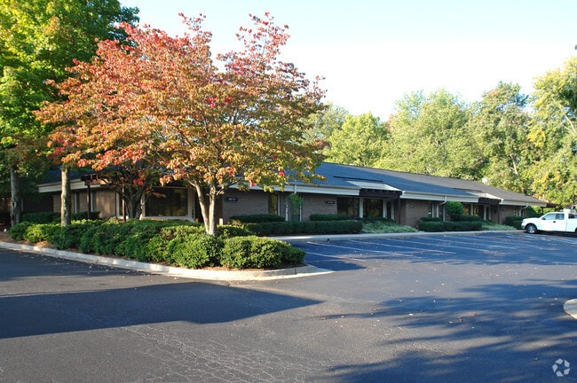
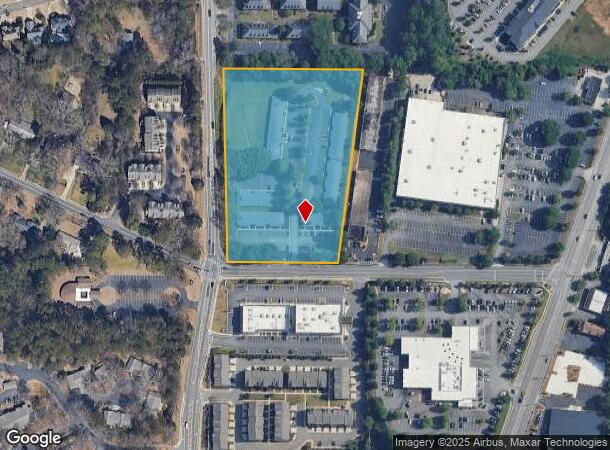
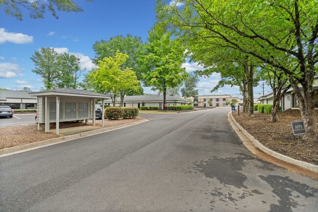
600 Houze Way
Atlanta-Sandy Springs-Roswell, GA
North Fulton Executive Square
12-2071-0483-001-9
40
Officecondo
Fulton
X
Georgia
13121C0062F
40
2024
0.02 AC
2025
N Fulton/Forsyth County
011416
Atlanta
964 SF
DEMOGRAPHICS near 600 Houze Way
1 Mile
3 Mile
5 Mile
2024 Total Population
6,583
64,900
164,178
2029 Population
6,830
66,401
167,393
Pop Growth 2024-2029
+ 3.75%
+ 2.31%
+ 1.96%
Average Age
42
40
40
2024 Total Households
2,755
25,921
64,386
HH Growth 2024-2029
+ 3.88%
+ 2.50%
+ 2.10%
Median Household Inc
$120,631
$112,903
$122,621
Avg Household Size
2.30
2.40
2.50
2024 Avg HH Vehicles
2.00
2.00
2.00
Median Home Value
$392,983
$428,281
$483,348
Median Year Built
1990
1990
1989
Nearby Places
Map Layers
Map Styles
 Street
 Aerial
- Restaurants
- Banks
- Shops
- Fitness
- Groceries
PUBLIC TRANSPORTATION
AIRPORT
Hartsfield - Jackson Atlanta International
DRIVE
WALK
Distance
Hartsfield - Jackson Atlanta International
46 min
32.3 mi
Freight Ports
Georgia Ports - Savannah
DRIVE
WALK
Distance
Georgia Ports - Savannah
309 min
271.6 mi
Nearby Properties
Address
Land Use
TOTAL SIZE
Lot Size
Zoning
Address
Land Use
TOTAL SIZE
Lot Size
Zoning
683,219 SF
48.04 AC
R4C
Address
Land Use
TOTAL SIZE
Lot Size
Zoning
1,078,010 SF
3.80 AC
OPC
Address
Land Use
TOTAL SIZE
Lot Size
Zoning
415,701 SF
6.75 AC
OI
Address
Land Use
TOTAL SIZE
Lot Size
Zoning
3,459,339 SF
26.51 AC
OI
Address
Land Use
TOTAL SIZE
Lot Size
Zoning
5,892,558 SF
33.38 AC
R4
Address
Land Use
TOTAL SIZE
Lot Size
Zoning
11.82 AC
Address
Land Use
TOTAL SIZE
Lot Size
Zoning
380,453 SF
10.28 AC
R4
Address
Land Use
TOTAL SIZE
Lot Size
Zoning
260,648 SF
34.20 AC
C3C
Address
Land Use
TOTAL SIZE
Lot Size
Zoning
1,672,146 SF
21.21 AC
R4
Address
Land Use
TOTAL SIZE
Lot Size
Zoning
1,159,560 SF
7.12 AC
CUP
Address
Land Use
TOTAL SIZE
Lot Size
Zoning
2,674,992 SF
28.94 AC
R4C
Address
Land Use
TOTAL SIZE
Lot Size
Zoning
7,788,760 SF
46.55 AC
R4
Address
Land Use
TOTAL SIZE
Lot Size
Zoning
10,614,240 SF
24.05 AC
A
Address
Land Use
TOTAL SIZE
Lot Size
Zoning
2,109,527 SF
70.17 AC
OP
Address
Land Use
TOTAL SIZE
Lot Size
Zoning
666,599 SF
24.20 AC
PSC
Address
Land Use
TOTAL SIZE
Lot Size
Zoning
8,014,916 SF
28.58 AC
R4
Address
Land Use
TOTAL SIZE
Lot Size
Zoning
510,068 SF
64.18 AC
OPMS
Address
Land Use
TOTAL SIZE
Lot Size
Zoning
938,151 SF
21.22 AC
C3
Address
Land Use
TOTAL SIZE
Lot Size
Zoning
308,494 SF
2.64 AC
OI
Address
Land Use
TOTAL SIZE
Lot Size
Zoning
367,876 SF
41.40 AC
PSC
Address
Land Use
TOTAL SIZE
Lot Size
Zoning
1,185,316 SF
19.09 AC
R4
Address
Land Use
TOTAL SIZE
Lot Size
Zoning
264,255 SF
51 AC
E2
Address
Land Use
TOTAL SIZE
Lot Size
Zoning
1,071,370 SF
22.30 AC
R4
Address
Land Use
TOTAL SIZE
Lot Size
Zoning
2,964,850 SF
38.74 AC
R4
Address
Land Use
TOTAL SIZE
Lot Size
Zoning
306,753 SF
19.77 AC
HMS
Address
Land Use
TOTAL SIZE
Lot Size
Zoning
878,080 SF
18.07 AC
CUP
Address
Land Use
TOTAL SIZE
Lot Size
Zoning
247,067 SF
4.97 AC
OI
Address
Land Use
TOTAL SIZE
Lot Size
Zoning
402,680 SF
35.81 AC
Address
Land Use
TOTAL SIZE
Lot Size
Zoning
4,758,628 SF
25.92 AC
R4
Address
Land Use
TOTAL SIZE
Lot Size
Zoning
1,861,254 SF
33 AC
R4C
The World's #1 Commercial Real Estate Marketplace
Connect with us
© 2025 CoStar Group
The information above has been obtained from sources believed reliable. While we do not doubt its accuracy we have not verified it and make no guarantee, warranty or representation about it. It is your responsibility to independently confirm its accuracy and completeness. Any projections, opinions, assumptions, or estimates used are for example only and do not represent the current or future performance of the property. The value of this transaction to you depends on tax and other factors which should be evaluated by your tax, financial, and legal advisors. You and your advisors should conduct a careful, independent investigation of the property to determine to your satisfaction the suitability of the property for your needs.