Property Record
Curtis Saunders Ct, Chesapeake, VA 23321
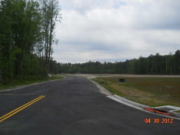

Property Detail
Curtis Saunders Ct
0233002000004
UNIT 4 CORR & AMENDED ENTERPRISE SOUTH COMMERCE PARK 102.055 AC
Commercialacreage
CHESAPEAKE
M1: LIGHT
Virginia
B and X Area of moderate flood hazard, usually the area between the limits of the 100-year and 500-year floods.
102.06 AC
2024
Southern Chesapeake
2025
Hampton Roads
021505
Virginia Beach-Chesapeake-Norfolk, VA-NC
NEARBY LISTINGS FOR SALE OR LEASE
DEMOGRAPHICS near Curtis Saunders Ct
1 mile
3 mile
5 mile
2025 Total Population
1,390
36,582
111,168
2030 Population
1,413
36,522
111,663
Pop Growth 2025-2030
+ 1.65%
(0.16%)
+ 0.45%
Average Age
41
40
39
2025 Total Households
526
13,465
41,498
HH Growth 2025-2030
+ 1.71%
(0.29%)
+ 0.37%
Median Household Inc
$78,030
$72,506
$74,445
Avg Household Size
2.60
2.60
2.60
2025 Avg HH Vehicles
3.00
2.00
2.00
Median Home Value
$385,605
$286,056
$300,426
Median Year Built
1992
1973
1975
Nearby Places
Map Layers
Map Styles
 Street
 Aerial
Layers
 Traffic
 Biking
Places
Listings with unknown addresses are not visible on the map
- Restaurants
- Banks
- Shops
- Fitness
- Groceries
PUBLIC TRANSPORTATION
AIRPORT
Norfolk International
Drive
Walk
Distance
Norfolk International
34 min
18.4 mi
Newport News/Williamsburg International
Drive
Walk
Distance
Newport News/Williamsburg International
49 min
32.5 mi
Freight Ports
Virginia Port Authority - Portsmouth
Drive
Walk
Distance
Virginia Port Authority - Portsmouth
24 min
11.3 mi
Nearby Properties
Address
Land Use
TOTAL SIZE
Lot Size
Zoning
Address
Land Use
TOTAL SIZE
Lot Size
Zoning
71,039 SF
22.69 AC
R10S: RESI
Address
Land Use
TOTAL SIZE
Lot Size
Zoning
1,684 SF
23.36 AC
RMF1: MULT
Address
Land Use
TOTAL SIZE
Lot Size
Zoning
120,471 SF
10.32 AC
M1: LIGHT
Address
Land Use
TOTAL SIZE
Lot Size
Zoning
295,000 SF
27.89 AC
M1: LIGHT
Address
Land Use
TOTAL SIZE
Lot Size
Zoning
206,652 SF
64.32 AC
A1: AGRICU
Address
Land Use
TOTAL SIZE
Lot Size
Zoning
264,975 SF
50.36 AC
R10S: RESI
Address
Land Use
TOTAL SIZE
Lot Size
Zoning
333,833 SF
23.53 AC
M1: LIGHT
Address
Land Use
TOTAL SIZE
Lot Size
Zoning
241,397 SF
50.65 AC
M1: LIGHT
Address
Land Use
TOTAL SIZE
Lot Size
Zoning
195,550 SF
8.58 AC
M1: LIGHT
Address
Land Use
TOTAL SIZE
Lot Size
Zoning
29,828 SF
230.23 AC
MULTI: MUL
Address
Land Use
TOTAL SIZE
Lot Size
Zoning
181,723 SF
41.87 AC
M1: LIGHT
Address
Land Use
TOTAL SIZE
Lot Size
Zoning
143,220 SF
44.78 AC
M1: LIGHT
Address
Land Use
TOTAL SIZE
Lot Size
Zoning
130,510 SF
33.74 AC
M1: LIGHT
Address
Land Use
TOTAL SIZE
Lot Size
Zoning
85,266 SF
10.10 AC
M1: LIGHT
Address
Land Use
TOTAL SIZE
Lot Size
Zoning
193,534 SF
17.99 AC
M1: LIGHT
Address
Land Use
TOTAL SIZE
Lot Size
Zoning
197,533 SF
15 AC
M1: LIGHT
Address
Land Use
TOTAL SIZE
Lot Size
Zoning
98,715 SF
20.64 AC
UR
Address
Land Use
TOTAL SIZE
Lot Size
Zoning
50,486 SF
11.50 AC
M1: LIGHT
Address
Land Use
TOTAL SIZE
Lot Size
Zoning
48,511 SF
20.71 AC
M1: LIGHT
Address
Land Use
TOTAL SIZE
Lot Size
Zoning
115,740 SF
12.07 AC
M1: LIGHT
Address
Land Use
TOTAL SIZE
Lot Size
Zoning
174,400 SF
10.97 AC
URM
Address
Land Use
TOTAL SIZE
Lot Size
Zoning
201,612 SF
12.54 AC
IL
Address
Land Use
TOTAL SIZE
Lot Size
Zoning
188,496 SF
12 AC
M1: LIGHT
Address
Land Use
TOTAL SIZE
Lot Size
Zoning
165,281 SF
14 AC
M1: LIGHT
Address
Land Use
TOTAL SIZE
Lot Size
Zoning
8,820 SF
26.40 AC
M1: LIGHT
Address
Land Use
TOTAL SIZE
Lot Size
Zoning
25,610 SF
5.16 AC
B4: SHOPPI
Address
Land Use
TOTAL SIZE
Lot Size
Zoning
41,335 SF
16.35 AC
M1: LIGHT
Address
Land Use
TOTAL SIZE
Lot Size
Zoning
100,792 SF
16.35 AC
R8S: RESID
Address
Land Use
TOTAL SIZE
Lot Size
Zoning
25,133 SF
34.93 AC
AC: ASSEMB
Address
Land Use
TOTAL SIZE
Lot Size
Zoning
64,721 SF
12.15 AC
M1: LIGHT
The World's #1 Commercial Real Estate Marketplace
Connect with us
© 2026 CoStar Group
The information above has been obtained from sources believed reliable. While we do not doubt its accuracy we have not verified it and make no guarantee, warranty or representation about it. It is your responsibility to independently confirm its accuracy and completeness. Any projections, opinions, assumptions, or estimates used are for example only and do not represent the current or future performance of the property. The value of this transaction to you depends on tax and other factors which should be evaluated by your tax, financial, and legal advisors. You and your advisors should conduct a careful, independent investigation of the property to determine to your satisfaction the suitability of the property for your needs.