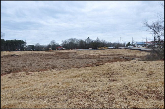
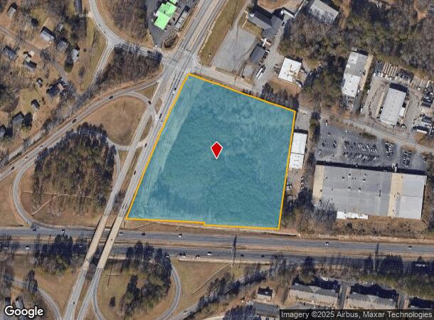
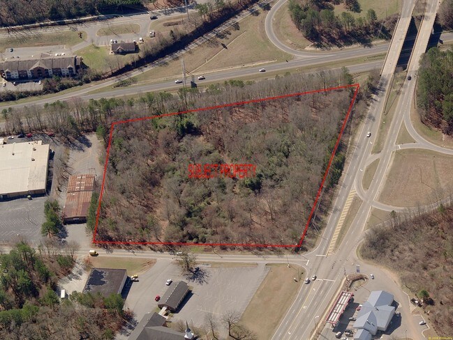
Property Record
600 Danielsville Rd, Athens, GA 30601

NEARBY LISTINGS FOR SALE OR LEASE
Property Detail
600 Danielsville Rd
Athens-Clarke County, GA
Com-St-046->06-10
162-020
DEEDED ACS: 7.790
Commercialacreage
Clarke
X
Georgia
13059C0016F
7.79 AC
2025
North Athens
2025
Other Market Areas
030102
DEMOGRAPHICS near 600 Danielsville Rd
1 Mile
3 Mile
5 Mile
2024 Total Population
6,919
47,442
105,014
2029 Population
6,829
47,605
105,464
Pop Growth 2024-2029
(1.30%)
+ 0.34%
+ 0.43%
Average Age
32
31
34
2024 Total Households
2,917
16,758
41,079
HH Growth 2024-2029
(1.65%)
+ 0.29%
+ 0.40%
Median Household Inc
$33,544
$37,550
$47,066
Avg Household Size
2.30
2.20
2.20
2024 Avg HH Vehicles
2.00
2.00
2.00
Median Home Value
$207,673
$213,217
$230,838
Median Year Built
1994
1983
1983
Nearby Places
Map Layers
Map Styles
 Street
 Aerial
- Restaurants
- Banks
- Shops
- Fitness
- Groceries
SALE & LEASE HISTORY
LISTING DATE
SALE/LEASE

Sep 24, 2016
For Sale
Nearby Properties
Address
Land Use
TOTAL SIZE
Lot Size
Zoning
Address
Land Use
TOTAL SIZE
Lot Size
Zoning
11.36 AC
G
Address
Land Use
TOTAL SIZE
Lot Size
Zoning
33.61 AC
G
Address
Land Use
TOTAL SIZE
Lot Size
Zoning
81,812 SF
6.23 AC
C-D (RIV)
Address
Land Use
TOTAL SIZE
Lot Size
Zoning
21.57 AC
G
Address
Land Use
TOTAL SIZE
Lot Size
Zoning
49.33 AC
G
Address
Land Use
TOTAL SIZE
Lot Size
Zoning
35 AC
G
Address
Land Use
TOTAL SIZE
Lot Size
Zoning
17.90 AC
G
Address
Land Use
TOTAL SIZE
Lot Size
Zoning
24.70 AC
G
Address
Land Use
TOTAL SIZE
Lot Size
Zoning
163,904 SF
3.75 AC
C-D
Address
Land Use
TOTAL SIZE
Lot Size
Zoning
10,240 SF
6.47 AC
G
Address
Land Use
TOTAL SIZE
Lot Size
Zoning
104,964 SF
40.38 AC
RM-2
Address
Land Use
TOTAL SIZE
Lot Size
Zoning
16.60 AC
G
Address
Land Use
TOTAL SIZE
Lot Size
Zoning
21.64 AC
G
Address
Land Use
TOTAL SIZE
Lot Size
Zoning
122,400 SF
12.51 AC
G
Address
Land Use
TOTAL SIZE
Lot Size
Zoning
21.04 AC
G
Address
Land Use
TOTAL SIZE
Lot Size
Zoning
8.38 AC
G
Address
Land Use
TOTAL SIZE
Lot Size
Zoning
213,612 SF
3.07 AC
C-D
Address
Land Use
TOTAL SIZE
Lot Size
Zoning
184,293 SF
1.84 AC
C-D
Address
Land Use
TOTAL SIZE
Lot Size
Zoning
56.15 AC
G
Address
Land Use
TOTAL SIZE
Lot Size
Zoning
226,339 SF
2.32 AC
C-D (RIV)
Address
Land Use
TOTAL SIZE
Lot Size
Zoning
36.88 AC
G
Address
Land Use
TOTAL SIZE
Lot Size
Zoning
17.23 AC
G
Address
Land Use
TOTAL SIZE
Lot Size
Zoning
6.15 AC
G
Address
Land Use
TOTAL SIZE
Lot Size
Zoning
81,973 SF
4.97 AC
G
Address
Land Use
TOTAL SIZE
Lot Size
Zoning
5,501 SF
1.47 AC
C-D
Address
Land Use
TOTAL SIZE
Lot Size
Zoning
1,403 SF
21.64 AC
C-G
Address
Land Use
TOTAL SIZE
Lot Size
Zoning
3.16 AC
E-I
Address
Land Use
TOTAL SIZE
Lot Size
Zoning
265,400 SF
2.95 AC
C-D
Address
Land Use
TOTAL SIZE
Lot Size
Zoning
2,856 SF
39.78 AC
C-G
Address
Land Use
TOTAL SIZE
Lot Size
Zoning
15.29 AC
G
The World's #1 Commercial Real Estate Marketplace
Connect with us
© 2025 CoStar Group
The information above has been obtained from sources believed reliable. While we do not doubt its accuracy we have not verified it and make no guarantee, warranty or representation about it. It is your responsibility to independently confirm its accuracy and completeness. Any projections, opinions, assumptions, or estimates used are for example only and do not represent the current or future performance of the property. The value of this transaction to you depends on tax and other factors which should be evaluated by your tax, financial, and legal advisors. You and your advisors should conduct a careful, independent investigation of the property to determine to your satisfaction the suitability of the property for your needs.