Property Record
600 Dundee Rd, Dundee, FL 33838
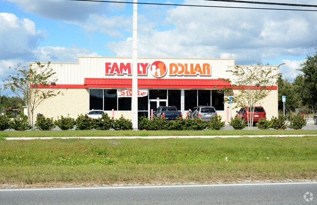


Property Detail
600 Dundee Rd
27-28-29-000000-012010
SE1/4 OF NE1/4 LYING S & E OF OLD DUNDEE RD & SCENIC HEIGHTS PB 22 PG 21 LOT 126 & REPLAT OF B B GRAY PROPERTY PB 31 PG 2 IN SEC 29 T28 R27 LOT D & THAT PT OF VACATED OLD DUNDEE RD LYING BETWEEN ABOVE LESS ADDNL RD R/W AS DESC IN OR 8748-631
Storebuilding
POLK
C1
Florida
A Areas with a 1% annual chance of flooding and a 26% chance of flooding over the life of a 30-year mortgage.
126
2024
1.19 AC
2025
Polk County
014131
Tampa/St Petersburg
8,400 SF
Lakeland-Winter Haven, FL
NEARBY LISTINGS FOR SALE OR LEASE
DEMOGRAPHICS near 600 Dundee Rd
1 mile
3 mile
5 mile
2024 Total Population
4,058
19,782
66,994
2029 Population
4,652
22,602
76,709
Pop Growth 2024-2029
+ 14.64%
+ 14.26%
+ 14.50%
Average Age
43
43
43
2024 Total Households
1,592
7,814
26,551
HH Growth 2024-2029
+ 14.82%
+ 14.45%
+ 14.72%
Median Household Inc
$52,683
$67,445
$67,856
Avg Household Size
2.50
2.50
2.50
2024 Avg HH Vehicles
2.00
2.00
2.00
Median Home Value
$264,648
$290,787
$309,660
Median Year Built
1991
1990
1995
Nearby Places
Map Layers
Map Styles
 Street
 Aerial
Transit
 Traffic
 Biking
Places
Listings with unknown addresses are not visible on the map
- Restaurants
- Banks
- Shops
- Fitness
- Groceries
PUBLIC TRANSPORTATION
COMMUTER RAIL
Drive
Walk
Distance
16 min
8.2 mi
AIRPORT
Orlando International
Drive
Walk
Distance
Orlando International
61 min
44.2 mi
Nearby Properties
Address
Land Use
TOTAL SIZE
Lot Size
Zoning
Address
Land Use
TOTAL SIZE
Lot Size
Zoning
432,251 SF
57.14 AC
RC
Address
Land Use
TOTAL SIZE
Lot Size
Zoning
138,111 SF
40.01 AC
RC
Address
Land Use
TOTAL SIZE
Lot Size
Zoning
96,322 SF
8.45 AC
XX
Address
Land Use
TOTAL SIZE
Lot Size
Zoning
104,120 SF
19.25 AC
Address
Land Use
TOTAL SIZE
Lot Size
Zoning
240,920 SF
15.33 AC
AG
Address
Land Use
TOTAL SIZE
Lot Size
Zoning
147,825 SF
10.23 AC
Address
Land Use
TOTAL SIZE
Lot Size
Zoning
72,928 SF
4.73 AC
Address
Land Use
TOTAL SIZE
Lot Size
Zoning
85,890 SF
7.75 AC
C1
Address
Land Use
TOTAL SIZE
Lot Size
Zoning
35,632 SF
29.34 AC
RC
Address
Land Use
TOTAL SIZE
Lot Size
Zoning
100,177 SF
12.39 AC
XX
Address
Land Use
TOTAL SIZE
Lot Size
Zoning
74,292 SF
14.62 AC
Address
Land Use
TOTAL SIZE
Lot Size
Zoning
17,441 SF
119.40 AC
RC
Address
Land Use
TOTAL SIZE
Lot Size
Zoning
1,260 SF
473 AC
Address
Land Use
TOTAL SIZE
Lot Size
Zoning
91,964 SF
14.02 AC
XX
Address
Land Use
TOTAL SIZE
Lot Size
Zoning
31,565 SF
2.19 AC
Address
Land Use
TOTAL SIZE
Lot Size
Zoning
33,300 SF
8.94 AC
RC
Address
Land Use
TOTAL SIZE
Lot Size
Zoning
109,214 SF
14.64 AC
XX
Address
Land Use
TOTAL SIZE
Lot Size
Zoning
22,069 SF
7.74 AC
R1A
Address
Land Use
TOTAL SIZE
Lot Size
Zoning
189,241 SF
3.59 AC
C3
Address
Land Use
TOTAL SIZE
Lot Size
Zoning
70,000 SF
8.06 AC
C4
Address
Land Use
TOTAL SIZE
Lot Size
Zoning
33,962 SF
6.88 AC
C4
Address
Land Use
TOTAL SIZE
Lot Size
Zoning
15,400 SF
15.61 AC
Address
Land Use
TOTAL SIZE
Lot Size
Zoning
24.30 AC
Address
Land Use
TOTAL SIZE
Lot Size
Zoning
60,560 SF
9.33 AC
RC
Address
Land Use
TOTAL SIZE
Lot Size
Zoning
60,220 SF
12.05 AC
AG
Address
Land Use
TOTAL SIZE
Lot Size
Zoning
60,236 SF
4.90 AC
C1
Address
Land Use
TOTAL SIZE
Lot Size
Zoning
38,238 SF
1.80 AC
C1
Address
Land Use
TOTAL SIZE
Lot Size
Zoning
168,206 SF
8.43 AC
M
Address
Land Use
TOTAL SIZE
Lot Size
Zoning
15,800 SF
0.86 AC
C1
Address
Land Use
TOTAL SIZE
Lot Size
Zoning
10,623 SF
40.52 AC
The World's #1 Commercial Real Estate Marketplace
Connect with us
© 2026 CoStar Group
The information above has been obtained from sources believed reliable. While we do not doubt its accuracy we have not verified it and make no guarantee, warranty or representation about it. It is your responsibility to independently confirm its accuracy and completeness. Any projections, opinions, assumptions, or estimates used are for example only and do not represent the current or future performance of the property. The value of this transaction to you depends on tax and other factors which should be evaluated by your tax, financial, and legal advisors. You and your advisors should conduct a careful, independent investigation of the property to determine to your satisfaction the suitability of the property for your needs.