Property Record
600 E Atlanta Rd, Stockbridge, GA 30281
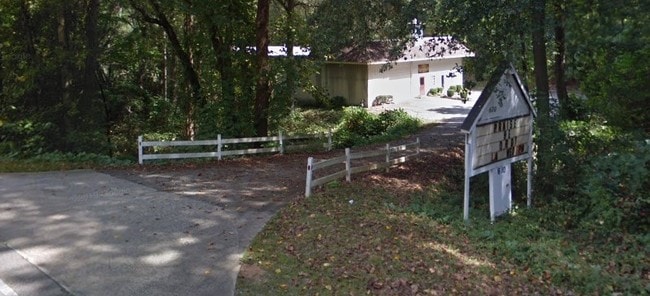

Property Detail
600 E Atlanta Rd
0S14-01-002-000
LAND LOT: 92 /LAND DISTRICT: 12
Warehouse
Henry
M1
Georgia
B and X Area of moderate flood hazard, usually the area between the limits of the 100-year and 500-year floods.
3.34 AC
2025
South Clayton/Henry Cnty
2025
Atlanta
070125
Atlanta-Sandy Springs-Roswell, GA
12,500 SF
NEARBY LISTINGS FOR SALE OR LEASE
DEMOGRAPHICS near 600 E Atlanta Rd
1 mile
3 mile
5 mile
2025 Total Population
3,842
47,254
120,891
2030 Population
4,103
48,845
124,509
Pop Growth 2025-2030
+ 6.79%
+ 3.37%
+ 2.99%
Average Age
38
37
39
2025 Total Households
1,312
17,273
43,095
HH Growth 2025-2030
+ 6.94%
+ 3.48%
+ 3.08%
Median Household Inc
$71,424
$64,833
$70,470
Avg Household Size
2.90
2.70
2.70
2025 Avg HH Vehicles
2.00
2.00
2.00
Median Home Value
$247,150
$241,369
$274,495
Median Year Built
1988
1994
1994
Nearby Places
Map Layers
Map Styles
 Street
 Aerial
Layers
 Traffic
 Biking
Places
Listings with unknown addresses are not visible on the map
- Restaurants
- Banks
- Shops
- Fitness
- Groceries
PUBLIC TRANSPORTATION
AIRPORT
Hartsfield - Jackson Atlanta International
Drive
Walk
Distance
Hartsfield - Jackson Atlanta International
28 min
17.2 mi
SALE & LEASE HISTORY
LISTING DATE
SALE/LEASE

Aug 09, 2017
For Sale
Nearby Properties
Address
Land Use
TOTAL SIZE
Lot Size
Zoning
Address
Land Use
TOTAL SIZE
Lot Size
Zoning
368 SF
42.85 AC
RM
Address
Land Use
TOTAL SIZE
Lot Size
Zoning
35,082 SF
31.82 AC
C3
Address
Land Use
TOTAL SIZE
Lot Size
Zoning
17,862 SF
30 AC
PD
Address
Land Use
TOTAL SIZE
Lot Size
Zoning
19,140 SF
40.11 AC
RM
Address
Land Use
TOTAL SIZE
Lot Size
Zoning
21,678 SF
26.44 AC
RM
Address
Land Use
TOTAL SIZE
Lot Size
Zoning
2,426 SF
19.79 AC
RM
Address
Land Use
TOTAL SIZE
Lot Size
Zoning
284 SF
29 AC
RM
Address
Land Use
TOTAL SIZE
Lot Size
Zoning
25,952 SF
28.88 AC
RM
Address
Land Use
TOTAL SIZE
Lot Size
Zoning
9,264 SF
26.63 AC
RM
Address
Land Use
TOTAL SIZE
Lot Size
Zoning
20.65 AC
RM
Address
Land Use
TOTAL SIZE
Lot Size
Zoning
182 SF
19.46 AC
RM
Address
Land Use
TOTAL SIZE
Lot Size
Zoning
158 SF
15.59 AC
RM
Address
Land Use
TOTAL SIZE
Lot Size
Zoning
1,638 SF
12.79 AC
RM
Address
Land Use
TOTAL SIZE
Lot Size
Zoning
391,708 SF
20.04 AC
C2
Address
Land Use
TOTAL SIZE
Lot Size
Zoning
127,735 SF
20.74 AC
M1
Address
Land Use
TOTAL SIZE
Lot Size
Zoning
26,018 SF
11.03 AC
GB
Address
Land Use
TOTAL SIZE
Lot Size
Zoning
8,590 SF
11.09 AC
R3
Address
Land Use
TOTAL SIZE
Lot Size
Zoning
14,862 SF
10.18 AC
GB
Address
Land Use
TOTAL SIZE
Lot Size
Zoning
466,048 SF
6.51 AC
RA
Address
Land Use
TOTAL SIZE
Lot Size
Zoning
102 SF
16.95 AC
RM
Address
Land Use
TOTAL SIZE
Lot Size
Zoning
83,397 SF
1.87 AC
C1
Address
Land Use
TOTAL SIZE
Lot Size
Zoning
83,900 SF
9.66 AC
C3
Address
Land Use
TOTAL SIZE
Lot Size
Zoning
131,920 SF
11.23 AC
GB
Address
Land Use
TOTAL SIZE
Lot Size
Zoning
126,237 SF
13.76 AC
C3
Address
Land Use
TOTAL SIZE
Lot Size
Zoning
201,480 SF
26.08 AC
Address
Land Use
TOTAL SIZE
Lot Size
Zoning
86,486 SF
8.47 AC
GB
Address
Land Use
TOTAL SIZE
Lot Size
Zoning
11,768 SF
3.54 AC
GB
Address
Land Use
TOTAL SIZE
Lot Size
Zoning
14,310 SF
1.53 AC
GB
Address
Land Use
TOTAL SIZE
Lot Size
Zoning
11,535 SF
1.81 AC
GB
Address
Land Use
TOTAL SIZE
Lot Size
Zoning
72,808 SF
13.66 AC
C2
The World's #1 Commercial Real Estate Marketplace
Connect with us
© 2026 CoStar Group
The information above has been obtained from sources believed reliable. While we do not doubt its accuracy we have not verified it and make no guarantee, warranty or representation about it. It is your responsibility to independently confirm its accuracy and completeness. Any projections, opinions, assumptions, or estimates used are for example only and do not represent the current or future performance of the property. The value of this transaction to you depends on tax and other factors which should be evaluated by your tax, financial, and legal advisors. You and your advisors should conduct a careful, independent investigation of the property to determine to your satisfaction the suitability of the property for your needs.