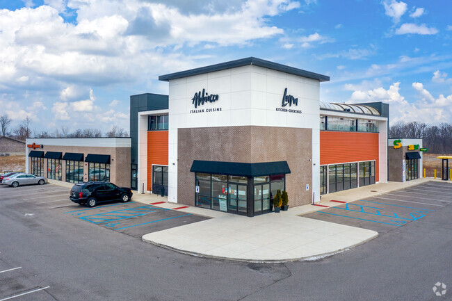
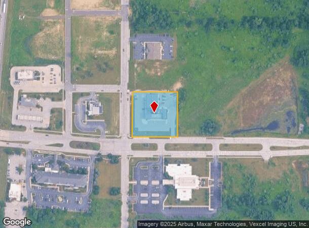
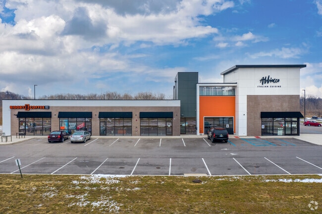
Property Record
600 Gateway Blvd N, Chesterton, IN 46304
NEARBY LISTINGS FOR SALE OR LEASE
Property Detail
600 Gateway Blvd N
Chicago-Naperville-Elgin, IL-IN-WI
First Add To Coffee Creek Center
64-07-18-104-001.000-007
FIRST ADD TO COFFEE CREEK CENTER PH B LOT 1 1.55A TIF
Regionalshoppingcenterormallwithanchorstore
Porter
X
Indiana
18127C0133D
1
2023
1.55 AC
2024
Porter County
050104
Chicago
16,615 SF
DEMOGRAPHICS near 600 Gateway Blvd N
1 Mile
3 Mile
5 Mile
2024 Total Population
1,833
21,000
43,258
2029 Population
1,941
21,705
44,432
Pop Growth 2024-2029
+ 5.89%
+ 3.36%
+ 2.71%
Average Age
43
42
42
2024 Total Households
701
8,240
16,887
HH Growth 2024-2029
+ 6.13%
+ 3.37%
+ 2.74%
Median Household Inc
$141,964
$88,665
$86,024
Avg Household Size
2.50
2.50
2.50
2024 Avg HH Vehicles
2.00
2.00
2.00
Median Home Value
$371,767
$281,367
$278,434
Median Year Built
2007
1987
1984
Nearby Places
- Restaurants
- Banks
- Shops
- Fitness
- Groceries
PUBLIC TRANSPORTATION
COMMUTER RAIL
Dune Park (Chesterton) Station (South Shore Line - Northern Indiana Commuter Transportation District (South Shore Line))
DRIVE
WALK
Distance
Dune Park (Chesterton) Station (South Shore Line - Northern Indiana Commuter Transportation District (South Shore Line))
10 min
5.5 mi
DRIVE
WALK
Distance
16 min
9.2 mi
Nearby Properties
Address
Land Use
TOTAL SIZE
Lot Size
Zoning
Address
Land Use
TOTAL SIZE
Lot Size
Zoning
389,754 SF
0.01 AC
Address
Land Use
TOTAL SIZE
Lot Size
Zoning
531,461 SF
174 SF
Address
Land Use
TOTAL SIZE
Lot Size
Zoning
189,071 SF
87 SF
Address
Land Use
TOTAL SIZE
Lot Size
Zoning
174,766 SF
87 SF
Address
Land Use
TOTAL SIZE
Lot Size
Zoning
109,131 SF
44 SF
Address
Land Use
TOTAL SIZE
Lot Size
Zoning
61,120 SF
44 SF
Address
Land Use
TOTAL SIZE
Lot Size
Zoning
78,087 SF
44 SF
Address
Land Use
TOTAL SIZE
Lot Size
Zoning
108,528 SF
10.28 AC
Address
Land Use
TOTAL SIZE
Lot Size
Zoning
88,064 SF
3.87 AC
Address
Land Use
TOTAL SIZE
Lot Size
Zoning
52,765 SF
5.92 AC
Address
Land Use
TOTAL SIZE
Lot Size
Zoning
61,873 SF
44 SF
Address
Land Use
TOTAL SIZE
Lot Size
Zoning
38,337 SF
44 SF
Address
Land Use
TOTAL SIZE
Lot Size
Zoning
62,127 SF
64.25 AC
Address
Land Use
TOTAL SIZE
Lot Size
Zoning
114,061 SF
6.26 AC
Address
Land Use
TOTAL SIZE
Lot Size
Zoning
72,408 SF
2.75 AC
Address
Land Use
TOTAL SIZE
Lot Size
Zoning
62,401 SF
44 SF
Address
Land Use
TOTAL SIZE
Lot Size
Zoning
50,191 SF
2.43 AC
Address
Land Use
TOTAL SIZE
Lot Size
Zoning
35,456 SF
7.88 AC
Address
Land Use
TOTAL SIZE
Lot Size
Zoning
62,261 SF
44 SF
Address
Land Use
TOTAL SIZE
Lot Size
Zoning
42.89 AC
Address
Land Use
TOTAL SIZE
Lot Size
Zoning
62,068 SF
10.56 AC
Address
Land Use
TOTAL SIZE
Lot Size
Zoning
35,384 SF
151 AC
Address
Land Use
TOTAL SIZE
Lot Size
Zoning
20,400 SF
44 SF
Address
Land Use
TOTAL SIZE
Lot Size
Zoning
33,300 SF
1.97 AC
Address
Land Use
TOTAL SIZE
Lot Size
Zoning
11,978 SF
20 AC
Address
Land Use
TOTAL SIZE
Lot Size
Zoning
419,212 SF
78.36 AC
Address
Land Use
TOTAL SIZE
Lot Size
Zoning
25,646 SF
2.57 AC
Address
Land Use
TOTAL SIZE
Lot Size
Zoning
56,807 SF
44 SF
Address
Land Use
TOTAL SIZE
Lot Size
Zoning
19,896 SF
2.09 AC
The World's #1 Commercial Real Estate Marketplace
Connect with us
© 2025 CoStar Group
The information above has been obtained from sources believed reliable. While we do not doubt its accuracy we have not verified it and make no guarantee, warranty or representation about it. It is your responsibility to independently confirm its accuracy and completeness. Any projections, opinions, assumptions, or estimates used are for example only and do not represent the current or future performance of the property. The value of this transaction to you depends on tax and other factors which should be evaluated by your tax, financial, and legal advisors. You and your advisors should conduct a careful, independent investigation of the property to determine to your satisfaction the suitability of the property for your needs.