Property Record
600 Hicks Rd, Rolling Meadows, IL 60008
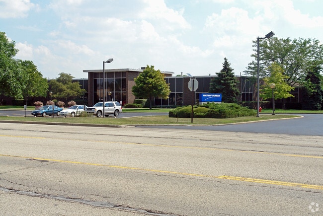
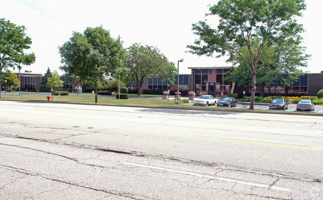
Property Detail
600 Hicks Rd
02-23-402-016-0000
Cook
Industrialgeneral
Illinois
B and X Area of moderate flood hazard, usually the area between the limits of the 100-year and 500-year floods.
3.79 AC
2023
Northwest Cook
2025
Chicago
803901
Chicago-Naperville-Elgin, IL-IN
NEARBY LISTINGS FOR SALE OR LEASE
DEMOGRAPHICS near 600 Hicks Rd
1 mile
3 mile
5 mile
2025 Total Population
10,450
121,957
265,306
2030 Population
10,558
123,019
266,928
Pop Growth 2025-2030
+ 1.03%
+ 0.87%
+ 0.61%
Average Age
45
42
42
2025 Total Households
4,614
49,213
104,680
HH Growth 2025-2030
+ 0.93%
+ 0.73%
+ 0.44%
Median Household Inc
$94,992
$106,533
$108,924
Avg Household Size
2.20
2.40
2.50
2025 Avg HH Vehicles
2.00
2.00
2.00
Median Home Value
$313,429
$374,497
$374,284
Median Year Built
1971
1974
1975
Nearby Places
Map Layers
Map Styles
 Street
 Aerial
Transit
 Traffic
 Biking
Places
Listings with unknown addresses are not visible on the map
- Restaurants
- Banks
- Shops
- Fitness
- Groceries
PUBLIC TRANSPORTATION
COMMUTER RAIL
Arlington Park Station (Union Pacific Northwest Line - Northeast Illinois Regional Commuter Railroad (Metra))
Drive
Walk
Distance
Arlington Park Station (Union Pacific Northwest Line - Northeast Illinois Regional Commuter Railroad (Metra))
4 min
1.9 mi
Palatine Station (Union Pacific Northwest Line - Northeast Illinois Regional Commuter Railroad (Metra))
Drive
Walk
Distance
Palatine Station (Union Pacific Northwest Line - Northeast Illinois Regional Commuter Railroad (Metra))
5 min
2.0 mi
AIRPORT
Chicago O'Hare International
Drive
Walk
Distance
Chicago O'Hare International
23 min
15.6 mi
Chicago Midway International
Drive
Walk
Distance
Chicago Midway International
45 min
31.7 mi
Freight Ports
Port Milwaukee
Drive
Walk
Distance
Port Milwaukee
92 min
75.7 mi
Nearby Properties
Address
Land Use
TOTAL SIZE
Lot Size
Zoning
Address
Land Use
TOTAL SIZE
Lot Size
Zoning
800,552 SF
38.86 AC
Address
Land Use
TOTAL SIZE
Lot Size
Zoning
961,890 SF
42.21 AC
Address
Land Use
TOTAL SIZE
Lot Size
Zoning
787,336 SF
Address
Land Use
TOTAL SIZE
Lot Size
Zoning
Address
Land Use
TOTAL SIZE
Lot Size
Zoning
366,052 SF
32.18 AC
Address
Land Use
TOTAL SIZE
Lot Size
Zoning
Address
Land Use
TOTAL SIZE
Lot Size
Zoning
490,458 SF
13.52 AC
Address
Land Use
TOTAL SIZE
Lot Size
Zoning
29.21 AC
Address
Land Use
TOTAL SIZE
Lot Size
Zoning
197,097 SF
21.80 AC
Address
Land Use
TOTAL SIZE
Lot Size
Zoning
300,686 SF
8.47 AC
Address
Land Use
TOTAL SIZE
Lot Size
Zoning
295,685 SF
27.21 AC
Address
Land Use
TOTAL SIZE
Lot Size
Zoning
544,744 SF
14.87 AC
Address
Land Use
TOTAL SIZE
Lot Size
Zoning
18.34 AC
Address
Land Use
TOTAL SIZE
Lot Size
Zoning
369,303 SF
29.96 AC
Address
Land Use
TOTAL SIZE
Lot Size
Zoning
Address
Land Use
TOTAL SIZE
Lot Size
Zoning
14,099 SF
2.01 AC
Address
Land Use
TOTAL SIZE
Lot Size
Zoning
195,269 SF
11.07 AC
Address
Land Use
TOTAL SIZE
Lot Size
Zoning
303,701 SF
31.18 AC
Address
Land Use
TOTAL SIZE
Lot Size
Zoning
49,539 SF
1.57 AC
Address
Land Use
TOTAL SIZE
Lot Size
Zoning
19.35 AC
Address
Land Use
TOTAL SIZE
Lot Size
Zoning
Address
Land Use
TOTAL SIZE
Lot Size
Zoning
17.77 AC
Address
Land Use
TOTAL SIZE
Lot Size
Zoning
236,820 SF
6.54 AC
Address
Land Use
TOTAL SIZE
Lot Size
Zoning
117,825 SF
4.49 AC
Address
Land Use
TOTAL SIZE
Lot Size
Zoning
51,028 SF
4.20 AC
Address
Land Use
TOTAL SIZE
Lot Size
Zoning
191,100 SF
10.26 AC
Address
Land Use
TOTAL SIZE
Lot Size
Zoning
Address
Land Use
TOTAL SIZE
Lot Size
Zoning
Address
Land Use
TOTAL SIZE
Lot Size
Zoning
Address
Land Use
TOTAL SIZE
Lot Size
Zoning
287,328 SF
13.57 AC
The World's #1 Commercial Real Estate Marketplace
Connect with us
© 2026 CoStar Group
The information above has been obtained from sources believed reliable. While we do not doubt its accuracy we have not verified it and make no guarantee, warranty or representation about it. It is your responsibility to independently confirm its accuracy and completeness. Any projections, opinions, assumptions, or estimates used are for example only and do not represent the current or future performance of the property. The value of this transaction to you depends on tax and other factors which should be evaluated by your tax, financial, and legal advisors. You and your advisors should conduct a careful, independent investigation of the property to determine to your satisfaction the suitability of the property for your needs.