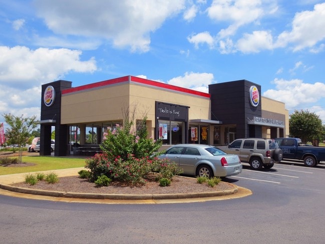
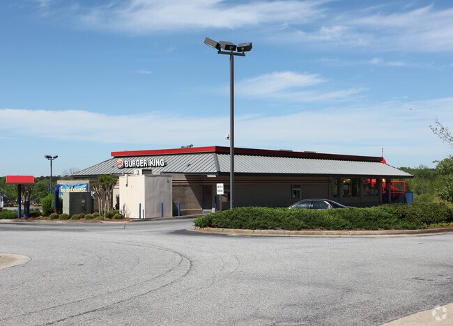
Property Record
600 Highway 29 N, Athens, GA 30601

NEARBY LISTINGS FOR SALE OR LEASE
-
-
View all Athens listings for sale on LoopNet.com
Property Detail
600 Highway 29 N
221-008-E
Com-St-070->00-03
Restaurantdrivein
DEEDED ACS: 3.000
X
Clarke
13059C0017F
Georgia
2025
2.58 AC
2025
East Athens
140400
Other Market Areas
3,548 SF
Athens-Clarke County, GA
DEMOGRAPHICS near 600 Highway 29 N
1 Mile
3 Mile
5 Mile
2024 Total Population
765
21,756
77,843
2029 Population
799
21,932
78,875
Pop Growth 2024-2029
+ 4.44%
+ 0.81%
+ 1.33%
Average Age
40
35
33
2024 Total Households
302
8,397
29,379
HH Growth 2024-2029
+ 4.64%
+ 0.61%
+ 1.26%
Median Household Inc
$62,867
$39,762
$44,436
Avg Household Size
2.50
2.50
2.30
2024 Avg HH Vehicles
2.00
2.00
2.00
Median Home Value
$95,237
$141,883
$201,723
Median Year Built
1996
1990
1984
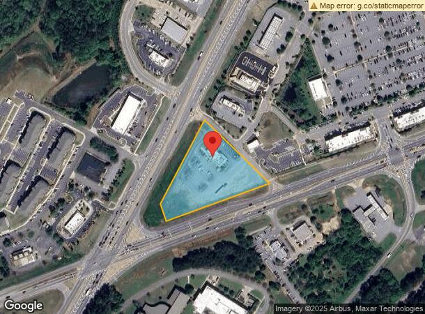
Nearby Places
Map Layers
Map Styles
 Street
 Aerial
- Restaurants
- Banks
- Shops
- Fitness
- Groceries
SALE & LEASE HISTORY
LISTING DATE
SALE/LEASE

Sep 24, 2016
For Sale
Nearby Properties
Address
Land Use
TOTAL SIZE
Lot Size
Zoning
Address
Land Use
TOTAL SIZE
Lot Size
Zoning
1,403 SF
21.64 AC
C-G
Address
Land Use
TOTAL SIZE
Lot Size
Zoning
3.16 AC
E-I
Address
Land Use
TOTAL SIZE
Lot Size
Zoning
2,856 SF
39.78 AC
C-G
Address
Land Use
TOTAL SIZE
Lot Size
Zoning
15.29 AC
G
Address
Land Use
TOTAL SIZE
Lot Size
Zoning
8,357 SF
22.38 AC
RM-2
Address
Land Use
TOTAL SIZE
Lot Size
Zoning
124,959 SF
20.54 AC
E-I
Address
Land Use
TOTAL SIZE
Lot Size
Zoning
2,880 SF
36.84 AC
RM-1
Address
Land Use
TOTAL SIZE
Lot Size
Zoning
3,628 SF
6.57 AC
RM-2
Address
Land Use
TOTAL SIZE
Lot Size
Zoning
140,375 SF
26.15 AC
E-I
Address
Land Use
TOTAL SIZE
Lot Size
Zoning
46.26 AC
G
Address
Land Use
TOTAL SIZE
Lot Size
Zoning
Address
Land Use
TOTAL SIZE
Lot Size
Zoning
9,600 SF
12.71 AC
RM-2
Address
Land Use
TOTAL SIZE
Lot Size
Zoning
14,000 SF
42.62 AC
E-I
Address
Land Use
TOTAL SIZE
Lot Size
Zoning
4,392 SF
11.79 AC
C-G
Address
Land Use
TOTAL SIZE
Lot Size
Zoning
26,100 SF
18.59 AC
C-G
Address
Land Use
TOTAL SIZE
Lot Size
Zoning
71,472 SF
43.36 AC
E-I
Address
Land Use
TOTAL SIZE
Lot Size
Zoning
72,072 SF
7.59 AC
RM-2
Address
Land Use
TOTAL SIZE
Lot Size
Zoning
262,387 SF
16.45 AC
E-I
Address
Land Use
TOTAL SIZE
Lot Size
Zoning
47,928 SF
80.47 AC
E-I
Address
Land Use
TOTAL SIZE
Lot Size
Zoning
16,800 SF
454.45 AC
G
Address
Land Use
TOTAL SIZE
Lot Size
Zoning
36.93 AC
G
Address
Land Use
TOTAL SIZE
Lot Size
Zoning
11,520 SF
5.03 AC
RM-2
Address
Land Use
TOTAL SIZE
Lot Size
Zoning
8,756 SF
2.83 AC
C-D
Address
Land Use
TOTAL SIZE
Lot Size
Zoning
2,465 SF
9.45 AC
RM-2
Address
Land Use
TOTAL SIZE
Lot Size
Zoning
26.40 AC
RM-2
Address
Land Use
TOTAL SIZE
Lot Size
Zoning
124,136 SF
19.82 AC
C-G (PD)
Address
Land Use
TOTAL SIZE
Lot Size
Zoning
136,460 SF
13.27 AC
C-G
Address
Land Use
TOTAL SIZE
Lot Size
Zoning
18.38 AC
G
Address
Land Use
TOTAL SIZE
Lot Size
Zoning
67,768 SF
40 AC
E-I
Address
Land Use
TOTAL SIZE
Lot Size
Zoning
15.34 AC
G
The World's #1 Commercial Real Estate Marketplace
Connect with us
© 2026 CoStar Group
The information above has been obtained from sources believed reliable. While we do not doubt its accuracy we have not verified it and make no guarantee, warranty or representation about it. It is your responsibility to independently confirm its accuracy and completeness. Any projections, opinions, assumptions, or estimates used are for example only and do not represent the current or future performance of the property. The value of this transaction to you depends on tax and other factors which should be evaluated by your tax, financial, and legal advisors. You and your advisors should conduct a careful, independent investigation of the property to determine to your satisfaction the suitability of the property for your needs.