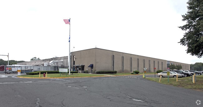
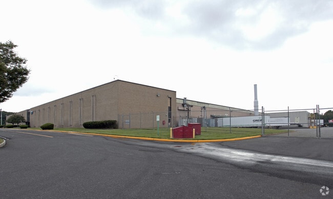
Property Record
600 Highway 36, Hazlet, NJ 07730
NEARBY LISTINGS FOR SALE OR LEASE
Property Detail
600 Highway 36
New York-Jersey City-White Plains, NY-NJ
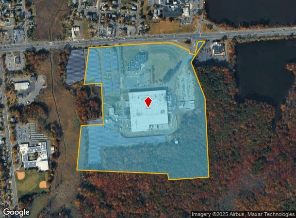
Alta/Acsm Survey Map Of Property
18-00120-0000-00003
LOTS 5 AND 6
Industrialgeneral
Monmouth
AE
New Jersey
34025C0041F
3
2024
52 AC
2025
Eastern Monmouth
802100
Northern New Jersey
42,314 SF
DEMOGRAPHICS near 600 Highway 36
1 Mile
3 Mile
5 Mile
2024 Total Population
9,589
65,458
126,002
2029 Population
9,477
64,965
125,067
Pop Growth 2024-2029
(1.17%)
(0.75%)
(0.74%)
Average Age
42
42
42
2024 Total Households
3,468
24,046
46,610
HH Growth 2024-2029
(1.38%)
(0.96%)
(0.93%)
Median Household Inc
$109,831
$95,982
$108,924
Avg Household Size
2.70
2.60
2.60
2024 Avg HH Vehicles
2.00
2.00
2.00
Median Home Value
$372,090
$390,228
$414,535
Median Year Built
1963
1965
1967
Nearby Places
Map Layers
Map Styles
 Street
 Aerial
- Restaurants
- Banks
- Shops
- Fitness
- Groceries
PUBLIC TRANSPORTATION
COMMUTER RAIL
Hazlet (North Jersey Coast Line - NJ Transit Commuter Rail (NJ Transit))
DRIVE
WALK
Distance
Hazlet (North Jersey Coast Line - NJ Transit Commuter Rail (NJ Transit))
7 min
3.7 mi
Aberdeen Matawan (North Jersey Coast Line - NJ Transit Commuter Rail (NJ Transit))
DRIVE
WALK
Distance
Aberdeen Matawan (North Jersey Coast Line - NJ Transit Commuter Rail (NJ Transit))
8 min
4.3 mi
AIRPORT
Newark Liberty International
DRIVE
WALK
Distance
Newark Liberty International
43 min
30.6 mi
LaGuardia
DRIVE
WALK
Distance
LaGuardia
72 min
47.9 mi
Freight Ports
New York Container Terminal
DRIVE
WALK
Distance
New York Container Terminal
36 min
25.6 mi
Nearby Properties
Address
Land Use
TOTAL SIZE
Lot Size
Zoning
Address
Land Use
TOTAL SIZE
Lot Size
Zoning
836,881 SF
253 AC
R-45
Address
Land Use
TOTAL SIZE
Lot Size
Zoning
2.91 AC
Address
Land Use
TOTAL SIZE
Lot Size
Zoning
6,500 SF
48.71 AC
CI
Address
Land Use
TOTAL SIZE
Lot Size
Zoning
37.83 AC
PUD
Address
Land Use
TOTAL SIZE
Lot Size
Zoning
157,615 SF
17.08 AC
M
Address
Land Use
TOTAL SIZE
Lot Size
Zoning
10.44 AC
TMHO
Address
Land Use
TOTAL SIZE
Lot Size
Zoning
158,298 SF
20.01 AC
MU15
Address
Land Use
TOTAL SIZE
Lot Size
Zoning
70,624 SF
1.56 AC
WD
Address
Land Use
TOTAL SIZE
Lot Size
Zoning
29.59 AC
CI
Address
Land Use
TOTAL SIZE
Lot Size
Zoning
118,375 SF
18.20 AC
MU15
Address
Land Use
TOTAL SIZE
Lot Size
Zoning
151,463 SF
20.58 AC
M-2
Address
Land Use
TOTAL SIZE
Lot Size
Zoning
39,965 SF
17.14 AC
BH
Address
Land Use
TOTAL SIZE
Lot Size
Zoning
186,567 SF
2.31 AC
RC
Address
Land Use
TOTAL SIZE
Lot Size
Zoning
82,166 SF
25.10 AC
R-7
Address
Land Use
TOTAL SIZE
Lot Size
Zoning
94,150 SF
13.62 AC
M
Address
Land Use
TOTAL SIZE
Lot Size
Zoning
3,641 SF
22.58 AC
C1
Address
Land Use
TOTAL SIZE
Lot Size
Zoning
196,948 SF
19.80 AC
BH
Address
Land Use
TOTAL SIZE
Lot Size
Zoning
81.64 AC
R70
Address
Land Use
TOTAL SIZE
Lot Size
Zoning
420 SF
87.76 AC
OL2
Address
Land Use
TOTAL SIZE
Lot Size
Zoning
8.62 AC
RC
Address
Land Use
TOTAL SIZE
Lot Size
Zoning
6 AC
RC
Address
Land Use
TOTAL SIZE
Lot Size
Zoning
5 AC
PUD
Address
Land Use
TOTAL SIZE
Lot Size
Zoning
141,313 SF
23.19 AC
R-22
Address
Land Use
TOTAL SIZE
Lot Size
Zoning
162,250 SF
2.80 AC
RC
Address
Land Use
TOTAL SIZE
Lot Size
Zoning
4,005 SF
87 SF
B-2
Address
Land Use
TOTAL SIZE
Lot Size
Zoning
9,904 SF
135.45 AC
M-2
Address
Land Use
TOTAL SIZE
Lot Size
Zoning
67,832 SF
10.46 AC
RGA2
Address
Land Use
TOTAL SIZE
Lot Size
Zoning
41,140 SF
3.15 AC
R-7
Address
Land Use
TOTAL SIZE
Lot Size
Zoning
28 AC
RO3
The World's #1 Commercial Real Estate Marketplace
Connect with us
© 2025 CoStar Group
The information above has been obtained from sources believed reliable. While we do not doubt its accuracy we have not verified it and make no guarantee, warranty or representation about it. It is your responsibility to independently confirm its accuracy and completeness. Any projections, opinions, assumptions, or estimates used are for example only and do not represent the current or future performance of the property. The value of this transaction to you depends on tax and other factors which should be evaluated by your tax, financial, and legal advisors. You and your advisors should conduct a careful, independent investigation of the property to determine to your satisfaction the suitability of the property for your needs.