Property Record
600 Homestead Rd S, Lehigh Acres, FL 33974


NEARBY LISTINGS FOR SALE OR LEASE
Property Detail
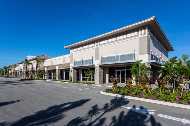
600 Homestead Rd S
16-45-27-24-00025.0010
Lee Blvd Corridor
Countyproperty
MIRROR LAKES UNIT 24 PB 27 PG 111 PORT OF PARCEL 25 AS DESC IN INST#2009000075218 LESS PORTS OF LAKE + RD R/W
X
Lee
12071C0475F
Florida
2024
3.95 AC
2025
S Ft Myers/San Carlos
040313
Southwest Florida
32,097 SF
Cape Coral-Fort Myers, FL
DEMOGRAPHICS near 600 Homestead Rd S
1 Mile
3 Mile
5 Mile
2024 Total Population
2,559
30,645
64,393
2029 Population
3,011
36,067
75,769
Pop Growth 2024-2029
+ 17.66%
+ 17.69%
+ 17.67%
Average Age
36
37
37
2024 Total Households
816
10,344
21,638
HH Growth 2024-2029
+ 17.16%
+ 17.06%
+ 17.09%
Median Household Inc
$65,586
$52,311
$53,470
Avg Household Size
3.00
2.80
2.90
2024 Avg HH Vehicles
2.00
2.00
2.00
Median Home Value
$235,776
$191,546
$205,822
Median Year Built
2004
2000
2000
Nearby Places
Map Layers
Map Styles
 Street
 Aerial
- Restaurants
- Banks
- Shops
- Fitness
- Groceries
PUBLIC TRANSPORTATION
AIRPORT
Southwest Florida International
DRIVE
WALK
Distance
Southwest Florida International
22 min
13.7 mi
Freight Ports
Port Manatee
DRIVE
WALK
Distance
Port Manatee
132 min
112.5 mi
SALE & LEASE HISTORY
LISTING DATE
SALE/LEASE

Sep 25, 2016
For Lease
Oct 21, 2020
For Lease
Mar 09, 2018
For Lease
Nearby Properties
Address
Land Use
TOTAL SIZE
Lot Size
Zoning
Address
Land Use
TOTAL SIZE
Lot Size
Zoning
187,647 SF
31.50 AC
RPD
Address
Land Use
TOTAL SIZE
Lot Size
Zoning
306,514 SF
18.98 AC
CF
Address
Land Use
TOTAL SIZE
Lot Size
Zoning
141,205 SF
33.03 AC
CF
Address
Land Use
TOTAL SIZE
Lot Size
Zoning
162,704 SF
25.47 AC
C-1A
Address
Land Use
TOTAL SIZE
Lot Size
Zoning
56,299 SF
5.57 AC
CF-2
Address
Land Use
TOTAL SIZE
Lot Size
Zoning
46,885 SF
6.94 AC
CPD
Address
Land Use
TOTAL SIZE
Lot Size
Zoning
250,479 SF
25.47 AC
RM-2
Address
Land Use
TOTAL SIZE
Lot Size
Zoning
161,390 SF
21.85 AC
RM-2
Address
Land Use
TOTAL SIZE
Lot Size
Zoning
16,764 SF
1.99 AC
CPD
Address
Land Use
TOTAL SIZE
Lot Size
Zoning
630.83 AC
AG-2
Address
Land Use
TOTAL SIZE
Lot Size
Zoning
78.43 AC
RPD
Address
Land Use
TOTAL SIZE
Lot Size
Zoning
15,596 SF
2.55 AC
MPD
Address
Land Use
TOTAL SIZE
Lot Size
Zoning
574.97 AC
AG-2
Address
Land Use
TOTAL SIZE
Lot Size
Zoning
6,352 SF
1.29 AC
C-2
Address
Land Use
TOTAL SIZE
Lot Size
Zoning
10,158 SF
2.42 AC
C-1A
Address
Land Use
TOTAL SIZE
Lot Size
Zoning
3,287 SF
2.28 AC
C-2
Address
Land Use
TOTAL SIZE
Lot Size
Zoning
29,834 SF
108.76 AC
RM-2
Address
Land Use
TOTAL SIZE
Lot Size
Zoning
312,719 SF
45.55 AC
AG-2
Address
Land Use
TOTAL SIZE
Lot Size
Zoning
25,735 SF
5.87 AC
CFPD
Address
Land Use
TOTAL SIZE
Lot Size
Zoning
9,214 SF
1.91 AC
C-1A
Address
Land Use
TOTAL SIZE
Lot Size
Zoning
13,997 SF
1.46 AC
CF
Address
Land Use
TOTAL SIZE
Lot Size
Zoning
8,440 SF
1.37 AC
C-1A
Address
Land Use
TOTAL SIZE
Lot Size
Zoning
13,014 SF
2 AC
C-2
Address
Land Use
TOTAL SIZE
Lot Size
Zoning
29,968 SF
4.10 AC
RM-2
Address
Land Use
TOTAL SIZE
Lot Size
Zoning
73,112 SF
3.92 AC
RM-2
Address
Land Use
TOTAL SIZE
Lot Size
Zoning
33,279 SF
5.78 AC
RM-8
Address
Land Use
TOTAL SIZE
Lot Size
Zoning
6,313 SF
2.61 AC
CPD
Address
Land Use
TOTAL SIZE
Lot Size
Zoning
7,220 SF
173.03 AC
CPD
Address
Land Use
TOTAL SIZE
Lot Size
Zoning
40.36 AC
RPD
The World's #1 Commercial Real Estate Marketplace
Connect with us
© 2026 CoStar Group
The information above has been obtained from sources believed reliable. While we do not doubt its accuracy we have not verified it and make no guarantee, warranty or representation about it. It is your responsibility to independently confirm its accuracy and completeness. Any projections, opinions, assumptions, or estimates used are for example only and do not represent the current or future performance of the property. The value of this transaction to you depends on tax and other factors which should be evaluated by your tax, financial, and legal advisors. You and your advisors should conduct a careful, independent investigation of the property to determine to your satisfaction the suitability of the property for your needs.