Property Record
550 Industrial Rd, Santa Teresa, NM 88008
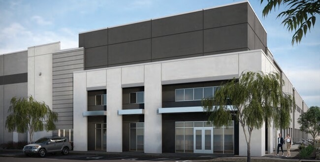

Property Detail
550 Industrial Rd
Las Cruces, NM
SUBD: WESTPARK LOGISITICS CENTER REPLAT 1 (BK 24 PG 511-512 - 2003662) LOT: 10-11 S: 26 T: 28S R: 2E AKA LOT 10A, INST#2138420
19-07151
DONA ANA
Commercialacreage
New Mexico
I2
10-11
2024
29.11 AC
2025
Las Cruces/Alamogordo
001701
Other Market Areas
367,476 SF
NEARBY LISTINGS FOR SALE OR LEASE
DEMOGRAPHICS near 550 Industrial Rd
1 mile
3 mile
5 mile
2025 Total Population
0
13
11,674
2030 Population
0
14
12,210
Pop Growth 2025-2030
0.00%
+ 7.69%
+ 4.59%
Average Age
0
40
36
2025 Total Households
0
5
3,859
HH Growth 2025-2030
0.00%
0.00%
+ 4.72%
Median Household Inc
$0
$99,999
$73,276
Avg Household Size
.00
2.40
3.00
2025 Avg HH Vehicles
.00
2.00
2.00
Median Home Value
$0
$250,000
$257,328
Median Year Built
0
1994
2005
Nearby Places
Map Layers
Map Styles
 Street
 Aerial
Layers
 Traffic
 Biking
Places
Listings with unknown addresses are not visible on the map
- Restaurants
- Banks
- Shops
- Fitness
- Groceries
PUBLIC TRANSPORTATION
AIRPORT
El Paso International
Drive
Walk
Distance
El Paso International
52 min
34.7 mi
Freight Ports
Port of San Diego
Drive
Walk
Distance
Port of San Diego
760 min
723.2 mi
SALE & LEASE HISTORY
LISTING DATE
SALE/LEASE

Nov 18, 2021
For Lease
Jul 07, 2023
For Lease
Nearby Properties
Address
Land Use
TOTAL SIZE
Lot Size
Zoning
Address
Land Use
TOTAL SIZE
Lot Size
Zoning
419,192 SF
27.65 AC
I2
Address
Land Use
TOTAL SIZE
Lot Size
Zoning
10,845 SF
15.80 AC
I2
Address
Land Use
TOTAL SIZE
Lot Size
Zoning
319,342 SF
25.71 AC
I2
Address
Land Use
TOTAL SIZE
Lot Size
Zoning
77,634 SF
12 AC
I2
Address
Land Use
TOTAL SIZE
Lot Size
Zoning
16.85 AC
I2
Address
Land Use
TOTAL SIZE
Lot Size
Zoning
214,580 SF
31.42 AC
I2
Address
Land Use
TOTAL SIZE
Lot Size
Zoning
330,989 SF
21.99 AC
I2
Address
Land Use
TOTAL SIZE
Lot Size
Zoning
221,573 SF
25.63 AC
I2
Address
Land Use
TOTAL SIZE
Lot Size
Zoning
291,040 SF
21.36 AC
I2
Address
Land Use
TOTAL SIZE
Lot Size
Zoning
225,200 SF
13.07 AC
I2
Address
Land Use
TOTAL SIZE
Lot Size
Zoning
182,620 SF
10.62 AC
I2
Address
Land Use
TOTAL SIZE
Lot Size
Zoning
135,000 SF
13.13 AC
I2
Address
Land Use
TOTAL SIZE
Lot Size
Zoning
118,578 SF
60 AC
I2
Address
Land Use
TOTAL SIZE
Lot Size
Zoning
111,711 SF
6.77 AC
I2
Address
Land Use
TOTAL SIZE
Lot Size
Zoning
115,750 SF
12.51 AC
I2
Address
Land Use
TOTAL SIZE
Lot Size
Zoning
22,326 SF
11.78 AC
C3
Address
Land Use
TOTAL SIZE
Lot Size
Zoning
10.08 AC
I2
Address
Land Use
TOTAL SIZE
Lot Size
Zoning
117,532 SF
5.42 AC
I2
Address
Land Use
TOTAL SIZE
Lot Size
Zoning
67,620 SF
4.27 AC
I2
Address
Land Use
TOTAL SIZE
Lot Size
Zoning
91,931 SF
5.22 AC
I2
Address
Land Use
TOTAL SIZE
Lot Size
Zoning
10.02 AC
I2
Address
Land Use
TOTAL SIZE
Lot Size
Zoning
70,258 SF
6.35 AC
I2
Address
Land Use
TOTAL SIZE
Lot Size
Zoning
50,000 SF
7.08 AC
I2
Address
Land Use
TOTAL SIZE
Lot Size
Zoning
94,400 SF
6.05 AC
I2
Address
Land Use
TOTAL SIZE
Lot Size
Zoning
80,000 SF
5.40 AC
I2
Address
Land Use
TOTAL SIZE
Lot Size
Zoning
55,850 SF
6.74 AC
I2
Address
Land Use
TOTAL SIZE
Lot Size
Zoning
48,000 SF
4.67 AC
I2
Address
Land Use
TOTAL SIZE
Lot Size
Zoning
12,320 SF
REM
Address
Land Use
TOTAL SIZE
Lot Size
Zoning
32,409 SF
3.01 AC
I2
The World's #1 Commercial Real Estate Marketplace
Connect with us
© 2026 CoStar Group
The information above has been obtained from sources believed reliable. While we do not doubt its accuracy we have not verified it and make no guarantee, warranty or representation about it. It is your responsibility to independently confirm its accuracy and completeness. Any projections, opinions, assumptions, or estimates used are for example only and do not represent the current or future performance of the property. The value of this transaction to you depends on tax and other factors which should be evaluated by your tax, financial, and legal advisors. You and your advisors should conduct a careful, independent investigation of the property to determine to your satisfaction the suitability of the property for your needs.