Property Record
600 Keller Haslet Rd N, Haslet, TX 76052

Property Detail
600 Keller Haslet Rd N
Dallas-Fort Worth-Arlington, TX
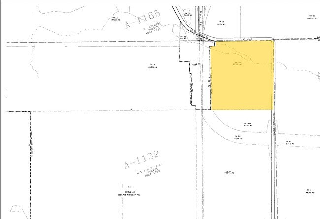
M E P & P RR CO SURVEY #12 ABSTRACT 1132 TRACT 1A02
06690750
TARRANT
Timberlandforesttreesagricultural
Texas
AE The base floodplain where base flood elevations are provided. AE Zones are now used on new format FIRMs instead of A1-A30 Zones.
23.49 AC
2025
Alliance
2025
Dallas/Ft Worth
114111
NEARBY LISTINGS FOR SALE OR LEASE
DEMOGRAPHICS near 600 Keller Haslet Rd N
1 mile
3 mile
5 mile
2025 Total Population
893
20,958
102,962
2030 Population
967
23,531
112,784
Pop Growth 2025-2030
+ 8.29%
+ 12.28%
+ 9.54%
Average Age
31
35
35
2025 Total Households
271
6,576
32,959
HH Growth 2025-2030
+ 8.49%
+ 12.55%
+ 9.67%
Median Household Inc
$111,046
$151,381
$122,418
Avg Household Size
3.30
3.20
3.10
2025 Avg HH Vehicles
2.00
2.00
2.00
Median Home Value
$327,472
$443,173
$398,226
Median Year Built
2009
2010
2010
Nearby Places
Map Layers
Map Styles
 Street
 Aerial
Transit
 Traffic
 Biking
Places
Listings with unknown addresses are not visible on the map
- Restaurants
- Banks
- Shops
- Fitness
- Groceries
PUBLIC TRANSPORTATION
AIRPORT
Dallas-Fort Worth International
Drive
Walk
Distance
Dallas-Fort Worth International
36 min
24.3 mi
Dallas Love Field
Drive
Walk
Distance
Dallas Love Field
54 min
38.1 mi
Nearby Properties
Address
Land Use
TOTAL SIZE
Lot Size
Zoning
Address
Land Use
TOTAL SIZE
Lot Size
Zoning
348,270 SF
39.34 AC
Address
Land Use
TOTAL SIZE
Lot Size
Zoning
830,399 SF
11.02 AC
Address
Land Use
TOTAL SIZE
Lot Size
Zoning
564,806 SF
162.94 AC
Address
Land Use
TOTAL SIZE
Lot Size
Zoning
1,150,000 SF
117.10 AC
Address
Land Use
TOTAL SIZE
Lot Size
Zoning
1,141,133 SF
67.79 AC
Address
Land Use
TOTAL SIZE
Lot Size
Zoning
1,179,900 SF
73.58 AC
Address
Land Use
TOTAL SIZE
Lot Size
Zoning
882,565 SF
56.65 AC
Address
Land Use
TOTAL SIZE
Lot Size
Zoning
1,030,050 SF
95.93 AC
Address
Land Use
TOTAL SIZE
Lot Size
Zoning
1,071,600 SF
74.77 AC
Address
Land Use
TOTAL SIZE
Lot Size
Zoning
1,001,600 SF
58.47 AC
Address
Land Use
TOTAL SIZE
Lot Size
Zoning
1,075,256 SF
127.44 AC
Address
Land Use
TOTAL SIZE
Lot Size
Zoning
1,140,525 SF
45.79 AC
Address
Land Use
TOTAL SIZE
Lot Size
Zoning
202.10 AC
Address
Land Use
TOTAL SIZE
Lot Size
Zoning
175,000 SF
14.48 AC
Address
Land Use
TOTAL SIZE
Lot Size
Zoning
807,229 SF
46.10 AC
Address
Land Use
TOTAL SIZE
Lot Size
Zoning
804,270 SF
58.79 AC
Address
Land Use
TOTAL SIZE
Lot Size
Zoning
295,161 SF
257.32 AC
Address
Land Use
TOTAL SIZE
Lot Size
Zoning
708,400 SF
85.97 AC
Address
Land Use
TOTAL SIZE
Lot Size
Zoning
672,150 SF
36.62 AC
Address
Land Use
TOTAL SIZE
Lot Size
Zoning
677,700 SF
42.17 AC
Address
Land Use
TOTAL SIZE
Lot Size
Zoning
634,042 SF
35.88 AC
Address
Land Use
TOTAL SIZE
Lot Size
Zoning
546,000 SF
33.60 AC
Address
Land Use
TOTAL SIZE
Lot Size
Zoning
562,500 SF
29.64 AC
Address
Land Use
TOTAL SIZE
Lot Size
Zoning
731,548 SF
56.18 AC
Address
Land Use
TOTAL SIZE
Lot Size
Zoning
184,400 SF
19.75 AC
Address
Land Use
TOTAL SIZE
Lot Size
Zoning
436,589 SF
32.43 AC
Address
Land Use
TOTAL SIZE
Lot Size
Zoning
433,500 SF
27.58 AC
Address
Land Use
TOTAL SIZE
Lot Size
Zoning
360,000 SF
28.63 AC
Address
Land Use
TOTAL SIZE
Lot Size
Zoning
74,825 SF
13.41 AC
Address
Land Use
TOTAL SIZE
Lot Size
Zoning
218,037 SF
11.23 AC
The World's #1 Commercial Real Estate Marketplace
Connect with us
© 2026 CoStar Group
The information above has been obtained from sources believed reliable. While we do not doubt its accuracy we have not verified it and make no guarantee, warranty or representation about it. It is your responsibility to independently confirm its accuracy and completeness. Any projections, opinions, assumptions, or estimates used are for example only and do not represent the current or future performance of the property. The value of this transaction to you depends on tax and other factors which should be evaluated by your tax, financial, and legal advisors. You and your advisors should conduct a careful, independent investigation of the property to determine to your satisfaction the suitability of the property for your needs.