Property Record
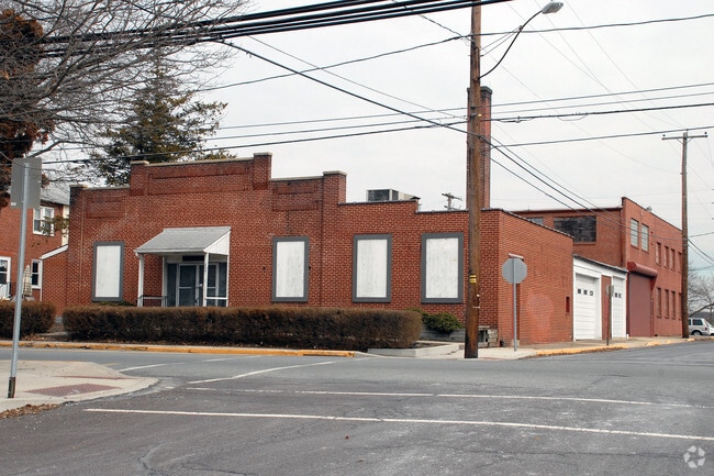
600 Main St, Green Lane, PA 18054


NEARBY LISTINGS FOR SALE OR LEASE
Property Detail
600 Main St
17-00-00370-009
ASSESSOR BLOCK-UNIT NUMBER 10-10
Vehiclerentalsvehiclesales
Montgomery
X
Pennsylvania
42091C0038G
10
2024
0.56 AC
2025
West Montgomery County
207600
Philadelphia
8,120 SF
Philadelphia-Camden-Wilmington, PA-NJ-DE-MD
DEMOGRAPHICS near 600 Main St
1 Mile
3 Mile
5 Mile
2024 Total Population
4,994
19,524
30,445
2029 Population
5,089
19,807
30,623
Pop Growth 2024-2029
+ 1.90%
+ 1.45%
+ 0.58%
Average Age
42
40
41
2024 Total Households
1,950
7,190
11,274
HH Growth 2024-2029
+ 1.79%
+ 1.31%
+ 0.49%
Median Household Inc
$94,989
$94,706
$98,480
Avg Household Size
2.50
2.60
2.60
2024 Avg HH Vehicles
2.00
2.00
2.00
Median Home Value
$242,375
$277,904
$317,444
Median Year Built
1985
1979
1976
Nearby Places
Map Layers
Map Styles
 Street
 Aerial
- Restaurants
- Banks
- Shops
- Fitness
- Groceries
PUBLIC TRANSPORTATION
AIRPORT
Lehigh Valley International
DRIVE
WALK
Distance
Lehigh Valley International
45 min
25.0 mi
Freight Ports
Port of Philadelphia
DRIVE
WALK
Distance
Port of Philadelphia
63 min
38.5 mi
Nearby Properties
Address
Land Use
TOTAL SIZE
Lot Size
Zoning
Address
Land Use
TOTAL SIZE
Lot Size
Zoning
202,162 SF
43.74 AC
R1
Address
Land Use
TOTAL SIZE
Lot Size
Zoning
238,859 SF
25.57 AC
R1
Address
Land Use
TOTAL SIZE
Lot Size
Zoning
155,554 SF
20.09 AC
LIC
Address
Land Use
TOTAL SIZE
Lot Size
Zoning
152,003 SF
8.05 AC
I
Address
Land Use
TOTAL SIZE
Lot Size
Zoning
137,273 SF
18.06 AC
IN
Address
Land Use
TOTAL SIZE
Lot Size
Zoning
78,045 SF
48.01 AC
R1
Address
Land Use
TOTAL SIZE
Lot Size
Zoning
1,212.07 AC
R1
Address
Land Use
TOTAL SIZE
Lot Size
Zoning
74,052 SF
21.35 AC
R1
Address
Land Use
TOTAL SIZE
Lot Size
Zoning
134,607 SF
16.42 AC
SC
Address
Land Use
TOTAL SIZE
Lot Size
Zoning
44,420 SF
730 AC
R1
Address
Land Use
TOTAL SIZE
Lot Size
Zoning
38,890 SF
1.75 AC
R3
Address
Land Use
TOTAL SIZE
Lot Size
Zoning
697.54 AC
R1
Address
Land Use
TOTAL SIZE
Lot Size
Zoning
287,614 SF
30.40 AC
LIC1
Address
Land Use
TOTAL SIZE
Lot Size
Zoning
42,045 SF
2.81 AC
I
Address
Land Use
TOTAL SIZE
Lot Size
Zoning
237,905 SF
22.23 AC
LI
Address
Land Use
TOTAL SIZE
Lot Size
Zoning
72,843 SF
5.99 AC
R4
Address
Land Use
TOTAL SIZE
Lot Size
Zoning
69,402 SF
6.89 AC
I
Address
Land Use
TOTAL SIZE
Lot Size
Zoning
61,534 SF
6.08 AC
I
Address
Land Use
TOTAL SIZE
Lot Size
Zoning
35,723 SF
22.16 AC
R1
Address
Land Use
TOTAL SIZE
Lot Size
Zoning
118,910 SF
4.08 AC
LI
Address
Land Use
TOTAL SIZE
Lot Size
Zoning
34,896 SF
26.97 AC
R1
Address
Land Use
TOTAL SIZE
Lot Size
Zoning
31,274 SF
13.32 AC
LI
Address
Land Use
TOTAL SIZE
Lot Size
Zoning
32,124 SF
2.70 AC
I
Address
Land Use
TOTAL SIZE
Lot Size
Zoning
65,620 SF
11.77 AC
LIC1
Address
Land Use
TOTAL SIZE
Lot Size
Zoning
35,570 SF
4.84 AC
LIC
Address
Land Use
TOTAL SIZE
Lot Size
Zoning
102,480 SF
18.75 AC
LIC1
Address
Land Use
TOTAL SIZE
Lot Size
Zoning
27,400 SF
LIC1
Address
Land Use
TOTAL SIZE
Lot Size
Zoning
29,626 SF
18.43 AC
R1
Address
Land Use
TOTAL SIZE
Lot Size
Zoning
26,248 SF
3.90 AC
LIC1
Address
Land Use
TOTAL SIZE
Lot Size
Zoning
23,777 SF
2.38 AC
C
The World's #1 Commercial Real Estate Marketplace
Connect with us
© 2026 CoStar Group
The information above has been obtained from sources believed reliable. While we do not doubt its accuracy we have not verified it and make no guarantee, warranty or representation about it. It is your responsibility to independently confirm its accuracy and completeness. Any projections, opinions, assumptions, or estimates used are for example only and do not represent the current or future performance of the property. The value of this transaction to you depends on tax and other factors which should be evaluated by your tax, financial, and legal advisors. You and your advisors should conduct a careful, independent investigation of the property to determine to your satisfaction the suitability of the property for your needs.