Property Record
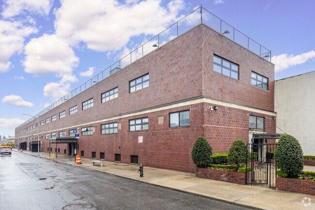
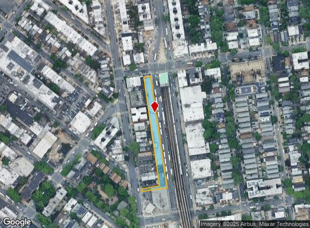
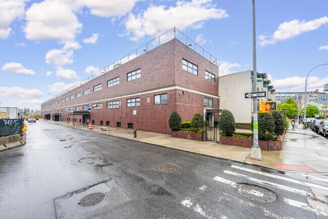
600 Mcdonald Ave, Brooklyn, NY 11218
NEARBY LISTINGS FOR SALE OR LEASE
Property Detail
600 Mcdonald Ave
05369-0006
DOCID-2021020700002002
Religious
Kings
X
New York
3604970213F
6
0
0.64 AC
2025
South Brooklyn
048600
Long Island (New York)
31,880 SF
New York-Jersey City-White Plains, NY-NJ
DEMOGRAPHICS near 600 Mcdonald Ave
1 Mile
3 Mile
5 Mile
2024 Total Population
161,658
1,139,900
2,250,648
2029 Population
151,033
1,062,911
2,106,443
Pop Growth 2024-2029
(6.57%)
(6.75%)
(6.41%)
Average Age
35
39
39
2024 Total Households
49,397
399,279
826,325
HH Growth 2024-2029
(6.88%)
(7.03%)
(6.72%)
Median Household Inc
$60,772
$72,331
$69,281
Avg Household Size
3.10
2.70
2.60
2024 Avg HH Vehicles
1.00
1.00
1.00
Median Home Value
$919,755
$902,843
$837,491
Median Year Built
1948
1947
1948
Nearby Places
- Restaurants
- Banks
- Shops
- Fitness
- Groceries
PUBLIC TRANSPORTATION
TRANSIT/SUBWAY
Ditmas Avenue (F - New York MTA Subway (The Subway))
DRIVE
WALK
Distance
Ditmas Avenue (F - New York MTA Subway (The Subway))
0 min
4 min
0.2 mi
Church Avenue (F,G Line) (F - New York MTA Subway (The Subway))
DRIVE
WALK
Distance
Church Avenue (F,G Line) (F - New York MTA Subway (The Subway))
1 min
5 min
0.3 mi
18 Avenue (F Line) (F - New York MTA Subway (The Subway))
DRIVE
WALK
Distance
18 Avenue (F Line) (F - New York MTA Subway (The Subway))
1 min
13 min
0.7 mi
Cortelyou Road (Q - New York MTA Subway (The Subway))
DRIVE
WALK
Distance
Cortelyou Road (Q - New York MTA Subway (The Subway))
4 min
18 min
1.0 mi
Fort Hamilton Parkway (D,M Line) (D - New York MTA Subway (The Subway), M - New York MTA Subway (The Subway))
DRIVE
WALK
Distance
Fort Hamilton Parkway (D,M Line) (D - New York MTA Subway (The Subway), M - New York MTA Subway (The Subway))
3 min
20 min
1.1 mi
COMMUTER RAIL
Nostrand Avenue Station (Far Rockaway Branch - Long Island Rail Road, Hempstead Branch - Long Island Rail Road, Long Beach Branch - Long Island Rail Road, West Hempstead Branch - Long Island Rail Road)
DRIVE
WALK
Distance
Nostrand Avenue Station (Far Rockaway Branch - Long Island Rail Road, Hempstead Branch - Long Island Rail Road, Long Beach Branch - Long Island Rail Road, West Hempstead Branch - Long Island Rail Road)
11 min
4.3 mi
Atlantic Terminal (Babylon Branch - Long Island Rail Road, City Terminal Zone - Long Island Rail Road, Hempstead Branch - Long Island Rail Road, West Hempstead Branch - Long Island Rail Road)
DRIVE
WALK
Distance
Atlantic Terminal (Babylon Branch - Long Island Rail Road, City Terminal Zone - Long Island Rail Road, Hempstead Branch - Long Island Rail Road, West Hempstead Branch - Long Island Rail Road)
10 min
4.3 mi
AIRPORT
John F Kennedy International
DRIVE
WALK
Distance
John F Kennedy International
23 min
13.2 mi
LaGuardia
DRIVE
WALK
Distance
LaGuardia
26 min
15.3 mi
Newark Liberty International
DRIVE
WALK
Distance
Newark Liberty International
31 min
18.8 mi
Freight Ports
NY - Red Hook Container Terminal
DRIVE
WALK
Distance
NY - Red Hook Container Terminal
7 min
4.2 mi
Nearby Properties
Address
Land Use
TOTAL SIZE
Lot Size
Zoning
Address
Land Use
TOTAL SIZE
Lot Size
Zoning
869,038 SF
1.53 AC
M1-1
Address
Land Use
TOTAL SIZE
Lot Size
Zoning
92,440 SF
466.23 AC
R5
Address
Land Use
TOTAL SIZE
Lot Size
Zoning
1,503,150 SF
20.47 AC
R5
Address
Land Use
TOTAL SIZE
Lot Size
Zoning
393.54 AC
PARK
Address
Land Use
TOTAL SIZE
Lot Size
Zoning
577,381 SF
3.19 AC
R6
Address
Land Use
TOTAL SIZE
Lot Size
Zoning
902,000 SF
6.44 AC
M3-1
Address
Land Use
TOTAL SIZE
Lot Size
Zoning
965,600 SF
6.65 AC
R5
Address
Land Use
TOTAL SIZE
Lot Size
Zoning
1,061,228 SF
8.86 AC
R5
Address
Land Use
TOTAL SIZE
Lot Size
Zoning
460,000 SF
3.21 AC
R6
Address
Land Use
TOTAL SIZE
Lot Size
Zoning
1,073,920 SF
16.53 AC
R6
Address
Land Use
TOTAL SIZE
Lot Size
Zoning
561,945 SF
11.58 AC
R6
Address
Land Use
TOTAL SIZE
Lot Size
Zoning
335,800 SF
1.51 AC
R6
Address
Land Use
TOTAL SIZE
Lot Size
Zoning
785,450 SF
14.22 AC
R6
Address
Land Use
TOTAL SIZE
Lot Size
Zoning
1,324,592 SF
5.13 AC
M3-1
Address
Land Use
TOTAL SIZE
Lot Size
Zoning
296,915 SF
0.31 AC
C5-3
Address
Land Use
TOTAL SIZE
Lot Size
Zoning
397,354 SF
0.61 AC
C5-2
Address
Land Use
TOTAL SIZE
Lot Size
Zoning
566,000 SF
12.33 AC
R6
Address
Land Use
TOTAL SIZE
Lot Size
Zoning
427,208 SF
1.30 AC
R6
Address
Land Use
TOTAL SIZE
Lot Size
Zoning
393,092 SF
1.07 AC
R8A
Address
Land Use
TOTAL SIZE
Lot Size
Zoning
371,139 SF
3.22 AC
R5
Address
Land Use
TOTAL SIZE
Lot Size
Zoning
5,359,400 SF
59.07 AC
M2-1
Address
Land Use
TOTAL SIZE
Lot Size
Zoning
240,382 SF
0.24 AC
R9
Address
Land Use
TOTAL SIZE
Lot Size
Zoning
3,970,000 SF
91.14 AC
M3-1
Address
Land Use
TOTAL SIZE
Lot Size
Zoning
1,466,751 SF
24.79 AC
R5
Address
Land Use
TOTAL SIZE
Lot Size
Zoning
635,994 SF
17.90 AC
R5
Address
Land Use
TOTAL SIZE
Lot Size
Zoning
689,850 SF
3.08 AC
M3-1
Address
Land Use
TOTAL SIZE
Lot Size
Zoning
241,735 SF
1.99 AC
C8-4
Address
Land Use
TOTAL SIZE
Lot Size
Zoning
336,534 SF
47.78 AC
M1-1
Address
Land Use
TOTAL SIZE
Lot Size
Zoning
308,757 SF
0.74 AC
R7-1
Address
Land Use
TOTAL SIZE
Lot Size
Zoning
673,895 SF
3.22 AC
M3-1
The World's #1 Commercial Real Estate Marketplace
Connect with us
© 2025 CoStar Group
The information above has been obtained from sources believed reliable. While we do not doubt its accuracy we have not verified it and make no guarantee, warranty or representation about it. It is your responsibility to independently confirm its accuracy and completeness. Any projections, opinions, assumptions, or estimates used are for example only and do not represent the current or future performance of the property. The value of this transaction to you depends on tax and other factors which should be evaluated by your tax, financial, and legal advisors. You and your advisors should conduct a careful, independent investigation of the property to determine to your satisfaction the suitability of the property for your needs.