Property Record
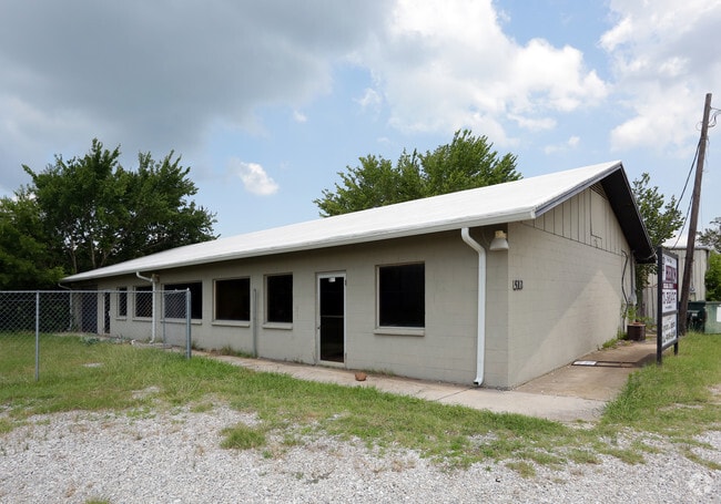
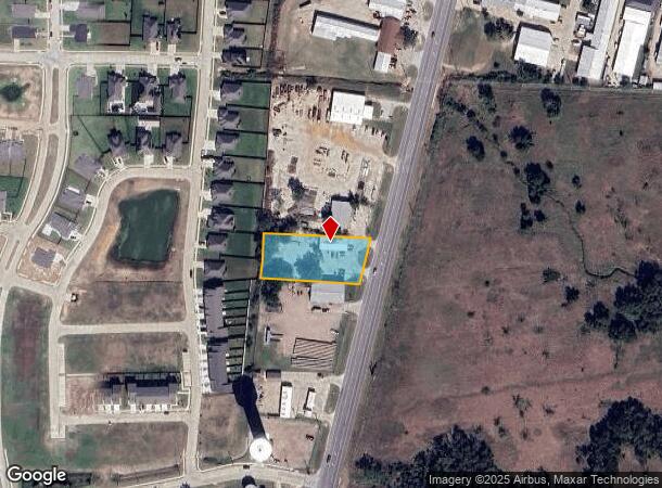
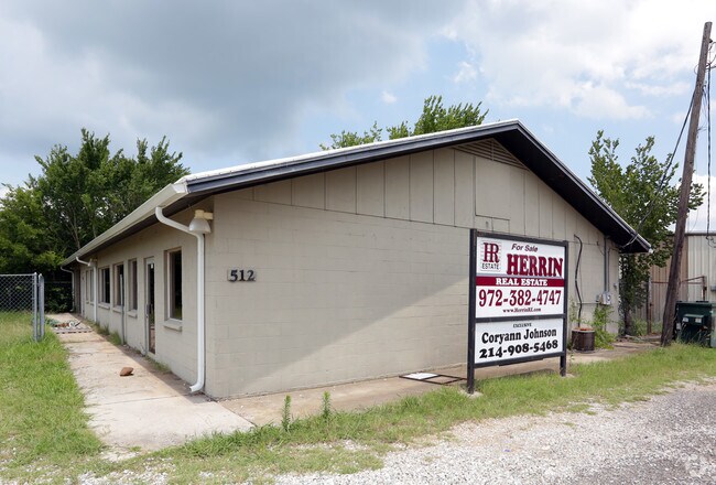
600 N Highway 377, Pilot Point, TX 76258
Property Detail
600 N Highway 377
R41373
C. Smith
Commercialnec
A1139A C. SMITH, TR 5, 1.003 ACRES
X
Denton
48121C0115G
Texas
2024
1 AC
2025
East Lewisville
020129
Dallas/Ft Worth
3,200 SF
Dallas-Fort Worth-Arlington, TX
NEARBY LISTINGS FOR SALE OR LEASE
DEMOGRAPHICS near 600 N Highway 377
1 mile
3 mile
5 mile
2024 Total Population
2,584
5,492
7,360
2029 Population
3,114
6,579
8,727
Pop Growth 2024-2029
+ 20.51%
+ 19.79%
+ 18.57%
Average Age
40
41
41
2024 Total Households
920
1,951
2,657
HH Growth 2024-2029
+ 21.09%
+ 20.35%
+ 19.08%
Median Household Inc
$80,675
$85,771
$87,093
Avg Household Size
2.80
2.80
2.70
2024 Avg HH Vehicles
2.00
3.00
3.00
Median Home Value
$219,565
$278,733
$321,167
Median Year Built
1988
1991
1992
Nearby Places
Map Layers
Map Styles
 Street
 Aerial
Transit
 Traffic
 Biking
Places
Listings with unknown addresses are not visible on the map
- Restaurants
- Banks
- Shops
- Fitness
- Groceries
Nearby Properties
Address
Land Use
TOTAL SIZE
Lot Size
Zoning
Address
Land Use
TOTAL SIZE
Lot Size
Zoning
83,087 SF
23.24 AC
Address
Land Use
TOTAL SIZE
Lot Size
Zoning
118,721 SF
4.68 AC
Address
Land Use
TOTAL SIZE
Lot Size
Zoning
107,421 SF
15.99 AC
Address
Land Use
TOTAL SIZE
Lot Size
Zoning
312.59 AC
Address
Land Use
TOTAL SIZE
Lot Size
Zoning
210,260 SF
17.39 AC
Address
Land Use
TOTAL SIZE
Lot Size
Zoning
5,000 SF
112.65 AC
Address
Land Use
TOTAL SIZE
Lot Size
Zoning
5,951 SF
44.58 AC
Address
Land Use
TOTAL SIZE
Lot Size
Zoning
17.59 AC
Address
Land Use
TOTAL SIZE
Lot Size
Zoning
53,500 SF
3.30 AC
Address
Land Use
TOTAL SIZE
Lot Size
Zoning
42,263 SF
4.95 AC
Address
Land Use
TOTAL SIZE
Lot Size
Zoning
138,700 SF
13.42 AC
Address
Land Use
TOTAL SIZE
Lot Size
Zoning
19,558 SF
2.53 AC
Address
Land Use
TOTAL SIZE
Lot Size
Zoning
33,448 SF
15 AC
Address
Land Use
TOTAL SIZE
Lot Size
Zoning
51,500 SF
10 AC
Address
Land Use
TOTAL SIZE
Lot Size
Zoning
18,629 SF
1.61 AC
Address
Land Use
TOTAL SIZE
Lot Size
Zoning
8,640 SF
16.40 AC
Address
Land Use
TOTAL SIZE
Lot Size
Zoning
Address
Land Use
TOTAL SIZE
Lot Size
Zoning
Address
Land Use
TOTAL SIZE
Lot Size
Zoning
Address
Land Use
TOTAL SIZE
Lot Size
Zoning
1,200 SF
15 AC
Address
Land Use
TOTAL SIZE
Lot Size
Zoning
Address
Land Use
TOTAL SIZE
Lot Size
Zoning
41,862 SF
3.25 AC
Address
Land Use
TOTAL SIZE
Lot Size
Zoning
10,400 SF
0.46 AC
Address
Land Use
TOTAL SIZE
Lot Size
Zoning
10,995 SF
0.79 AC
Address
Land Use
TOTAL SIZE
Lot Size
Zoning
24,460 SF
0.23 AC
Address
Land Use
TOTAL SIZE
Lot Size
Zoning
20,725 SF
1.86 AC
Address
Land Use
TOTAL SIZE
Lot Size
Zoning
5,735 SF
0.90 AC
Address
Land Use
TOTAL SIZE
Lot Size
Zoning
9,400 SF
0.98 AC
Address
Land Use
TOTAL SIZE
Lot Size
Zoning
484 SF
33.49 AC
Address
Land Use
TOTAL SIZE
Lot Size
Zoning
45,047 SF
4.41 AC
The World's #1 Commercial Real Estate Marketplace
Connect with us
© 2026 CoStar Group
The information above has been obtained from sources believed reliable. While we do not doubt its accuracy we have not verified it and make no guarantee, warranty or representation about it. It is your responsibility to independently confirm its accuracy and completeness. Any projections, opinions, assumptions, or estimates used are for example only and do not represent the current or future performance of the property. The value of this transaction to you depends on tax and other factors which should be evaluated by your tax, financial, and legal advisors. You and your advisors should conduct a careful, independent investigation of the property to determine to your satisfaction the suitability of the property for your needs.