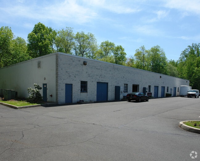
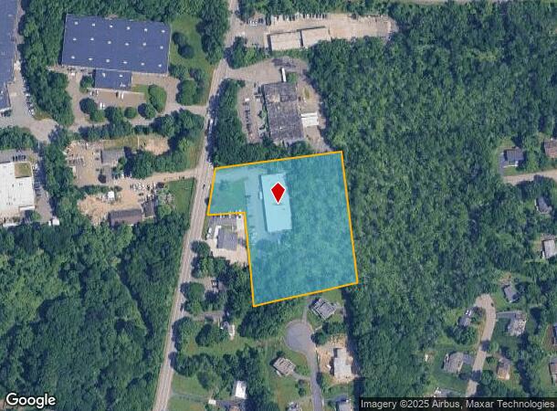
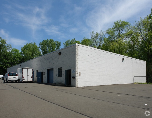
Property Record
600 N Main St, Sparkill, NY 10976
NEARBY LISTINGS FOR SALE OR LEASE
Property Detail
600 N Main St
392615-063-005-0001-019-000-0000
Rockland
Warehouse
New York
A
19.0
36087C0156G
3.77 AC
2023
Rockland County
2024
Northern New Jersey
013402
New York-Jersey City-White Plains, NY-NJ
14,400 SF
DEMOGRAPHICS near 600 N Main St
1 Mile
3 Mile
5 Mile
2024 Total Population
16,359
137,847
250,121
2029 Population
16,258
137,039
249,293
Pop Growth 2024-2029
(0.62%)
(0.59%)
(0.33%)
Average Age
35
33
36
2024 Total Households
4,714
36,874
73,327
HH Growth 2024-2029
(0.66%)
(0.56%)
(0.28%)
Median Household Inc
$84,280
$85,131
$106,236
Avg Household Size
3.30
3.50
3.20
2024 Avg HH Vehicles
2.00
2.00
2.00
Median Home Value
$528,707
$581,509
$636,727
Median Year Built
1971
1972
1971
Nearby Places
Map Layers
Map Styles
 Street
 Aerial
- Restaurants
- Banks
- Shops
- Fitness
- Groceries
PUBLIC TRANSPORTATION
COMMUTER RAIL
Spring Valley (Pascack Valley Line - NJ Transit Commuter Rail (NJ Transit))
DRIVE
WALK
Distance
Spring Valley (Pascack Valley Line - NJ Transit Commuter Rail (NJ Transit))
3 min
1.3 mi
Nanuet (Pascack Valley Line - NJ Transit Commuter Rail (NJ Transit))
DRIVE
WALK
Distance
Nanuet (Pascack Valley Line - NJ Transit Commuter Rail (NJ Transit))
7 min
3.5 mi
AIRPORT
Westchester County
DRIVE
WALK
Distance
Westchester County
37 min
25.7 mi
LaGuardia
DRIVE
WALK
Distance
LaGuardia
52 min
31.9 mi
New York Stewart International
DRIVE
WALK
Distance
New York Stewart International
58 min
42.4 mi
Freight Ports
Maher Terminal
DRIVE
WALK
Distance
Maher Terminal
53 min
35.2 mi
Nearby Properties
Address
Land Use
TOTAL SIZE
Lot Size
Zoning
Address
Land Use
TOTAL SIZE
Lot Size
Zoning
402,385 SF
23.10 AC
LI
Address
Land Use
TOTAL SIZE
Lot Size
Zoning
63,621 SF
180.20 AC
LI
Address
Land Use
TOTAL SIZE
Lot Size
Zoning
11.48 AC
OR-3
Address
Land Use
TOTAL SIZE
Lot Size
Zoning
17 AC
OR1
Address
Land Use
TOTAL SIZE
Lot Size
Zoning
37,600 SF
31.41 AC
Address
Land Use
TOTAL SIZE
Lot Size
Zoning
116,650 SF
39.20 AC
05
Address
Land Use
TOTAL SIZE
Lot Size
Zoning
11.50 AC
OR1
Address
Land Use
TOTAL SIZE
Lot Size
Zoning
107,043 SF
11 AC
OR3
Address
Land Use
TOTAL SIZE
Lot Size
Zoning
152,854 SF
18.75 AC
RS
Address
Land Use
TOTAL SIZE
Lot Size
Zoning
Address
Land Use
TOTAL SIZE
Lot Size
Zoning
119,025 SF
16.57 AC
OR3
Address
Land Use
TOTAL SIZE
Lot Size
Zoning
13 AC
R40
Address
Land Use
TOTAL SIZE
Lot Size
Zoning
270,962 SF
21.80 AC
CS
Address
Land Use
TOTAL SIZE
Lot Size
Zoning
9.29 AC
OR3
Address
Land Use
TOTAL SIZE
Lot Size
Zoning
67,962 SF
8.30 AC
02 - SINGL
Address
Land Use
TOTAL SIZE
Lot Size
Zoning
126,835 SF
14.66 AC
OR3
Address
Land Use
TOTAL SIZE
Lot Size
Zoning
345,670 SF
49.40 AC
Address
Land Use
TOTAL SIZE
Lot Size
Zoning
247,496 SF
24.20 AC
Address
Land Use
TOTAL SIZE
Lot Size
Zoning
7.48 AC
OR1
Address
Land Use
TOTAL SIZE
Lot Size
Zoning
208,628 SF
11.95 AC
Address
Land Use
TOTAL SIZE
Lot Size
Zoning
2,220 SF
15.10 AC
02 - SINGL
Address
Land Use
TOTAL SIZE
Lot Size
Zoning
95,890 SF
60 AC
Address
Land Use
TOTAL SIZE
Lot Size
Zoning
1,578 SF
3.30 AC
R40
Address
Land Use
TOTAL SIZE
Lot Size
Zoning
Address
Land Use
TOTAL SIZE
Lot Size
Zoning
4.90 AC
OR2
Address
Land Use
TOTAL SIZE
Lot Size
Zoning
59,900 SF
3.20 AC
CC
Address
Land Use
TOTAL SIZE
Lot Size
Zoning
70,527 SF
10.20 AC
RSH
Address
Land Use
TOTAL SIZE
Lot Size
Zoning
4.34 AC
OR3
Address
Land Use
TOTAL SIZE
Lot Size
Zoning
64,784 SF
14.30 AC
RS
Address
Land Use
TOTAL SIZE
Lot Size
Zoning
4.12 AC
OR2
The World's #1 Commercial Real Estate Marketplace
Connect with us
© 2025 CoStar Group
The information above has been obtained from sources believed reliable. While we do not doubt its accuracy we have not verified it and make no guarantee, warranty or representation about it. It is your responsibility to independently confirm its accuracy and completeness. Any projections, opinions, assumptions, or estimates used are for example only and do not represent the current or future performance of the property. The value of this transaction to you depends on tax and other factors which should be evaluated by your tax, financial, and legal advisors. You and your advisors should conduct a careful, independent investigation of the property to determine to your satisfaction the suitability of the property for your needs.