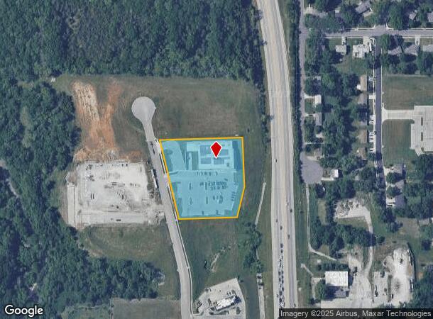
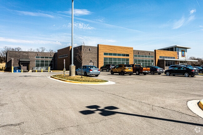
Property Record
600 N Millridge St, Olathe, KS 66061

NEARBY LISTINGS FOR SALE OR LEASE
Property Detail
600 N Millridge St
Kansas City, MO-KS
Stags Ridge
DP71860000-0001
STAGS RIDGE, LOT 1
Supermarket
Johnson
X
Kansas
20091C0078G
1
2024
2.48 AC
2024
South Johnson County
052805
Kansas City
21,168 SF
DEMOGRAPHICS near 600 N Millridge St
1 Mile
3 Mile
5 Mile
2024 Total Population
10,924
66,284
138,371
2029 Population
11,337
69,216
144,242
Pop Growth 2024-2029
+ 3.78%
+ 4.42%
+ 4.24%
Average Age
36
37
37
2024 Total Households
3,756
23,525
48,915
HH Growth 2024-2029
+ 3.97%
+ 4.58%
+ 4.37%
Median Household Inc
$83,841
$87,674
$99,980
Avg Household Size
2.80
2.70
2.70
2024 Avg HH Vehicles
2.00
2.00
2.00
Median Home Value
$248,611
$282,657
$301,284
Median Year Built
1987
1989
1993
Nearby Places
Map Layers
Map Styles
 Street
 Aerial
- Restaurants
- Banks
- Shops
- Fitness
- Groceries
PUBLIC TRANSPORTATION
AIRPORT
Kansas City International
DRIVE
WALK
Distance
Kansas City International
53 min
43.5 mi
Freight Ports
Tulsa Port Of Catoosa
DRIVE
WALK
Distance
Tulsa Port Of Catoosa
259 min
228.2 mi
Nearby Properties
Address
Land Use
TOTAL SIZE
Lot Size
Zoning
Address
Land Use
TOTAL SIZE
Lot Size
Zoning
401,604 SF
28.35 AC
CP-O
Address
Land Use
TOTAL SIZE
Lot Size
Zoning
356,910 SF
50.52 AC
RP-4
Address
Land Use
TOTAL SIZE
Lot Size
Zoning
307,761 SF
6.59 AC
C-2
Address
Land Use
TOTAL SIZE
Lot Size
Zoning
290,674 SF
74.32 AC
RP-1
Address
Land Use
TOTAL SIZE
Lot Size
Zoning
162,499 SF
38.74 AC
R-1
Address
Land Use
TOTAL SIZE
Lot Size
Zoning
456,742 SF
27.31 AC
R-1
Address
Land Use
TOTAL SIZE
Lot Size
Zoning
97,340 SF
1.82 AC
C-2
Address
Land Use
TOTAL SIZE
Lot Size
Zoning
88,459 SF
15.13 AC
R-1
Address
Land Use
TOTAL SIZE
Lot Size
Zoning
204,792 SF
15.20 AC
RP-3
Address
Land Use
TOTAL SIZE
Lot Size
Zoning
130,576 SF
15.20 AC
RP-4
Address
Land Use
TOTAL SIZE
Lot Size
Zoning
323,377 SF
15.55 AC
R-1
Address
Land Use
TOTAL SIZE
Lot Size
Zoning
211,785 SF
35.56 AC
RP-3
Address
Land Use
TOTAL SIZE
Lot Size
Zoning
19,460 SF
9.12 AC
R-1
Address
Land Use
TOTAL SIZE
Lot Size
Zoning
66,664 SF
2.94 AC
C-2
Address
Land Use
TOTAL SIZE
Lot Size
Zoning
5,355 SF
0.87 AC
431.AS
Address
Land Use
TOTAL SIZE
Lot Size
Zoning
155,267 SF
37.69 AC
R-1
Address
Land Use
TOTAL SIZE
Lot Size
Zoning
177,274 SF
2.69 AC
C-2
Address
Land Use
TOTAL SIZE
Lot Size
Zoning
251,981 SF
10.79 AC
R-5
Address
Land Use
TOTAL SIZE
Lot Size
Zoning
68,131 SF
6.01 AC
Address
Land Use
TOTAL SIZE
Lot Size
Zoning
137,122 SF
7.68 AC
C-1
Address
Land Use
TOTAL SIZE
Lot Size
Zoning
53,359 SF
41.55 AC
R-1
Address
Land Use
TOTAL SIZE
Lot Size
Zoning
188,944 SF
31.48 AC
R-1
Address
Land Use
TOTAL SIZE
Lot Size
Zoning
44,486 SF
2.70 AC
C-2
Address
Land Use
TOTAL SIZE
Lot Size
Zoning
228,577 SF
17.11 AC
M-2
Address
Land Use
TOTAL SIZE
Lot Size
Zoning
44,486 SF
3.05 AC
C-2
Address
Land Use
TOTAL SIZE
Lot Size
Zoning
71,146 SF
12.67 AC
CP-2
Address
Land Use
TOTAL SIZE
Lot Size
Zoning
45,125 SF
2.83 AC
R-2
Address
Land Use
TOTAL SIZE
Lot Size
Zoning
49,415 SF
16.88 AC
BP
Address
Land Use
TOTAL SIZE
Lot Size
Zoning
68,212 SF
14.30 AC
RP-1
Address
Land Use
TOTAL SIZE
Lot Size
Zoning
205,752 SF
15.50 AC
M-2
The World's #1 Commercial Real Estate Marketplace
Connect with us
© 2026 CoStar Group
The information above has been obtained from sources believed reliable. While we do not doubt its accuracy we have not verified it and make no guarantee, warranty or representation about it. It is your responsibility to independently confirm its accuracy and completeness. Any projections, opinions, assumptions, or estimates used are for example only and do not represent the current or future performance of the property. The value of this transaction to you depends on tax and other factors which should be evaluated by your tax, financial, and legal advisors. You and your advisors should conduct a careful, independent investigation of the property to determine to your satisfaction the suitability of the property for your needs.