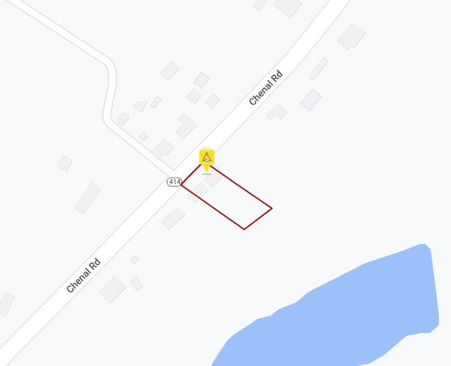
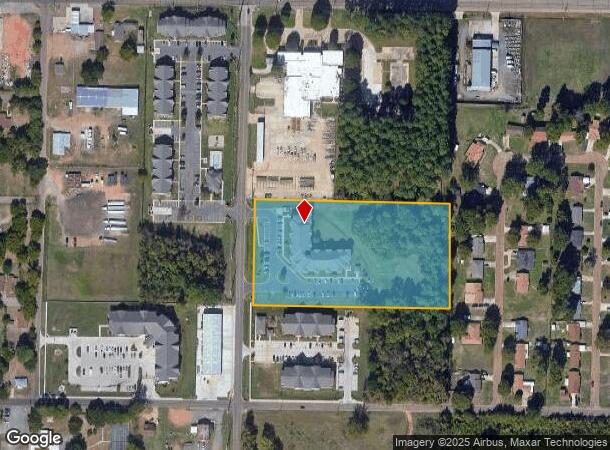
Property Record
600 N Oats St, Texarkana, AR 71854
NEARBY LISTINGS FOR SALE OR LEASE
Property Detail
600 N Oats St
Texarkana, TX-AR
28-15S-28W
00334800
LOT 7 NW NW
Apartment
Miller
X
Arkansas
48037C0370E
7
2025
4.62 AC
2025
Arkansas South Area
020600
Other Market Areas
50,212 SF
DEMOGRAPHICS near 600 N Oats St
1 Mile
3 Mile
5 Mile
2024 Total Population
4,688
30,780
58,730
2029 Population
4,825
31,051
59,065
Pop Growth 2024-2029
+ 2.92%
+ 0.88%
+ 0.57%
Average Age
38
39
39
2024 Total Households
1,792
12,032
23,630
HH Growth 2024-2029
+ 3.07%
+ 0.90%
+ 0.58%
Median Household Inc
$23,569
$38,940
$40,845
Avg Household Size
2.30
2.30
2.30
2024 Avg HH Vehicles
1.00
2.00
2.00
Median Home Value
$104,460
$113,304
$130,913
Median Year Built
1984
1973
1977
Nearby Places
Map Layers
Map Styles
 Street
 Aerial
- Restaurants
- Banks
- Shops
- Fitness
- Groceries
PUBLIC TRANSPORTATION
COMMUTER RAIL
Texarkana Amtrak Station (Texas Eagle - Amtrak)
DRIVE
WALK
Distance
Texarkana Amtrak Station (Texas Eagle - Amtrak)
4 min
2.6 mi
AIRPORT
Texarkana Regional-Webb Field
DRIVE
WALK
Distance
Texarkana Regional-Webb Field
8 min
2.9 mi
Freight Ports
Port of Shreveport
DRIVE
WALK
Distance
Port of Shreveport
104 min
92.8 mi
Nearby Properties
Address
Land Use
TOTAL SIZE
Lot Size
Zoning
Address
Land Use
TOTAL SIZE
Lot Size
Zoning
1,896,910 SF
46.19 AC
Address
Land Use
TOTAL SIZE
Lot Size
Zoning
Address
Land Use
TOTAL SIZE
Lot Size
Zoning
1,896,910 SF
Address
Land Use
TOTAL SIZE
Lot Size
Zoning
32.42 AC
Address
Land Use
TOTAL SIZE
Lot Size
Zoning
102,614 SF
0.89 AC
Address
Land Use
TOTAL SIZE
Lot Size
Zoning
100,000 SF
5.92 AC
Address
Land Use
TOTAL SIZE
Lot Size
Zoning
74,246 SF
1.34 AC
Address
Land Use
TOTAL SIZE
Lot Size
Zoning
55,033 SF
Address
Land Use
TOTAL SIZE
Lot Size
Zoning
4.43 AC
Address
Land Use
TOTAL SIZE
Lot Size
Zoning
219,618 SF
17.61 AC
Address
Land Use
TOTAL SIZE
Lot Size
Zoning
114,456 SF
10.11 AC
Address
Land Use
TOTAL SIZE
Lot Size
Zoning
43,378 SF
5 AC
Address
Land Use
TOTAL SIZE
Lot Size
Zoning
67,944 SF
13.78 AC
Address
Land Use
TOTAL SIZE
Lot Size
Zoning
270,796 SF
33.10 AC
Address
Land Use
TOTAL SIZE
Lot Size
Zoning
185,060 SF
Address
Land Use
TOTAL SIZE
Lot Size
Zoning
8.44 AC
Address
Land Use
TOTAL SIZE
Lot Size
Zoning
15,048 SF
1.61 AC
Address
Land Use
TOTAL SIZE
Lot Size
Zoning
79,236 SF
4.79 AC
Address
Land Use
TOTAL SIZE
Lot Size
Zoning
2.55 AC
Address
Land Use
TOTAL SIZE
Lot Size
Zoning
17,152 SF
3.15 AC
Address
Land Use
TOTAL SIZE
Lot Size
Zoning
28,480 SF
0.96 AC
Address
Land Use
TOTAL SIZE
Lot Size
Zoning
179,723 SF
36.84 AC
Address
Land Use
TOTAL SIZE
Lot Size
Zoning
104,341 SF
11.79 AC
Address
Land Use
TOTAL SIZE
Lot Size
Zoning
26,696 SF
1.29 AC
Address
Land Use
TOTAL SIZE
Lot Size
Zoning
21,296 SF
1.82 AC
Address
Land Use
TOTAL SIZE
Lot Size
Zoning
2.07 AC
Address
Land Use
TOTAL SIZE
Lot Size
Zoning
22,840 SF
1.43 AC
Address
Land Use
TOTAL SIZE
Lot Size
Zoning
47,776 SF
8 AC
Address
Land Use
TOTAL SIZE
Lot Size
Zoning
54,136 SF
7.45 AC
Address
Land Use
TOTAL SIZE
Lot Size
Zoning
36,320 SF
2.98 AC
The World's #1 Commercial Real Estate Marketplace
Connect with us
© 2026 CoStar Group
The information above has been obtained from sources believed reliable. While we do not doubt its accuracy we have not verified it and make no guarantee, warranty or representation about it. It is your responsibility to independently confirm its accuracy and completeness. Any projections, opinions, assumptions, or estimates used are for example only and do not represent the current or future performance of the property. The value of this transaction to you depends on tax and other factors which should be evaluated by your tax, financial, and legal advisors. You and your advisors should conduct a careful, independent investigation of the property to determine to your satisfaction the suitability of the property for your needs.