Property Record
600 Peters Rd, Harvey, LA 70058
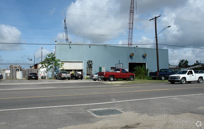


Property Detail
600 Peters Rd
0300000001
X A DEPTH OPPOSITE SIDE OF 275.65 FT HARVEY CANAL 9542277 9841330
Miscpropertynotclassed
Jefferson
M3
Louisiana
C and X Area of minimal flood hazard, usually depicted on FIRMs as above the 500-year flood level.
1.31 AC
2025
Westbank
2025
New Orleans/Metairie/Kenner
026000
New Orleans-Metairie, LA
NEARBY LISTINGS FOR SALE OR LEASE
DEMOGRAPHICS near 600 Peters Rd
1 mile
3 mile
5 mile
2025 Total Population
6,955
129,081
331,989
2030 Population
6,847
126,703
324,902
Pop Growth 2025-2030
(1.55%)
(1.84%)
(2.13%)
Average Age
42
41
41
2025 Total Households
3,008
57,609
140,916
HH Growth 2025-2030
(1.73%)
(1.99%)
(2.23%)
Median Household Inc
$42,785
$58,720
$59,218
Avg Household Size
2.20
2.10
2.20
2025 Avg HH Vehicles
1.00
1.00
1.00
Median Home Value
$183,579
$302,214
$273,870
Median Year Built
1961
1961
1962
Nearby Places
Map Layers
Map Styles
 Street
 Aerial
Layers
 Traffic
 Biking
Places
Listings with unknown addresses are not visible on the map
- Restaurants
- Banks
- Shops
- Fitness
- Groceries
PUBLIC TRANSPORTATION
COMMUTER RAIL
Drive
Walk
Distance
12 min
7.2 mi
AIRPORT
Louis Armstrong New Orleans International
Drive
Walk
Distance
Louis Armstrong New Orleans International
30 min
21.5 mi
Freight Ports
Plaquemines Port
Drive
Walk
Distance
Plaquemines Port
14 min
7.6 mi
Nearby Properties
Address
Land Use
TOTAL SIZE
Lot Size
Zoning
Address
Land Use
TOTAL SIZE
Lot Size
Zoning
44.43 AC
CBD-4
Address
Land Use
TOTAL SIZE
Lot Size
Zoning
468,704 SF
8.66 AC
MC
Address
Land Use
TOTAL SIZE
Lot Size
Zoning
3.66 AC
MC
Address
Land Use
TOTAL SIZE
Lot Size
Zoning
0.12 AC
Address
Land Use
TOTAL SIZE
Lot Size
Zoning
Address
Land Use
TOTAL SIZE
Lot Size
Zoning
512,729 SF
6.60 AC
Address
Land Use
TOTAL SIZE
Lot Size
Zoning
0.14 AC
Address
Land Use
TOTAL SIZE
Lot Size
Zoning
0.67 AC
CBD-3
Address
Land Use
TOTAL SIZE
Lot Size
Zoning
25.26 AC
Address
Land Use
TOTAL SIZE
Lot Size
Zoning
4.12 AC
Address
Land Use
TOTAL SIZE
Lot Size
Zoning
246,930 SF
9.40 AC
CBD-4
Address
Land Use
TOTAL SIZE
Lot Size
Zoning
Address
Land Use
TOTAL SIZE
Lot Size
Zoning
1.15 AC
Address
Land Use
TOTAL SIZE
Lot Size
Zoning
0.17 AC
Address
Land Use
TOTAL SIZE
Lot Size
Zoning
121,349 SF
0.85 AC
CBD-3
Address
Land Use
TOTAL SIZE
Lot Size
Zoning
Address
Land Use
TOTAL SIZE
Lot Size
Zoning
151,320 SF
27.55 AC
Address
Land Use
TOTAL SIZE
Lot Size
Zoning
0.17 AC
Address
Land Use
TOTAL SIZE
Lot Size
Zoning
222,425 SF
1.11 AC
CBD-6
Address
Land Use
TOTAL SIZE
Lot Size
Zoning
0.63 AC
CBD-1
Address
Land Use
TOTAL SIZE
Lot Size
Zoning
21.99 AC
CBD-4
Address
Land Use
TOTAL SIZE
Lot Size
Zoning
9.02 AC
HU-RD2
Address
Land Use
TOTAL SIZE
Lot Size
Zoning
23.90 AC
Address
Land Use
TOTAL SIZE
Lot Size
Zoning
7,468 SF
8.13 AC
HU-RD2
Address
Land Use
TOTAL SIZE
Lot Size
Zoning
1.27 AC
HU-RM1
Address
Land Use
TOTAL SIZE
Lot Size
Zoning
188,935 SF
1.12 AC
CBD-6
Address
Land Use
TOTAL SIZE
Lot Size
Zoning
1.46 AC
CBD-5
Address
Land Use
TOTAL SIZE
Lot Size
Zoning
9.40 AC
CBD-4
Address
Land Use
TOTAL SIZE
Lot Size
Zoning
1.46 AC
CBD-5
Address
Land Use
TOTAL SIZE
Lot Size
Zoning
0.23 AC
The World's #1 Commercial Real Estate Marketplace
Connect with us
© 2026 CoStar Group
The information above has been obtained from sources believed reliable. While we do not doubt its accuracy we have not verified it and make no guarantee, warranty or representation about it. It is your responsibility to independently confirm its accuracy and completeness. Any projections, opinions, assumptions, or estimates used are for example only and do not represent the current or future performance of the property. The value of this transaction to you depends on tax and other factors which should be evaluated by your tax, financial, and legal advisors. You and your advisors should conduct a careful, independent investigation of the property to determine to your satisfaction the suitability of the property for your needs.