Property Record
600 Us Highway 27, Clermont, FL 34714
NEARBY LISTINGS FOR SALE OR LEASE
Property Detail
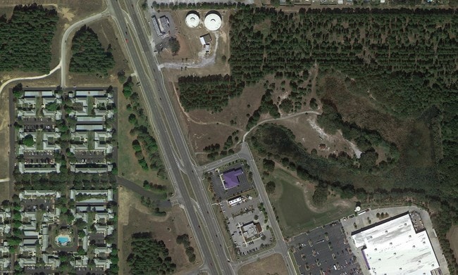
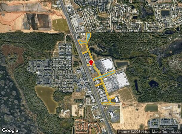
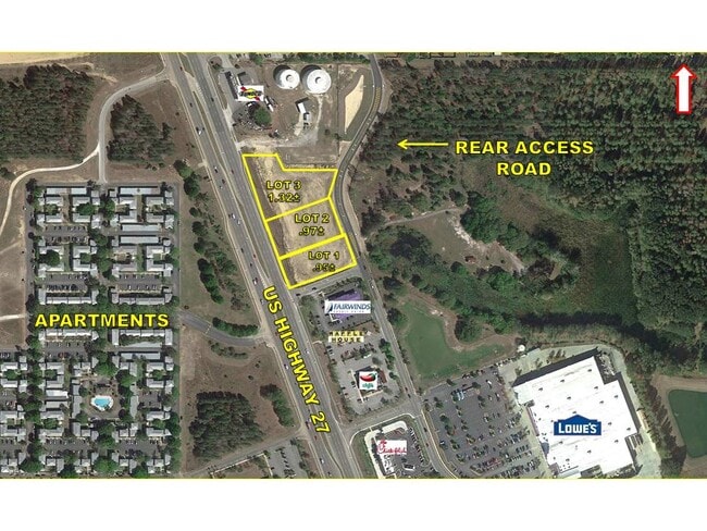
600 Us Highway 27
Orlando-Kissimmee-Sanford, FL
NE 1/4 LYING E OF US HWY 27 AND N 1/2 OF NE 1/4 OF SE 1/4 LYING E OF US HWY 27 OF SECTION 35 TOWNSHIP 24 SOUTH RANGE 26 EAST--LESS FROM NE COR OF SEC 35 RUN S 89-42-18 W ALONG N LINE OF NE 1/4 A DIST OF 1308.05 FT FOR POB CONT S 89-42-18 W ALONG SAID
35-24-26-0001-000-00100
Lake
Transportationcommunicationsgeneral
Florida
X
1
12105C0100G
10.44 AC
2024
Lake County
2026
Orlando
031317
DEMOGRAPHICS near 600 Us Highway 27
1 Mile
3 Mile
5 Mile
2024 Total Population
10,556
51,773
86,525
2029 Population
12,313
62,706
104,274
Pop Growth 2024-2029
+ 16.64%
+ 21.12%
+ 20.51%
Average Age
35
38
37
2024 Total Households
4,358
19,523
31,367
HH Growth 2024-2029
+ 15.92%
+ 20.91%
+ 20.42%
Median Household Inc
$55,712
$63,382
$66,820
Avg Household Size
2.40
2.60
2.70
2024 Avg HH Vehicles
1.00
2.00
2.00
Median Home Value
$250,265
$262,996
$285,455
Median Year Built
2000
2004
2006
Nearby Places
Map Layers
Map Styles
 Street
 Aerial
- Restaurants
- Banks
- Shops
- Fitness
- Groceries
PUBLIC TRANSPORTATION
AIRPORT
Orlando International
DRIVE
WALK
Distance
Orlando International
43 min
29.0 mi
Freight Ports
Port of Tampa Bay
DRIVE
WALK
Distance
Port of Tampa Bay
80 min
65.3 mi
SALE & LEASE HISTORY
LISTING DATE
SALE/LEASE

Aug 14, 2017
For Sale
Nearby Properties
Address
Land Use
TOTAL SIZE
Lot Size
Zoning
Address
Land Use
TOTAL SIZE
Lot Size
Zoning
414,620 SF
16.64 AC
P-D
Address
Land Use
TOTAL SIZE
Lot Size
Zoning
489,411 SF
19.04 AC
Address
Land Use
TOTAL SIZE
Lot Size
Zoning
364,023 SF
18.77 AC
OPD
Address
Land Use
TOTAL SIZE
Lot Size
Zoning
128,000 SF
19.60 AC
P-D
Address
Land Use
TOTAL SIZE
Lot Size
Zoning
381,117 SF
10.72 AC
Address
Land Use
TOTAL SIZE
Lot Size
Zoning
306,139 SF
19.77 AC
P-D
Address
Land Use
TOTAL SIZE
Lot Size
Zoning
333,280 SF
14.73 AC
Address
Land Use
TOTAL SIZE
Lot Size
Zoning
353,423 SF
16.51 AC
PUD
Address
Land Use
TOTAL SIZE
Lot Size
Zoning
316,273 SF
12.24 AC
Address
Land Use
TOTAL SIZE
Lot Size
Zoning
442,457 SF
28.76 AC
RC
Address
Land Use
TOTAL SIZE
Lot Size
Zoning
357,292 SF
1.34 AC
P-D
Address
Land Use
TOTAL SIZE
Lot Size
Zoning
277,616 SF
19.03 AC
Address
Land Use
TOTAL SIZE
Lot Size
Zoning
330,913 SF
16.74 AC
PUD
Address
Land Use
TOTAL SIZE
Lot Size
Zoning
375,326 SF
20.03 AC
PUD
Address
Land Use
TOTAL SIZE
Lot Size
Zoning
272,106 SF
12.22 AC
Address
Land Use
TOTAL SIZE
Lot Size
Zoning
315,346 SF
22.69 AC
PUD
Address
Land Use
TOTAL SIZE
Lot Size
Zoning
299,696 SF
9.79 AC
PUD
Address
Land Use
TOTAL SIZE
Lot Size
Zoning
283,492 SF
11.97 AC
PUD
Address
Land Use
TOTAL SIZE
Lot Size
Zoning
189.88 AC
P-D
Address
Land Use
TOTAL SIZE
Lot Size
Zoning
114,592 SF
18.46 AC
OCT
Address
Land Use
TOTAL SIZE
Lot Size
Zoning
196,553 SF
6.13 AC
Address
Land Use
TOTAL SIZE
Lot Size
Zoning
97.51 AC
P-D
Address
Land Use
TOTAL SIZE
Lot Size
Zoning
71,280 SF
0.59 AC
P-D
Address
Land Use
TOTAL SIZE
Lot Size
Zoning
330,563 SF
20.07 AC
PUD
Address
Land Use
TOTAL SIZE
Lot Size
Zoning
16,371 SF
266.28 AC
C1
Address
Land Use
TOTAL SIZE
Lot Size
Zoning
149,856 SF
4.66 AC
PUD
Address
Land Use
TOTAL SIZE
Lot Size
Zoning
168,045 SF
8.48 AC
OPUD
Address
Land Use
TOTAL SIZE
Lot Size
Zoning
38.50 AC
P-D
Address
Land Use
TOTAL SIZE
Lot Size
Zoning
24,465 SF
0.57 AC
P-D
Address
Land Use
TOTAL SIZE
Lot Size
Zoning
116,811 SF
3.94 AC
PUD
The World's #1 Commercial Real Estate Marketplace
Connect with us
© 2025 CoStar Group
The information above has been obtained from sources believed reliable. While we do not doubt its accuracy we have not verified it and make no guarantee, warranty or representation about it. It is your responsibility to independently confirm its accuracy and completeness. Any projections, opinions, assumptions, or estimates used are for example only and do not represent the current or future performance of the property. The value of this transaction to you depends on tax and other factors which should be evaluated by your tax, financial, and legal advisors. You and your advisors should conduct a careful, independent investigation of the property to determine to your satisfaction the suitability of the property for your needs.