Property Record
600 W University Heights Dr N, Flagstaff, AZ 86005


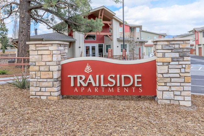

Property Detail
600 W University Heights Dr N
Flagstaff, AZ
SUBDIVISION: UNIVERSITY HEIGHTS PT LOTS 2,3 & 4 OF PCL 1 CASE 2 MAP 334 AND PT PCL DESC IN INST 3778672 DESC AS FLLWS; BEG NWLY COR LOT 4; TH S63-52-41E 90.82; TH S38-39-14E 482.82; TH S24-30-2W 423.12; TH N61-34-52W 113.87; NC A 249.43 R 199.89 R N2
112-20-013C
COCONINO
Apartment
Arizona
AE The base floodplain where base flood elevations are provided. AE Zones are now used on new format FIRMs instead of A1-A30 Zones.
2,3,4
2024
3.84 AC
2025
Flagstaff
001101
Other Market Areas
124,394 SF
NEARBY LISTINGS FOR SALE OR LEASE
DEMOGRAPHICS near 600 W University Heights Dr N
1 mile
3 mile
5 mile
2025 Total Population
16,427
46,295
67,519
2030 Population
16,288
46,248
67,117
Pop Growth 2025-2030
(0.85%)
(0.10%)
(0.60%)
Average Age
30
30
33
2025 Total Households
5,515
14,343
22,177
HH Growth 2025-2030
(1.61%)
(1.12%)
(1.58%)
Median Household Inc
$57,013
$62,833
$69,303
Avg Household Size
2.30
2.40
2.40
2025 Avg HH Vehicles
2.00
2.00
2.00
Median Home Value
$678,689
$667,289
$622,989
Median Year Built
1996
1997
1992
Nearby Places
Map Layers
Map Styles
 Street
 Aerial
Transit
 Traffic
 Biking
Places
Listings with unknown addresses are not visible on the map
- Restaurants
- Banks
- Shops
- Fitness
- Groceries
PUBLIC TRANSPORTATION
COMMUTER RAIL
Flagstaff (Southwest Chief - Amtrak)
Drive
Walk
Distance
Flagstaff (Southwest Chief - Amtrak)
7 min
2.7 mi
AIRPORT
Flagstaff Pulliam
Drive
Walk
Distance
Flagstaff Pulliam
7 min
3.6 mi
Freight Ports
Port of San Diego
Drive
Walk
Distance
Port of San Diego
531 min
486.2 mi
Nearby Properties
Address
Land Use
TOTAL SIZE
Lot Size
Zoning
Address
Land Use
TOTAL SIZE
Lot Size
Zoning
385,095 SF
13.33 AC
Address
Land Use
TOTAL SIZE
Lot Size
Zoning
579,936 SF
6.07 AC
Address
Land Use
TOTAL SIZE
Lot Size
Zoning
602,053 SF
4.81 AC
Address
Land Use
TOTAL SIZE
Lot Size
Zoning
475,521 SF
12.26 AC
Address
Land Use
TOTAL SIZE
Lot Size
Zoning
544,788 SF
93.65 AC
Address
Land Use
TOTAL SIZE
Lot Size
Zoning
480,583 SF
2.68 AC
Address
Land Use
TOTAL SIZE
Lot Size
Zoning
323,846 SF
26.50 AC
Address
Land Use
TOTAL SIZE
Lot Size
Zoning
366,782 SF
2.01 AC
Address
Land Use
TOTAL SIZE
Lot Size
Zoning
308,364 SF
2.43 AC
Address
Land Use
TOTAL SIZE
Lot Size
Zoning
239,308 SF
16.28 AC
Address
Land Use
TOTAL SIZE
Lot Size
Zoning
233,703 SF
14.92 AC
Address
Land Use
TOTAL SIZE
Lot Size
Zoning
178,737 SF
7.35 AC
Address
Land Use
TOTAL SIZE
Lot Size
Zoning
182,018 SF
11.28 AC
Address
Land Use
TOTAL SIZE
Lot Size
Zoning
218,329 SF
39.12 AC
Address
Land Use
TOTAL SIZE
Lot Size
Zoning
202,220 SF
4.31 AC
Address
Land Use
TOTAL SIZE
Lot Size
Zoning
176,750 SF
9.53 AC
Address
Land Use
TOTAL SIZE
Lot Size
Zoning
161,548 SF
6.71 AC
Address
Land Use
TOTAL SIZE
Lot Size
Zoning
41,141 SF
0.92 AC
Address
Land Use
TOTAL SIZE
Lot Size
Zoning
75,751 SF
4.76 AC
Address
Land Use
TOTAL SIZE
Lot Size
Zoning
116,631 SF
5.60 AC
Address
Land Use
TOTAL SIZE
Lot Size
Zoning
110,642 SF
12.40 AC
Address
Land Use
TOTAL SIZE
Lot Size
Zoning
122,164 SF
10.74 AC
Address
Land Use
TOTAL SIZE
Lot Size
Zoning
141,415 SF
11.27 AC
Address
Land Use
TOTAL SIZE
Lot Size
Zoning
109,305 SF
5.17 AC
Address
Land Use
TOTAL SIZE
Lot Size
Zoning
109,940 SF
6.35 AC
Address
Land Use
TOTAL SIZE
Lot Size
Zoning
92,988 SF
6.76 AC
Address
Land Use
TOTAL SIZE
Lot Size
Zoning
122,145 SF
12.23 AC
Address
Land Use
TOTAL SIZE
Lot Size
Zoning
258,774 SF
31.89 AC
Address
Land Use
TOTAL SIZE
Lot Size
Zoning
96,074 SF
5.48 AC
The World's #1 Commercial Real Estate Marketplace
Connect with us
© 2026 CoStar Group
The information above has been obtained from sources believed reliable. While we do not doubt its accuracy we have not verified it and make no guarantee, warranty or representation about it. It is your responsibility to independently confirm its accuracy and completeness. Any projections, opinions, assumptions, or estimates used are for example only and do not represent the current or future performance of the property. The value of this transaction to you depends on tax and other factors which should be evaluated by your tax, financial, and legal advisors. You and your advisors should conduct a careful, independent investigation of the property to determine to your satisfaction the suitability of the property for your needs.