Property Record
6000 Aurora Ave, Des Moines, IA 50322

Current Lease Availabilities
NEARBY LISTINGS FOR SALE OR LEASE
Property Detail
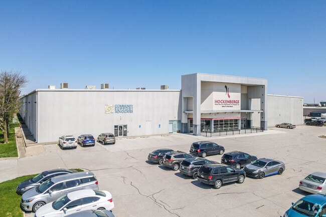
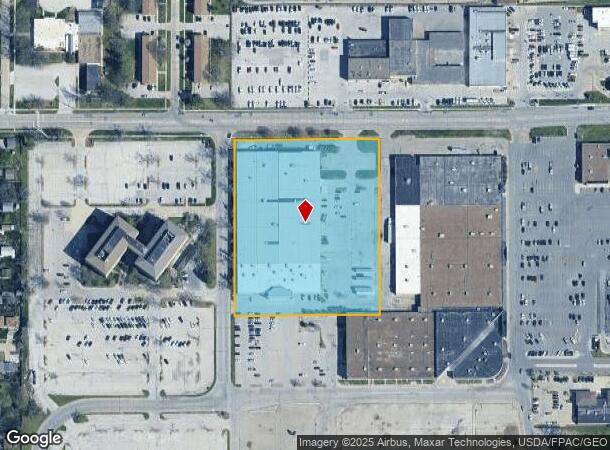
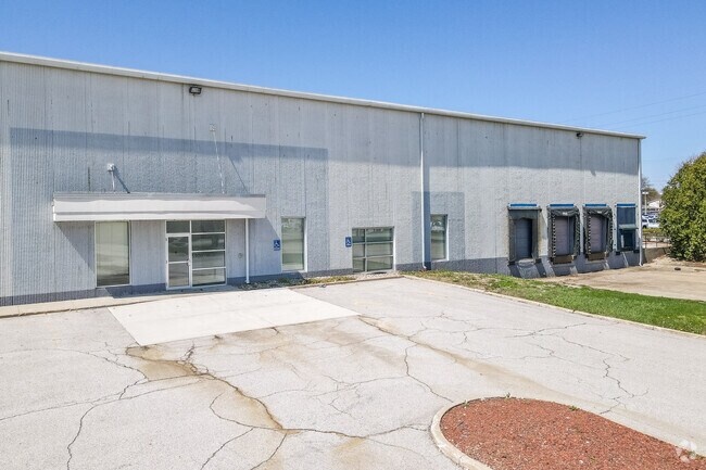
6000 Aurora Ave
Des Moines-West Des Moines, IA
Merle Hay-Aurora Place
100-09472010010
W170F LT 9 & ALL LT 12 & N239.5F LT 13 & ALL LT E MERLE HAY-AURORA PLACE
Storebuilding
Polk
X
Iowa
19153C0189F
9
2024
5.02 AC
2025
Western Suburbs
000801
Des Moines
99,700 SF
DEMOGRAPHICS near 6000 Aurora Ave
1 Mile
3 Mile
5 Mile
2024 Total Population
12,275
82,366
184,994
2029 Population
12,604
84,897
191,568
Pop Growth 2024-2029
+ 2.68%
+ 3.07%
+ 3.55%
Average Age
38
40
39
2024 Total Households
5,128
34,566
77,391
HH Growth 2024-2029
+ 2.91%
+ 3.26%
+ 3.76%
Median Household Inc
$64,138
$73,329
$69,703
Avg Household Size
2.40
2.30
2.30
2024 Avg HH Vehicles
2.00
2.00
2.00
Median Home Value
$183,388
$216,258
$219,518
Median Year Built
1966
1969
1970
Nearby Places
Map Layers
Map Styles
 Street
 Aerial
- Restaurants
- Banks
- Shops
- Fitness
- Groceries
PUBLIC TRANSPORTATION
AIRPORT
Des Moines International
DRIVE
WALK
Distance
Des Moines International
21 min
9.7 mi
Freight Ports
Port Milwaukee
DRIVE
WALK
Distance
Port Milwaukee
417 min
375.3 mi
Nearby Properties
Address
Land Use
TOTAL SIZE
Lot Size
Zoning
Address
Land Use
TOTAL SIZE
Lot Size
Zoning
627,104 SF
40.09 AC
Address
Land Use
TOTAL SIZE
Lot Size
Zoning
255,521 SF
60.90 AC
RE
Address
Land Use
TOTAL SIZE
Lot Size
Zoning
407,183 SF
17.02 AC
PUD
Address
Land Use
TOTAL SIZE
Lot Size
Zoning
415,320 SF
51.16 AC
PUD
Address
Land Use
TOTAL SIZE
Lot Size
Zoning
133,256 SF
15.93 AC
Address
Land Use
TOTAL SIZE
Lot Size
Zoning
166,160 SF
11.88 AC
Address
Land Use
TOTAL SIZE
Lot Size
Zoning
307,734 SF
23.59 AC
R-3
Address
Land Use
TOTAL SIZE
Lot Size
Zoning
71,938 SF
8.23 AC
C-O
Address
Land Use
TOTAL SIZE
Lot Size
Zoning
101,592 SF
7.79 AC
PUD
Address
Land Use
TOTAL SIZE
Lot Size
Zoning
386,236 SF
9.62 AC
C-4
Address
Land Use
TOTAL SIZE
Lot Size
Zoning
117,272 SF
3.46 AC
R1-60
Address
Land Use
TOTAL SIZE
Lot Size
Zoning
141,377 SF
3.16 AC
Address
Land Use
TOTAL SIZE
Lot Size
Zoning
166,908 SF
8.03 AC
R-3
Address
Land Use
TOTAL SIZE
Lot Size
Zoning
188,453 SF
14.20 AC
R-3
Address
Land Use
TOTAL SIZE
Lot Size
Zoning
125,396 SF
12.89 AC
PUD
Address
Land Use
TOTAL SIZE
Lot Size
Zoning
146,025 SF
9.59 AC
PUD
Address
Land Use
TOTAL SIZE
Lot Size
Zoning
258,178 SF
5.95 AC
Address
Land Use
TOTAL SIZE
Lot Size
Zoning
91,985 SF
13.11 AC
PUD
Address
Land Use
TOTAL SIZE
Lot Size
Zoning
223,876 SF
15.01 AC
Address
Land Use
TOTAL SIZE
Lot Size
Zoning
120,696 SF
5.40 AC
PUD
Address
Land Use
TOTAL SIZE
Lot Size
Zoning
143,831 SF
16.12 AC
PUD
Address
Land Use
TOTAL SIZE
Lot Size
Zoning
95,039 SF
4.52 AC
PUD
Address
Land Use
TOTAL SIZE
Lot Size
Zoning
120,808 SF
4.41 AC
PUD
Address
Land Use
TOTAL SIZE
Lot Size
Zoning
112,472 SF
7.48 AC
R-3
Address
Land Use
TOTAL SIZE
Lot Size
Zoning
94,467 SF
8.13 AC
PUD
Address
Land Use
TOTAL SIZE
Lot Size
Zoning
56,478 SF
5.86 AC
Address
Land Use
TOTAL SIZE
Lot Size
Zoning
158,256 SF
8.87 AC
R-3
Address
Land Use
TOTAL SIZE
Lot Size
Zoning
130,686 SF
1.23 AC
Address
Land Use
TOTAL SIZE
Lot Size
Zoning
130,136 SF
6.77 AC
PARKVIEW P
Address
Land Use
TOTAL SIZE
Lot Size
Zoning
203,062 SF
17.82 AC
C-2
The World's #1 Commercial Real Estate Marketplace
Connect with us
© 2025 CoStar Group
The information above has been obtained from sources believed reliable. While we do not doubt its accuracy we have not verified it and make no guarantee, warranty or representation about it. It is your responsibility to independently confirm its accuracy and completeness. Any projections, opinions, assumptions, or estimates used are for example only and do not represent the current or future performance of the property. The value of this transaction to you depends on tax and other factors which should be evaluated by your tax, financial, and legal advisors. You and your advisors should conduct a careful, independent investigation of the property to determine to your satisfaction the suitability of the property for your needs.