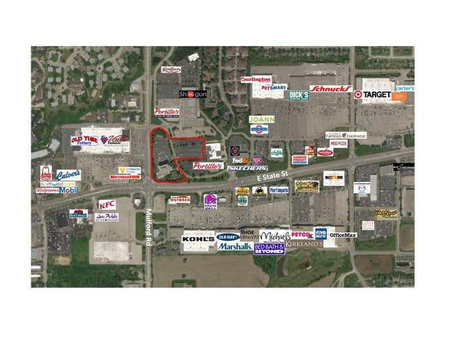
Property Record
6000 E State St, Rockford, IL 61108

Current Lease Availabilities
Property Detail
6000 E State St
12-22-352-002
MULFORD VILLAGE SUB PT SW 1/4 SEC 22 &PT NW 1/4 SEC 27-44-2 (EXC THAT PT TOCITY OF RKFD BY 86-37- 0690)(EXC THATPT TO STATE BY 93-82-1490) ALL LOT 1
Officebuilding
Winnebago
C3
Illinois
B and X Area of moderate flood hazard, usually the area between the limits of the 100-year and 500-year floods.
1
2024
4 AC
2024
I-39 Corr/Winnebago Cnty
000511
Chicago
84,569 SF
Rockford, IL
NEARBY LISTINGS FOR SALE OR LEASE
DEMOGRAPHICS near 6000 E State St
1 mile
3 mile
5 mile
2025 Total Population
7,636
60,403
147,836
2030 Population
7,663
60,286
147,929
Pop Growth 2025-2030
+ 0.35%
(0.19%)
+ 0.06%
Average Age
43
42
41
2025 Total Households
3,225
24,891
62,335
HH Growth 2025-2030
+ 0.43%
(0.10%)
+ 0.12%
Median Household Inc
$67,387
$72,574
$64,021
Avg Household Size
2.20
2.30
2.30
2025 Avg HH Vehicles
2.00
2.00
2.00
Median Home Value
$168,886
$166,867
$158,342
Median Year Built
1980
1972
1968
Nearby Places
Map Layers
Map Styles
 Street
 Aerial
Layers
 Traffic
 Biking
Places
Listings with unknown addresses are not visible on the map
- Restaurants
- Banks
- Shops
- Fitness
- Groceries
PUBLIC TRANSPORTATION
AIRPORT
Chicago/Rockford International
Drive
Walk
Distance
Chicago/Rockford International
23 min
12.4 mi
Freight Ports
Port Milwaukee
Drive
Walk
Distance
Port Milwaukee
108 min
90.8 mi
Nearby Properties
Address
Land Use
TOTAL SIZE
Lot Size
Zoning
Address
Land Use
TOTAL SIZE
Lot Size
Zoning
559,880 SF
56.87 AC
CC
Address
Land Use
TOTAL SIZE
Lot Size
Zoning
177,667 SF
22.14 AC
C3
Address
Land Use
TOTAL SIZE
Lot Size
Zoning
302,569 SF
24.58 AC
C2
Address
Land Use
TOTAL SIZE
Lot Size
Zoning
920,723 SF
82.07 AC
Address
Land Use
TOTAL SIZE
Lot Size
Zoning
218,420 SF
33.07 AC
C3
Address
Land Use
TOTAL SIZE
Lot Size
Zoning
169,198 SF
14 AC
C3
Address
Land Use
TOTAL SIZE
Lot Size
Zoning
138,658 SF
12.91 AC
C2
Address
Land Use
TOTAL SIZE
Lot Size
Zoning
195,672 SF
10.63 AC
C3
Address
Land Use
TOTAL SIZE
Lot Size
Zoning
134,779 SF
9.93 AC
C2
Address
Land Use
TOTAL SIZE
Lot Size
Zoning
217,520 SF
13.82 AC
C3
Address
Land Use
TOTAL SIZE
Lot Size
Zoning
119,560 SF
2.89 AC
R1
Address
Land Use
TOTAL SIZE
Lot Size
Zoning
79,055 SF
10.89 AC
R4
Address
Land Use
TOTAL SIZE
Lot Size
Zoning
200,666 SF
28.90 AC
IL
Address
Land Use
TOTAL SIZE
Lot Size
Zoning
110,218 SF
8.12 AC
C2
Address
Land Use
TOTAL SIZE
Lot Size
Zoning
160,288 SF
5.70 AC
C3
Address
Land Use
TOTAL SIZE
Lot Size
Zoning
96,130 SF
12.47 AC
R2
Address
Land Use
TOTAL SIZE
Lot Size
Zoning
73,031 SF
10.23 AC
C1
Address
Land Use
TOTAL SIZE
Lot Size
Zoning
70,986 SF
4.33 AC
OF
Address
Land Use
TOTAL SIZE
Lot Size
Zoning
141,752 SF
12.10 AC
C2
Address
Land Use
TOTAL SIZE
Lot Size
Zoning
19,406 SF
10.13 AC
R4
Address
Land Use
TOTAL SIZE
Lot Size
Zoning
128,736 SF
14.64 AC
C2
Address
Land Use
TOTAL SIZE
Lot Size
Zoning
147,900 SF
7.78 AC
Address
Land Use
TOTAL SIZE
Lot Size
Zoning
142,140 SF
13.44 AC
C2
Address
Land Use
TOTAL SIZE
Lot Size
Zoning
71,799 SF
4.51 AC
C1
Address
Land Use
TOTAL SIZE
Lot Size
Zoning
63,492 SF
4.92 AC
C1
Address
Land Use
TOTAL SIZE
Lot Size
Zoning
79,147 SF
5.08 AC
R3
Address
Land Use
TOTAL SIZE
Lot Size
Zoning
89,350 SF
9.17 AC
C2
Address
Land Use
TOTAL SIZE
Lot Size
Zoning
77,718 SF
11.12 AC
C2
Address
Land Use
TOTAL SIZE
Lot Size
Zoning
49,832 SF
5.62 AC
C2
The World's #1 Commercial Real Estate Marketplace
Connect with us
© 2026 CoStar Group
The information above has been obtained from sources believed reliable. While we do not doubt its accuracy we have not verified it and make no guarantee, warranty or representation about it. It is your responsibility to independently confirm its accuracy and completeness. Any projections, opinions, assumptions, or estimates used are for example only and do not represent the current or future performance of the property. The value of this transaction to you depends on tax and other factors which should be evaluated by your tax, financial, and legal advisors. You and your advisors should conduct a careful, independent investigation of the property to determine to your satisfaction the suitability of the property for your needs.