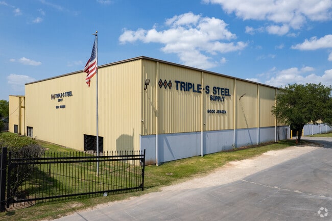
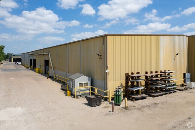
Property Record
6000 Jensen Dr, Houston, TX 77026
Property Detail
6000 Jensen Dr
Houston-Pasadena-The Woodlands, TX
LTS 1 THRU 17 & 19 THRU 23 & 27 THRU 30 & TR 18B BLK 1 WILSHIRE TERRACE
0422340000004
HARRIS
Miningfacilityoilgasmineralpreciousmetals
Texas
B and X Area of moderate flood hazard, usually the area between the limits of the 100-year and 500-year floods.
1
2024
7.75 AC
2025
North Outer Loop
220100
Houston
234,016 SF
NEARBY LISTINGS FOR SALE OR LEASE
DEMOGRAPHICS near 6000 Jensen Dr
1 mile
3 mile
5 mile
2025 Total Population
12,584
133,037
381,448
2030 Population
13,629
143,914
411,918
Pop Growth 2025-2030
+ 8.30%
+ 8.18%
+ 7.99%
Average Age
36
38
37
2025 Total Households
4,209
47,612
145,220
HH Growth 2025-2030
+ 8.51%
+ 8.45%
+ 8.60%
Median Household Inc
$45,207
$50,182
$67,008
Avg Household Size
3.00
2.70
2.50
2025 Avg HH Vehicles
2.00
2.00
2.00
Median Home Value
$172,419
$250,185
$306,367
Median Year Built
1964
1961
1974
Nearby Places
Map Layers
Map Styles
 Street
 Aerial
Transit
 Traffic
 Biking
Places
Listings with unknown addresses are not visible on the map
- Restaurants
- Banks
- Shops
- Fitness
- Groceries
PUBLIC TRANSPORTATION
COMMUTER RAIL
Houston (Sunset Limited - Amtrak)
Drive
Walk
Distance
Houston (Sunset Limited - Amtrak)
10 min
5.8 mi
AIRPORT
George Bush Intcntl/Houston
Drive
Walk
Distance
George Bush Intcntl/Houston
20 min
16.1 mi
William P Hobby
Drive
Walk
Distance
William P Hobby
29 min
16.3 mi
Freight Ports
Port of Houston
Drive
Walk
Distance
Port of Houston
18 min
10.4 mi
Nearby Properties
Address
Land Use
TOTAL SIZE
Lot Size
Zoning
Address
Land Use
TOTAL SIZE
Lot Size
Zoning
474,326 SF
43.16 AC
Address
Land Use
TOTAL SIZE
Lot Size
Zoning
587,156 SF
4.40 AC
Address
Land Use
TOTAL SIZE
Lot Size
Zoning
263,475 SF
7.90 AC
Address
Land Use
TOTAL SIZE
Lot Size
Zoning
186,808 SF
4.73 AC
Address
Land Use
TOTAL SIZE
Lot Size
Zoning
276,332 SF
6.05 AC
Address
Land Use
TOTAL SIZE
Lot Size
Zoning
498,726 SF
4.97 AC
Address
Land Use
TOTAL SIZE
Lot Size
Zoning
302,826 SF
2.87 AC
Address
Land Use
TOTAL SIZE
Lot Size
Zoning
545,628 SF
19.41 AC
Address
Land Use
TOTAL SIZE
Lot Size
Zoning
224,741 SF
10.75 AC
Address
Land Use
TOTAL SIZE
Lot Size
Zoning
213,548 SF
16.98 AC
Address
Land Use
TOTAL SIZE
Lot Size
Zoning
200,902 SF
4.36 AC
Address
Land Use
TOTAL SIZE
Lot Size
Zoning
188,582 SF
17.94 AC
Address
Land Use
TOTAL SIZE
Lot Size
Zoning
110,721 SF
0.94 AC
Address
Land Use
TOTAL SIZE
Lot Size
Zoning
304,925 SF
10.91 AC
Address
Land Use
TOTAL SIZE
Lot Size
Zoning
177,720 SF
14.96 AC
Address
Land Use
TOTAL SIZE
Lot Size
Zoning
89,184 SF
6.89 AC
Address
Land Use
TOTAL SIZE
Lot Size
Zoning
55,517 SF
13 AC
Address
Land Use
TOTAL SIZE
Lot Size
Zoning
113,014 SF
3.50 AC
Address
Land Use
TOTAL SIZE
Lot Size
Zoning
241,435 SF
13.47 AC
Address
Land Use
TOTAL SIZE
Lot Size
Zoning
15,917 SF
15.07 AC
Address
Land Use
TOTAL SIZE
Lot Size
Zoning
82,951 SF
21.32 AC
Address
Land Use
TOTAL SIZE
Lot Size
Zoning
51,941 SF
3.71 AC
Address
Land Use
TOTAL SIZE
Lot Size
Zoning
186,629 SF
9.75 AC
Address
Land Use
TOTAL SIZE
Lot Size
Zoning
622,385 SF
6.68 AC
Address
Land Use
TOTAL SIZE
Lot Size
Zoning
197,976 SF
24.32 AC
Address
Land Use
TOTAL SIZE
Lot Size
Zoning
67,380 SF
1.81 AC
Address
Land Use
TOTAL SIZE
Lot Size
Zoning
40,966 SF
3.30 AC
Address
Land Use
TOTAL SIZE
Lot Size
Zoning
136,996 SF
29.18 AC
Address
Land Use
TOTAL SIZE
Lot Size
Zoning
61,146 SF
1.40 AC
The World's #1 Commercial Real Estate Marketplace
Connect with us
© 2026 CoStar Group
The information above has been obtained from sources believed reliable. While we do not doubt its accuracy we have not verified it and make no guarantee, warranty or representation about it. It is your responsibility to independently confirm its accuracy and completeness. Any projections, opinions, assumptions, or estimates used are for example only and do not represent the current or future performance of the property. The value of this transaction to you depends on tax and other factors which should be evaluated by your tax, financial, and legal advisors. You and your advisors should conduct a careful, independent investigation of the property to determine to your satisfaction the suitability of the property for your needs.