Property Record
6000 River Forest Dr, Manassas, VA 20112

Save to a Folder
{{folder.Name}}
{{folder.ListingIds.length}} Properties
{{folder.ListingIds.length}} Property
Create a New Folder
Property Detail
6000 River Forest Dr
Washington-Arlington-Alexandria, DC-VA-MD-WV
RIVERVIEW ESTATES SEC 1 LOT 91A
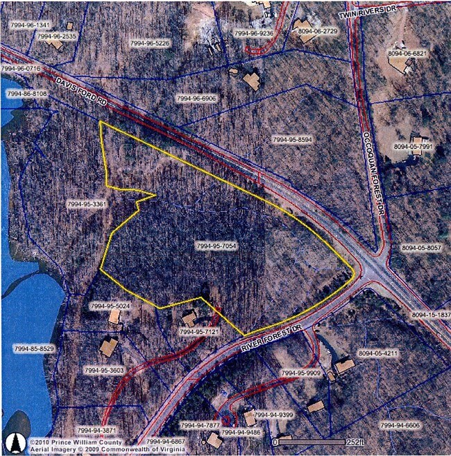
7994-95-7054
PRINCE WILLIAM
Vacantlandnec
Virginia
A1
91a
AE The base floodplain where base flood elevations are provided. AE Zones are now used on new format FIRMs instead of A1-A30 Zones.
9.39 AC
2025
Woodbridge/I-95 Corridor
2025
Washington, DC
901219
NEARBY LISTINGS FOR SALE OR LEASE
DEMOGRAPHICS near 6000 River Forest Dr
1 mile
3 mile
5 mile
2025 Total Population
1,797
15,869
125,156
2030 Population
1,848
16,195
127,765
Pop Growth 2025-2030
+ 2.84%
+ 2.05%
+ 2.08%
Average Age
45
43
39
2025 Total Households
628
5,114
40,220
HH Growth 2025-2030
+ 2.55%
+ 1.97%
+ 1.97%
Median Household Inc
$238,718
$202,815
$146,336
Avg Household Size
2.80
3.00
3.00
2025 Avg HH Vehicles
3.00
3.00
2.00
Median Home Value
$733,695
$747,587
$583,401
Median Year Built
1986
1989
1989
Nearby Places
Map Layers
Map Styles
 Street
 Aerial
Layers
 Traffic
 Biking
Places
Listings with unknown addresses are not visible on the map
- Restaurants
- Banks
- Shops
- Fitness
- Groceries
PUBLIC TRANSPORTATION
COMMUTER RAIL
Manassas Amtrak Station (Cardinal - Amtrak, Crescent - Amtrak, Manassas Line - Amtrak, Northeast Regional - Amtrak)
Drive
Walk
Distance
Manassas Amtrak Station (Cardinal - Amtrak, Crescent - Amtrak, Manassas Line - Amtrak, Northeast Regional - Amtrak)
13 min
6.6 mi
Manassas (Manassas Line - Virginia Railway Express)
Drive
Walk
Distance
Manassas (Manassas Line - Virginia Railway Express)
16 min
7.5 mi
AIRPORT
Washington Dulles International
Drive
Walk
Distance
Washington Dulles International
44 min
24.1 mi
Ronald Reagan Washington Ntl
Drive
Walk
Distance
Ronald Reagan Washington Ntl
49 min
30.1 mi
Freight Ports
Port of Baltimore
Drive
Walk
Distance
Port of Baltimore
103 min
72.3 mi
Nearby Properties
Address
Land Use
TOTAL SIZE
Lot Size
Zoning
Address
Land Use
TOTAL SIZE
Lot Size
Zoning
45,346 SF
64.42 AC
A1
Address
Land Use
TOTAL SIZE
Lot Size
Zoning
102,262 SF
11.75 AC
B2
Address
Land Use
TOTAL SIZE
Lot Size
Zoning
120,600 SF
6.25 AC
M2
Address
Land Use
TOTAL SIZE
Lot Size
Zoning
71,221 SF
23.05 AC
SR1
Address
Land Use
TOTAL SIZE
Lot Size
Zoning
1,504 SF
216.09 AC
030
Address
Land Use
TOTAL SIZE
Lot Size
Zoning
47,868 SF
7.33 AC
B2
Address
Land Use
TOTAL SIZE
Lot Size
Zoning
13,336 SF
65.55 AC
A1
Address
Land Use
TOTAL SIZE
Lot Size
Zoning
14,316 SF
2.54 AC
RPC
Address
Land Use
TOTAL SIZE
Lot Size
Zoning
41,266 SF
10.08 AC
A1
Address
Land Use
TOTAL SIZE
Lot Size
Zoning
59.69 AC
030
Address
Land Use
TOTAL SIZE
Lot Size
Zoning
13,464 SF
2.40 AC
B2
Address
Land Use
TOTAL SIZE
Lot Size
Zoning
24,280 SF
1.48 AC
OM
Address
Land Use
TOTAL SIZE
Lot Size
Zoning
14,470 SF
10.15 AC
A1
Address
Land Use
TOTAL SIZE
Lot Size
Zoning
81.47 AC
SR1
Address
Land Use
TOTAL SIZE
Lot Size
Zoning
7,833 SF
7.03 AC
MIXED
Address
Land Use
TOTAL SIZE
Lot Size
Zoning
48.74 AC
A1
Address
Land Use
TOTAL SIZE
Lot Size
Zoning
9,940 SF
2.23 AC
R4
Address
Land Use
TOTAL SIZE
Lot Size
Zoning
7,504 SF
1.31 AC
B1
Address
Land Use
TOTAL SIZE
Lot Size
Zoning
25,162 SF
11.03 AC
A1
Address
Land Use
TOTAL SIZE
Lot Size
Zoning
10,648 SF
12 AC
A1
Address
Land Use
TOTAL SIZE
Lot Size
Zoning
9,024 SF
2.20 AC
B1
Address
Land Use
TOTAL SIZE
Lot Size
Zoning
13,998 SF
121.01 AC
PMR
Address
Land Use
TOTAL SIZE
Lot Size
Zoning
14,736 SF
1.55 AC
PBD
Address
Land Use
TOTAL SIZE
Lot Size
Zoning
11,880 SF
12.13 AC
A1
Address
Land Use
TOTAL SIZE
Lot Size
Zoning
652 SF
57.65 AC
A1
Address
Land Use
TOTAL SIZE
Lot Size
Zoning
23.25 AC
030
Address
Land Use
TOTAL SIZE
Lot Size
Zoning
4,076 SF
3.14 AC
RPC
Address
Land Use
TOTAL SIZE
Lot Size
Zoning
55.03 AC
SR1
Address
Land Use
TOTAL SIZE
Lot Size
Zoning
3,719 SF
1.36 AC
PBD
Address
Land Use
TOTAL SIZE
Lot Size
Zoning
3,664 SF
1.37 AC
B1
The World's #1 Commercial Real Estate Marketplace
Connect with us
© 2026 CoStar Group
The information above has been obtained from sources believed reliable. While we do not doubt its accuracy we have not verified it and make no guarantee, warranty or representation about it. It is your responsibility to independently confirm its accuracy and completeness. Any projections, opinions, assumptions, or estimates used are for example only and do not represent the current or future performance of the property. The value of this transaction to you depends on tax and other factors which should be evaluated by your tax, financial, and legal advisors. You and your advisors should conduct a careful, independent investigation of the property to determine to your satisfaction the suitability of the property for your needs.