Property Record
6000 S 129Th St, Seattle, WA 98178
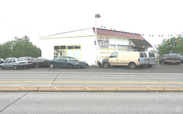

Property Detail
6000 S 129Th St
217200-0648
EAST RIVERTON GARDEN TRS 2ND PORTION OF TRACTS 124 & 125 LYING NLY OF FOLLOWING LINE - BEGIN INTSN OF ELY MGN OF TRACT 125 & NLY MGN OF S 129TH ST TH NLY ALONG ELY LINE OF TRACT125 121 FT TO BEGIN OF SAID LINE TH N 44-15-54 W 79.91 FT TH N 40-25-19 W
Publicstorage
KING
NBP
Washington
B and X Area of moderate flood hazard, usually the area between the limits of the 100-year and 500-year floods.
124-1
2025
1.51 AC
2024
Renton/Tukwila
026101
Seattle/Puget Sound
114,166 SF
Seattle-Tacoma-Bellevue, WA
NEARBY LISTINGS FOR SALE OR LEASE
DEMOGRAPHICS near 6000 S 129Th St
1 mile
3 mile
5 mile
2025 Total Population
13,867
98,903
307,671
2030 Population
14,398
103,118
319,981
Pop Growth 2025-2030
+ 3.83%
+ 4.26%
+ 4.00%
Average Age
39
40
40
2025 Total Households
4,885
37,102
114,901
HH Growth 2025-2030
+ 3.85%
+ 4.37%
+ 4.04%
Median Household Inc
$74,014
$86,093
$95,274
Avg Household Size
2.70
2.50
2.60
2025 Avg HH Vehicles
2.00
2.00
2.00
Median Home Value
$621,781
$653,083
$712,542
Median Year Built
1973
1970
1974
Nearby Places
Map Layers
Map Styles
 Street
 Aerial
Layers
 Traffic
 Biking
Places
Listings with unknown addresses are not visible on the map
- Restaurants
- Banks
- Shops
- Fitness
- Groceries
PUBLIC TRANSPORTATION
COMMUTER RAIL
King Street (Seattle) Station (Sounder South Line - Central Puget Sound Regional Transit Authority Rail (Link Light Rail/Sounder))
Drive
Walk
Distance
King Street (Seattle) Station (Sounder South Line - Central Puget Sound Regional Transit Authority Rail (Link Light Rail/Sounder))
14 min
9.1 mi
AIRPORT
Seattle-Tacoma International
Drive
Walk
Distance
Seattle-Tacoma International
15 min
5.4 mi
Seattle Paine Field International
Drive
Walk
Distance
Seattle Paine Field International
46 min
33.0 mi
Nearby Properties
Address
Land Use
TOTAL SIZE
Lot Size
Zoning
Address
Land Use
TOTAL SIZE
Lot Size
Zoning
31,032 SF
1,746.88 AC
AVO
Address
Land Use
TOTAL SIZE
Lot Size
Zoning
845,480 SF
153.28 AC
UC-2
Address
Land Use
TOTAL SIZE
Lot Size
Zoning
1,134 SF
53.17 AC
MIC/H
Address
Land Use
TOTAL SIZE
Lot Size
Zoning
412,720 SF
3.92 AC
UC-2
Address
Land Use
TOTAL SIZE
Lot Size
Zoning
256,848 SF
5.63 AC
UC-2
Address
Land Use
TOTAL SIZE
Lot Size
Zoning
11,000 SF
152.45 AC
IM
Address
Land Use
TOTAL SIZE
Lot Size
Zoning
141,643 SF
11.44 AC
MIC/H
Address
Land Use
TOTAL SIZE
Lot Size
Zoning
704,186 SF
21.86 AC
I
Address
Land Use
TOTAL SIZE
Lot Size
Zoning
383,418 SF
17.76 AC
RM-F
Address
Land Use
TOTAL SIZE
Lot Size
Zoning
7,440 SF
66.03 AC
IH
Address
Land Use
TOTAL SIZE
Lot Size
Zoning
473,420 SF
22.38 AC
IL
Address
Land Use
TOTAL SIZE
Lot Size
Zoning
264,797 SF
23.23 AC
CD
Address
Land Use
TOTAL SIZE
Lot Size
Zoning
334,335 SF
5.49 AC
UC-2
Address
Land Use
TOTAL SIZE
Lot Size
Zoning
311,885 SF
19.95 AC
IM
Address
Land Use
TOTAL SIZE
Lot Size
Zoning
10,662 SF
72.34 AC
IH
Address
Land Use
TOTAL SIZE
Lot Size
Zoning
34.25 AC
MIC/H
Address
Land Use
TOTAL SIZE
Lot Size
Zoning
17,994 SF
18.21 AC
UC-1
Address
Land Use
TOTAL SIZE
Lot Size
Zoning
617,238 SF
14.98 AC
CO
Address
Land Use
TOTAL SIZE
Lot Size
Zoning
241,186 SF
25.51 AC
MIC/H
Address
Land Use
TOTAL SIZE
Lot Size
Zoning
156,195 SF
3.77 AC
UC-2
Address
Land Use
TOTAL SIZE
Lot Size
Zoning
555,036 SF
9.13 AC
MIC/L
Address
Land Use
TOTAL SIZE
Lot Size
Zoning
148,896 SF
2.22 AC
UC-2
Address
Land Use
TOTAL SIZE
Lot Size
Zoning
325,494 SF
23.53 AC
AI-2
Address
Land Use
TOTAL SIZE
Lot Size
Zoning
527,118 SF
9.31 AC
TUC-P
Address
Land Use
TOTAL SIZE
Lot Size
Zoning
31,737 SF
9.55 AC
RSL (M)
Address
Land Use
TOTAL SIZE
Lot Size
Zoning
195,636 SF
11.50 AC
RM-F
Address
Land Use
TOTAL SIZE
Lot Size
Zoning
284,067 SF
14.36 AC
LI
Address
Land Use
TOTAL SIZE
Lot Size
Zoning
178,944 SF
7.79 AC
R24
Address
Land Use
TOTAL SIZE
Lot Size
Zoning
229,440 SF
14.87 AC
RM-F
The World's #1 Commercial Real Estate Marketplace
Connect with us
© 2026 CoStar Group
The information above has been obtained from sources believed reliable. While we do not doubt its accuracy we have not verified it and make no guarantee, warranty or representation about it. It is your responsibility to independently confirm its accuracy and completeness. Any projections, opinions, assumptions, or estimates used are for example only and do not represent the current or future performance of the property. The value of this transaction to you depends on tax and other factors which should be evaluated by your tax, financial, and legal advisors. You and your advisors should conduct a careful, independent investigation of the property to determine to your satisfaction the suitability of the property for your needs.