Property Record
6000 Tinker Diagonal, Oklahoma City, OK 73110
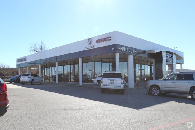

Property Detail
6000 Tinker Diagonal
151397780
UNPLTD PT SW4 & SE4 SEC 9 11N 2W BEG 934.55FT N OF N LINE SE 29TH STREET TH N167.60FT NE149.49FT NW183FT TO W LINE SE4 TH NWLY 292.43FT SWLY 190FT NWLY 82.5FT SWLY 254.8FT NWLY 568.66FT NE434.68FT NW149.80FT NW565.80FT SWLY 111.82FT S175.49FT WLY 346
Officebuilding
OKLAHOMA
AE The base floodplain where base flood elevations are provided. AE Zones are now used on new format FIRMs instead of A1-A30 Zones.
Oklahoma
2024
25.68 AC
2025
East Oklahoma County
107601
Oklahoma City
95,330 SF
Oklahoma City, OK
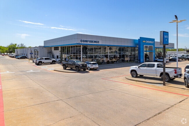
NEARBY LISTINGS FOR SALE OR LEASE
DEMOGRAPHICS near 6000 Tinker Diagonal
1 mile
3 mile
5 mile
2025 Total Population
10,150
67,341
132,542
2030 Population
10,573
69,003
136,378
Pop Growth 2025-2030
+ 4.17%
+ 2.47%
+ 2.89%
Average Age
35
37
37
2025 Total Households
4,000
27,073
52,698
HH Growth 2025-2030
+ 3.90%
+ 2.45%
+ 2.97%
Median Household Inc
$51,781
$58,141
$57,032
Avg Household Size
2.30
2.40
2.40
2025 Avg HH Vehicles
2.00
2.00
2.00
Median Home Value
$124,698
$144,123
$157,460
Median Year Built
1967
1969
1973
Nearby Places
Map Layers
Map Styles
 Street
 Aerial
Layers
 Traffic
 Biking
Places
Listings with unknown addresses are not visible on the map
- Restaurants
- Banks
- Shops
- Fitness
- Groceries
PUBLIC TRANSPORTATION
COMMUTER RAIL
Oklahoma City (Heartland Flyer - Amtrak)
Drive
Walk
Distance
Oklahoma City (Heartland Flyer - Amtrak)
10 min
6.5 mi
AIRPORT
Will Rogers World
Drive
Walk
Distance
Will Rogers World
27 min
15.9 mi
Freight Ports
Tulsa Port Of Catoosa
Drive
Walk
Distance
Tulsa Port Of Catoosa
136 min
124.6 mi
Nearby Properties
Address
Land Use
TOTAL SIZE
Lot Size
Zoning
Address
Land Use
TOTAL SIZE
Lot Size
Zoning
320,100 SF
10.41 AC
I-2
Address
Land Use
TOTAL SIZE
Lot Size
Zoning
318,692 SF
15.25 AC
Address
Land Use
TOTAL SIZE
Lot Size
Zoning
67,732 SF
6.99 AC
PUD
Address
Land Use
TOTAL SIZE
Lot Size
Zoning
200,784 SF
9.28 AC
I-2
Address
Land Use
TOTAL SIZE
Lot Size
Zoning
20,670 SF
3.56 AC
Address
Land Use
TOTAL SIZE
Lot Size
Zoning
313,650 SF
44.50 AC
I-2
Address
Land Use
TOTAL SIZE
Lot Size
Zoning
78,452 SF
5.19 AC
I-2
Address
Land Use
TOTAL SIZE
Lot Size
Zoning
142,772 SF
11.07 AC
Address
Land Use
TOTAL SIZE
Lot Size
Zoning
242,484 SF
13.18 AC
Address
Land Use
TOTAL SIZE
Lot Size
Zoning
431,366 SF
17.57 AC
Address
Land Use
TOTAL SIZE
Lot Size
Zoning
10,050 SF
0.79 AC
Address
Land Use
TOTAL SIZE
Lot Size
Zoning
84,940 SF
9.58 AC
Address
Land Use
TOTAL SIZE
Lot Size
Zoning
90,798 SF
11.07 AC
Address
Land Use
TOTAL SIZE
Lot Size
Zoning
141,387 SF
41 AC
PUD
Address
Land Use
TOTAL SIZE
Lot Size
Zoning
145,328 SF
14.95 AC
R-4
Address
Land Use
TOTAL SIZE
Lot Size
Zoning
119,916 SF
15.06 AC
I-3
Address
Land Use
TOTAL SIZE
Lot Size
Zoning
203,263 SF
45.46 AC
Address
Land Use
TOTAL SIZE
Lot Size
Zoning
14,992 SF
1.34 AC
Address
Land Use
TOTAL SIZE
Lot Size
Zoning
124,997 SF
9.80 AC
Address
Land Use
TOTAL SIZE
Lot Size
Zoning
126,556 SF
6.74 AC
R-4
Address
Land Use
TOTAL SIZE
Lot Size
Zoning
209,552 SF
11.67 AC
R-4
Address
Land Use
TOTAL SIZE
Lot Size
Zoning
171,622 SF
9.74 AC
Address
Land Use
TOTAL SIZE
Lot Size
Zoning
35,245 SF
2.60 AC
Address
Land Use
TOTAL SIZE
Lot Size
Zoning
100,000 SF
11.18 AC
I-2
Address
Land Use
TOTAL SIZE
Lot Size
Zoning
144,000 SF
17.72 AC
PUD
Address
Land Use
TOTAL SIZE
Lot Size
Zoning
8,811 SF
1.73 AC
Address
Land Use
TOTAL SIZE
Lot Size
Zoning
51,352 SF
10.56 AC
Address
Land Use
TOTAL SIZE
Lot Size
Zoning
94,261 SF
13.12 AC
Address
Land Use
TOTAL SIZE
Lot Size
Zoning
128,100 SF
4.71 AC
The World's #1 Commercial Real Estate Marketplace
Connect with us
© 2026 CoStar Group
The information above has been obtained from sources believed reliable. While we do not doubt its accuracy we have not verified it and make no guarantee, warranty or representation about it. It is your responsibility to independently confirm its accuracy and completeness. Any projections, opinions, assumptions, or estimates used are for example only and do not represent the current or future performance of the property. The value of this transaction to you depends on tax and other factors which should be evaluated by your tax, financial, and legal advisors. You and your advisors should conduct a careful, independent investigation of the property to determine to your satisfaction the suitability of the property for your needs.