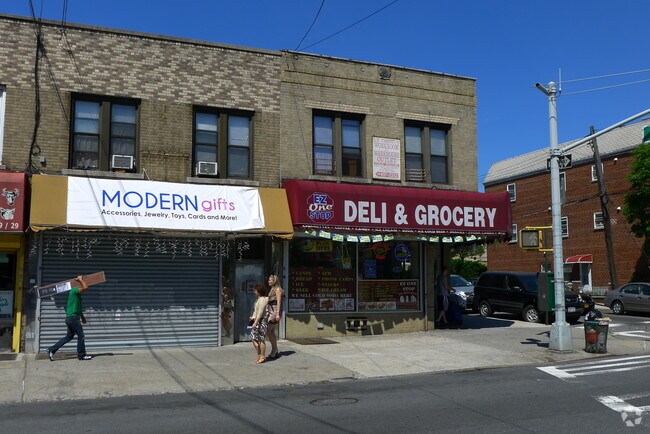
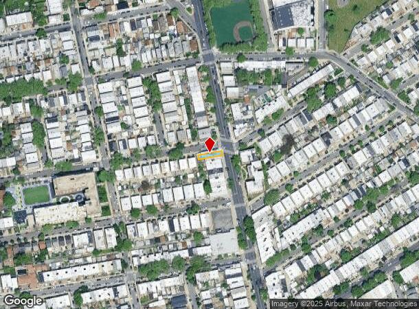
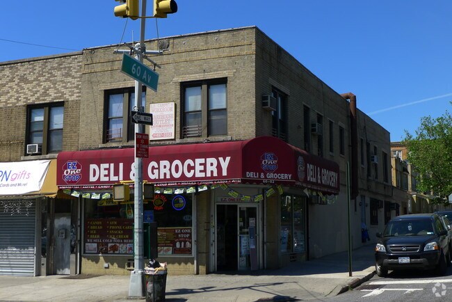
Property Record
6002 Fresh Pond Rd, Maspeth, NY 11378
NEARBY LISTINGS FOR SALE OR LEASE
Property Detail
6002 Fresh Pond Rd
02743-0036
Queens
Commercialofficeresidentialmixeduse
New York
X
36
3604970209F
0.05 AC
2024
Central Queens
2025
Long Island (New York)
059900
New York-Jersey City-White Plains, NY-NJ
3,600 SF
DEMOGRAPHICS near 6002 Fresh Pond Rd
1 mile
3 mile
5 mile
2024 Total Population
66,026
1,048,087
2,953,487
2029 Population
60,083
983,403
2,768,666
Pop Growth 2024-2029
(9.00%)
(6.17%)
(6.26%)
Average Age
40
39
39
2024 Total Households
23,953
386,872
1,179,890
HH Growth 2024-2029
(9.59%)
(6.37%)
(6.47%)
Median Household Inc
$75,046
$71,718
$76,785
Avg Household Size
2.70
2.60
2.40
2024 Avg HH Vehicles
1.00
1.00
.00
Median Home Value
$779,999
$718,374
$774,488
Median Year Built
1947
1949
1952
Nearby Places
Map Layers
Map Styles
 Street
 Aerial
Transit
 Traffic
 Biking
Places
Listings with unknown addresses are not visible on the map
- Restaurants
- Banks
- Shops
- Fitness
- Groceries
PUBLIC TRANSPORTATION
TRANSIT/SUBWAY
Fresh Pond Road (M - New York MTA Subway (The Subway))
Drive
Walk
Distance
Fresh Pond Road (M - New York MTA Subway (The Subway))
3 min
17 min
0.9 mi
Middle Village-Metropolitan Avenue (M - New York MTA Subway (The Subway))
Drive
Walk
Distance
Middle Village-Metropolitan Avenue (M - New York MTA Subway (The Subway))
2 min
18 min
0.9 mi
COMMUTER RAIL
Woodside Station (Babylon Branch - Long Island Rail Road, Far Rockaway Branch - Long Island Rail Road, Hempstead Branch - Long Island Rail Road, Long Beach Branch - Long Island Rail Road, Montauk Branch - Long Island Rail Road, Port Jefferson Branch - Long Island Rail Road, Port Washington Branch - Long Island Rail Road, Ronkonkoma Branch - Long Island Rail Road)
Drive
Walk
Distance
Woodside Station (Babylon Branch - Long Island Rail Road, Far Rockaway Branch - Long Island Rail Road, Hempstead Branch - Long Island Rail Road, Long Beach Branch - Long Island Rail Road, Montauk Branch - Long Island Rail Road, Port Jefferson Branch - Long Island Rail Road, Port Washington Branch - Long Island Rail Road, Ronkonkoma Branch - Long Island Rail Road)
7 min
2.6 mi
Hunterspoint Avenue Station (Hempstead Branch - Long Island Rail Road, Oyster Bay Branch - Long Island Rail Road)
Drive
Walk
Distance
Hunterspoint Avenue Station (Hempstead Branch - Long Island Rail Road, Oyster Bay Branch - Long Island Rail Road)
9 min
3.7 mi
AIRPORT
LaGuardia
Drive
Walk
Distance
LaGuardia
12 min
5.2 mi
John F Kennedy International
Drive
Walk
Distance
John F Kennedy International
18 min
10.5 mi
Newark Liberty International
Drive
Walk
Distance
Newark Liberty International
31 min
20.2 mi
Freight Ports
NY - Red Hook Container Terminal
Drive
Walk
Distance
NY - Red Hook Container Terminal
16 min
7.7 mi
Nearby Properties
Address
Land Use
TOTAL SIZE
Lot Size
Zoning
Address
Land Use
TOTAL SIZE
Lot Size
Zoning
2,812,739 SF
2.10 AC
C5-3
Address
Land Use
TOTAL SIZE
Lot Size
Zoning
1,065,915 SF
2.13 AC
M16R10
Address
Land Use
TOTAL SIZE
Lot Size
Zoning
1,502,532 SF
6.35 AC
R7B
Address
Land Use
TOTAL SIZE
Lot Size
Zoning
772,163 SF
5.24 AC
C4-5X
Address
Land Use
TOTAL SIZE
Lot Size
Zoning
54,170 SF
229.57 AC
PARK
Address
Land Use
TOTAL SIZE
Lot Size
Zoning
1,030,238 SF
2.94 AC
M15R73
Address
Land Use
TOTAL SIZE
Lot Size
Zoning
1,292,074 SF
C4-2F
Address
Land Use
TOTAL SIZE
Lot Size
Zoning
835,231 SF
11.32 AC
R6
Address
Land Use
TOTAL SIZE
Lot Size
Zoning
234,891 SF
3.17 AC
C4-5X
Address
Land Use
TOTAL SIZE
Lot Size
Zoning
882,579 SF
0.51 AC
M16R10
Address
Land Use
TOTAL SIZE
Lot Size
Zoning
505,416 SF
M16R10
Address
Land Use
TOTAL SIZE
Lot Size
Zoning
710,860 SF
1.52 AC
M15R9
Address
Land Use
TOTAL SIZE
Lot Size
Zoning
1,516,458 SF
5.97 AC
R7-1
Address
Land Use
TOTAL SIZE
Lot Size
Zoning
8.28 AC
R7-1
Address
Land Use
TOTAL SIZE
Lot Size
Zoning
8.28 AC
R7-1
Address
Land Use
TOTAL SIZE
Lot Size
Zoning
8.28 AC
R7-1
Address
Land Use
TOTAL SIZE
Lot Size
Zoning
515,311 SF
1.10 AC
M16R10
Address
Land Use
TOTAL SIZE
Lot Size
Zoning
777,258 SF
4.67 AC
M3-2
Address
Land Use
TOTAL SIZE
Lot Size
Zoning
863,800 SF
2.71 AC
M1-4
Address
Land Use
TOTAL SIZE
Lot Size
Zoning
519,182 SF
0.50 AC
M16R10
Address
Land Use
TOTAL SIZE
Lot Size
Zoning
126.85 AC
PARK
Address
Land Use
TOTAL SIZE
Lot Size
Zoning
524,716 SF
1.60 AC
M16R10
Address
Land Use
TOTAL SIZE
Lot Size
Zoning
264,691 SF
5.17 AC
M1-2
Address
Land Use
TOTAL SIZE
Lot Size
Zoning
743,160 SF
11.73 AC
R5
Address
Land Use
TOTAL SIZE
Lot Size
Zoning
743,160 SF
11.73 AC
R5
Address
Land Use
TOTAL SIZE
Lot Size
Zoning
743,160 SF
11.73 AC
R5
Address
Land Use
TOTAL SIZE
Lot Size
Zoning
743,160 SF
11.73 AC
R5
Address
Land Use
TOTAL SIZE
Lot Size
Zoning
743,160 SF
11.73 AC
R5
Address
Land Use
TOTAL SIZE
Lot Size
Zoning
743,160 SF
11.73 AC
R5
Address
Land Use
TOTAL SIZE
Lot Size
Zoning
743,160 SF
11.73 AC
R5
The World's #1 Commercial Real Estate Marketplace
Connect with us
© 2026 CoStar Group
The information above has been obtained from sources believed reliable. While we do not doubt its accuracy we have not verified it and make no guarantee, warranty or representation about it. It is your responsibility to independently confirm its accuracy and completeness. Any projections, opinions, assumptions, or estimates used are for example only and do not represent the current or future performance of the property. The value of this transaction to you depends on tax and other factors which should be evaluated by your tax, financial, and legal advisors. You and your advisors should conduct a careful, independent investigation of the property to determine to your satisfaction the suitability of the property for your needs.