Property Record
6002&6004 N Highway 177, Shawnee, OK 74804
NEARBY LISTINGS FOR SALE OR LEASE
-
-
View all Shawnee listings for sale on LoopNet.com
Property Detail
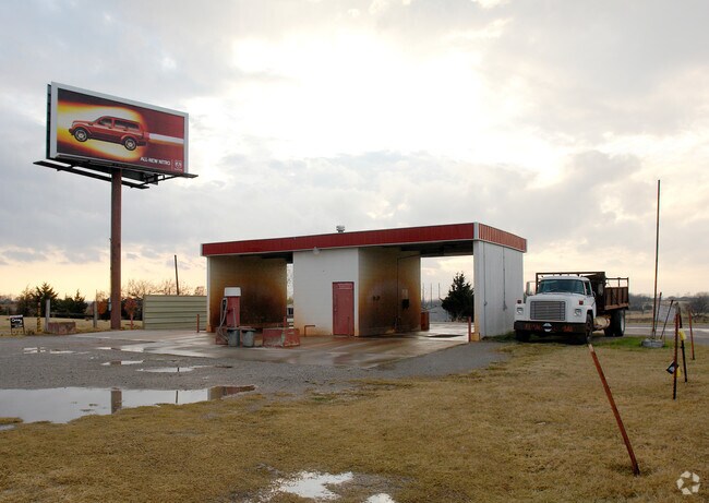
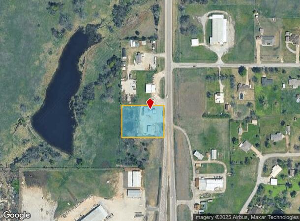
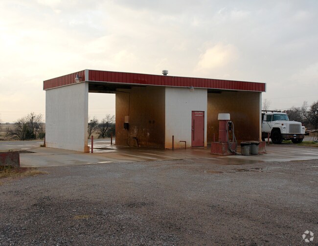
6002&6004 N Highway 177
000029011003002600
I-2U Beg 866.89N Se/C Se W208.71 N208.71
Storebuilding
I-2U BEG 866.89N SE/C SE W208.71 N208.71 E208.71 S208.71 POB. & TR DES BEG 866.89N & 208.71 W OF SE/C SE TH W104.36 TH N208.71 TH E104.36 TH S208.71 POB
X
Pottawatomie
40125C0045J
Oklahoma
2024
1.50 AC
2025
Oklahoma East Area
500700
Other Market Areas
2,568 SF
Shawnee, OK
DEMOGRAPHICS near 6002&6004 N Highway 177
1 Mile
3 Mile
5 Mile
2024 Total Population
536
2,874
13,285
2029 Population
552
3,000
13,800
Pop Growth 2024-2029
+ 2.99%
+ 4.38%
+ 3.88%
Average Age
40
41
38
2024 Total Households
200
1,104
4,607
HH Growth 2024-2029
+ 3.50%
+ 4.53%
+ 4.12%
Median Household Inc
$54,285
$51,269
$49,264
Avg Household Size
2.60
2.60
2.40
2024 Avg HH Vehicles
2.00
2.00
2.00
Median Home Value
$229,762
$183,103
$158,548
Median Year Built
1992
1989
1983
Nearby Places
Map Layers
Map Styles
 Street
 Aerial
- Restaurants
- Banks
- Shops
- Fitness
- Groceries
PUBLIC TRANSPORTATION
AIRPORT
Will Rogers World
DRIVE
WALK
Distance
Will Rogers World
49 min
37.3 mi
Nearby Properties
Address
Land Use
TOTAL SIZE
Lot Size
Zoning
Address
Land Use
TOTAL SIZE
Lot Size
Zoning
9,000 SF
4.69 AC
Address
Land Use
TOTAL SIZE
Lot Size
Zoning
52,919 SF
11 AC
Address
Land Use
TOTAL SIZE
Lot Size
Zoning
4,340 SF
5 AC
Address
Land Use
TOTAL SIZE
Lot Size
Zoning
10.43 AC
Address
Land Use
TOTAL SIZE
Lot Size
Zoning
21,750 SF
3.15 AC
Address
Land Use
TOTAL SIZE
Lot Size
Zoning
41,189 SF
5.85 AC
Address
Land Use
TOTAL SIZE
Lot Size
Zoning
5,908 SF
4 AC
Address
Land Use
TOTAL SIZE
Lot Size
Zoning
22,600 SF
10.36 AC
Address
Land Use
TOTAL SIZE
Lot Size
Zoning
14,013 SF
2.32 AC
Address
Land Use
TOTAL SIZE
Lot Size
Zoning
7,016 SF
2.24 AC
Address
Land Use
TOTAL SIZE
Lot Size
Zoning
5,400 SF
2.04 AC
Address
Land Use
TOTAL SIZE
Lot Size
Zoning
3,800 SF
0.63 AC
Address
Land Use
TOTAL SIZE
Lot Size
Zoning
27,000 SF
5 AC
Address
Land Use
TOTAL SIZE
Lot Size
Zoning
1,925 SF
2.32 AC
Address
Land Use
TOTAL SIZE
Lot Size
Zoning
3,900 SF
0.80 AC
Address
Land Use
TOTAL SIZE
Lot Size
Zoning
18,700 SF
3.02 AC
Address
Land Use
TOTAL SIZE
Lot Size
Zoning
Address
Land Use
TOTAL SIZE
Lot Size
Zoning
13,241 SF
2.82 AC
Address
Land Use
TOTAL SIZE
Lot Size
Zoning
9,210 SF
1.75 AC
Address
Land Use
TOTAL SIZE
Lot Size
Zoning
4,040 SF
10 AC
Address
Land Use
TOTAL SIZE
Lot Size
Zoning
8,120 SF
2.63 AC
Address
Land Use
TOTAL SIZE
Lot Size
Zoning
2,128 SF
8 AC
Address
Land Use
TOTAL SIZE
Lot Size
Zoning
864 SF
4.13 AC
Address
Land Use
TOTAL SIZE
Lot Size
Zoning
14,012 SF
3.25 AC
Address
Land Use
TOTAL SIZE
Lot Size
Zoning
5,464 SF
10.37 AC
Address
Land Use
TOTAL SIZE
Lot Size
Zoning
144 SF
11.27 AC
Address
Land Use
TOTAL SIZE
Lot Size
Zoning
700 SF
2 AC
Address
Land Use
TOTAL SIZE
Lot Size
Zoning
10,000 SF
64 AC
TM
Address
Land Use
TOTAL SIZE
Lot Size
Zoning
9,750 SF
10 AC
Address
Land Use
TOTAL SIZE
Lot Size
Zoning
4,000 SF
0.39 AC
The World's #1 Commercial Real Estate Marketplace
Connect with us
© 2025 CoStar Group
The information above has been obtained from sources believed reliable. While we do not doubt its accuracy we have not verified it and make no guarantee, warranty or representation about it. It is your responsibility to independently confirm its accuracy and completeness. Any projections, opinions, assumptions, or estimates used are for example only and do not represent the current or future performance of the property. The value of this transaction to you depends on tax and other factors which should be evaluated by your tax, financial, and legal advisors. You and your advisors should conduct a careful, independent investigation of the property to determine to your satisfaction the suitability of the property for your needs.