Property Record
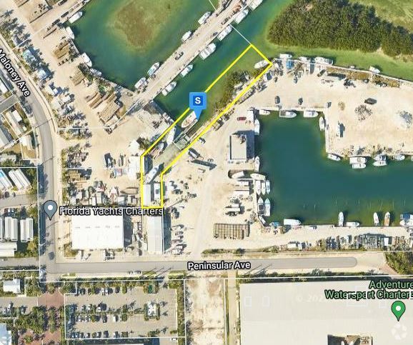
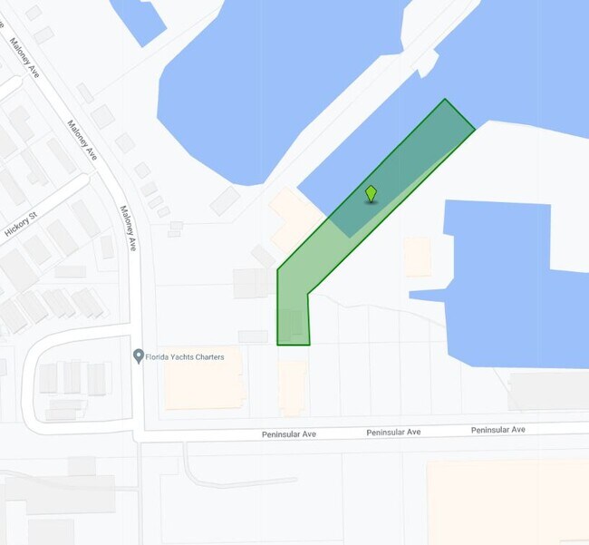
6003 Peninsular Ave, Key West, FL 33040
Property Detail
6003 Peninsular Ave
00125990-000000
BK 45 LT 51 MALONEY SUB SUBDIVISION PB1-55 STOCK ISLAND A1-229 OR542-809 OR645-200 OR828-612 OR1239-832 OR1342-438 OR1559-320 OR3176-2132 OR3180-1806 OR3180-1808
Storemultistory
MONROE
MU
Florida
AE The base floodplain where base flood elevations are provided. AE Zones are now used on new format FIRMs instead of A1-A30 Zones.
51
2024
0.14 AC
2025
Other Market Areas
971800
Key West-Key Largo, FL
3,096 SF
NEARBY LISTINGS FOR SALE OR LEASE
-
-
View all Key West listings for sale on LoopNet.com
DEMOGRAPHICS near 6003 Peninsular Ave
1 mile
3 mile
5 mile
2025 Total Population
3,043
14,221
28,196
2030 Population
2,809
13,379
26,548
Pop Growth 2025-2030
(7.69%)
(5.92%)
(5.84%)
Average Age
40
41
43
2025 Total Households
1,121
5,319
11,794
HH Growth 2025-2030
(7.94%)
(6.30%)
(6.02%)
Median Household Inc
$79,140
$82,975
$83,403
Avg Household Size
2.60
2.40
2.30
2025 Avg HH Vehicles
2.00
2.00
1.00
Median Home Value
$852,409
$776,315
$845,531
Median Year Built
1983
1979
1972
Nearby Places
Map Layers
Map Styles
 Street
 Aerial
Layers
 Traffic
 Biking
Places
Listings with unknown addresses are not visible on the map
- Restaurants
- Banks
- Shops
- Fitness
- Groceries
PUBLIC TRANSPORTATION
AIRPORT
Key West International
Drive
Walk
Distance
Key West International
13 min
4.6 mi
Freight Ports
Port of Miami
Drive
Walk
Distance
Port of Miami
242 min
162.1 mi
Nearby Properties
Address
Land Use
TOTAL SIZE
Lot Size
Zoning
Address
Land Use
TOTAL SIZE
Lot Size
Zoning
309.74 AC
MF
Address
Land Use
TOTAL SIZE
Lot Size
Zoning
105.78 AC
COW
Address
Land Use
TOTAL SIZE
Lot Size
Zoning
58,091 SF
4.87 AC
CT
Address
Land Use
TOTAL SIZE
Lot Size
Zoning
300,215 SF
13.94 AC
PS
Address
Land Use
TOTAL SIZE
Lot Size
Zoning
225,221 SF
17.11 AC
HDR
Address
Land Use
TOTAL SIZE
Lot Size
Zoning
126,563 SF
6.07 AC
HDR
Address
Land Use
TOTAL SIZE
Lot Size
Zoning
109,118 SF
7.80 AC
MU
Address
Land Use
TOTAL SIZE
Lot Size
Zoning
219,839 SF
7.52 AC
URM
Address
Land Use
TOTAL SIZE
Lot Size
Zoning
228,039 SF
18.85 AC
PS
Address
Land Use
TOTAL SIZE
Lot Size
Zoning
147,707 SF
6.24 AC
MDR
Address
Land Use
TOTAL SIZE
Lot Size
Zoning
90,585 SF
2 AC
CG
Address
Land Use
TOTAL SIZE
Lot Size
Zoning
232,414 SF
17.63 AC
CG
Address
Land Use
TOTAL SIZE
Lot Size
Zoning
2,594 SF
22.38 AC
MDR
Address
Land Use
TOTAL SIZE
Lot Size
Zoning
189,418 SF
17.41 AC
CG
Address
Land Use
TOTAL SIZE
Lot Size
Zoning
178,252 SF
15.21 AC
CG
Address
Land Use
TOTAL SIZE
Lot Size
Zoning
85,189 SF
1.91 AC
Address
Land Use
TOTAL SIZE
Lot Size
Zoning
64,746 SF
3.83 AC
CG
Address
Land Use
TOTAL SIZE
Lot Size
Zoning
68,168 SF
3.06 AC
CG
Address
Land Use
TOTAL SIZE
Lot Size
Zoning
60,305 SF
5.10 AC
CT
Address
Land Use
TOTAL SIZE
Lot Size
Zoning
254,529 SF
21.61 AC
M
Address
Land Use
TOTAL SIZE
Lot Size
Zoning
33,925 SF
3.14 AC
CG
Address
Land Use
TOTAL SIZE
Lot Size
Zoning
293,187 SF
168.13 AC
A
Address
Land Use
TOTAL SIZE
Lot Size
Zoning
56,115 SF
3.31 AC
CG
Address
Land Use
TOTAL SIZE
Lot Size
Zoning
43,942 SF
34.27 AC
PS
Address
Land Use
TOTAL SIZE
Lot Size
Zoning
63,357 SF
9.21 AC
PS
Address
Land Use
TOTAL SIZE
Lot Size
Zoning
37,090 SF
3.02 AC
CG
Address
Land Use
TOTAL SIZE
Lot Size
Zoning
47,058 SF
2.94 AC
CG
Address
Land Use
TOTAL SIZE
Lot Size
Zoning
7,694 SF
9.16 AC
RV
Address
Land Use
TOTAL SIZE
Lot Size
Zoning
32,757 SF
1.27 AC
CG
Address
Land Use
TOTAL SIZE
Lot Size
Zoning
65,166 SF
2.64 AC
PS
The World's #1 Commercial Real Estate Marketplace
Connect with us
© 2026 CoStar Group
The information above has been obtained from sources believed reliable. While we do not doubt its accuracy we have not verified it and make no guarantee, warranty or representation about it. It is your responsibility to independently confirm its accuracy and completeness. Any projections, opinions, assumptions, or estimates used are for example only and do not represent the current or future performance of the property. The value of this transaction to you depends on tax and other factors which should be evaluated by your tax, financial, and legal advisors. You and your advisors should conduct a careful, independent investigation of the property to determine to your satisfaction the suitability of the property for your needs.