Property Record
6006 Wardleigh Rd, Hill Air Force Base, UT 84056


NEARBY LISTINGS FOR SALE OR LEASE
Property Detail
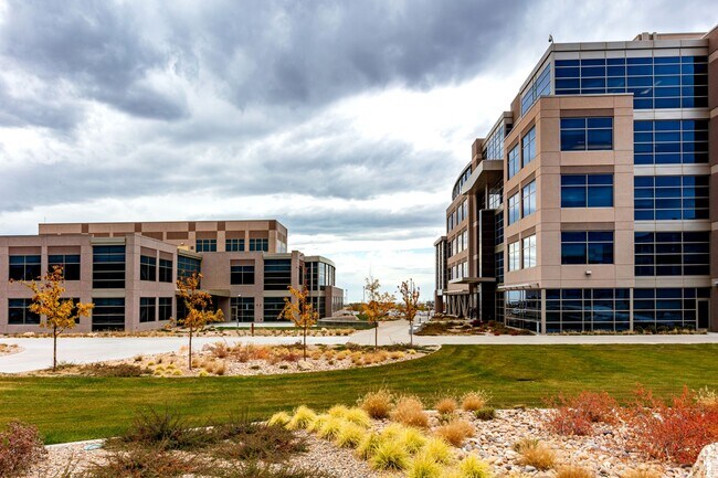
6006 Wardleigh Rd
55-001-0005
ALL OF LOT 1, MIDA - BUILDING 1575. CONT. 0.117 ACRES. ALSO, ALL OF LOT 2, MIDA - BUILDING 1575. CONT 0.806 ACRES. ALSO, ALL OF LOT 3, MIDA - BUILDING 1575. LESS & EXCEPT THAT POR
Officebuilding
Davis
X
Utah
49011C0210E
1-3
2025
7.12 AC
2025
Davis/Weber Counties
980000
Salt Lake City
125,164 SF
Ogden-Clearfield, UT
DEMOGRAPHICS near 6006 Wardleigh Rd
1 Mile
3 Mile
5 Mile
2024 Total Population
7,997
78,871
243,856
2029 Population
8,576
83,836
260,139
Pop Growth 2024-2029
+ 7.24%
+ 6.30%
+ 6.68%
Average Age
32
33
34
2024 Total Households
2,757
25,576
77,632
HH Growth 2024-2029
+ 7.47%
+ 6.44%
+ 6.84%
Median Household Inc
$59,266
$71,197
$81,882
Avg Household Size
2.80
3.00
3.10
2024 Avg HH Vehicles
2.00
2.00
2.00
Median Home Value
$281,236
$346,000
$371,220
Median Year Built
1968
1989
1993
Nearby Places
Map Layers
Map Styles
 Street
 Aerial
- Restaurants
- Banks
- Shops
- Fitness
- Groceries
PUBLIC TRANSPORTATION
COMMUTER RAIL
Clearfield (FrontRunner North - Utah Transit Authority (UTA))
DRIVE
WALK
Distance
Clearfield (FrontRunner North - Utah Transit Authority (UTA))
8 min
3.3 mi
Roy (FrontRunner North - Utah Transit Authority (UTA))
DRIVE
WALK
Distance
Roy (FrontRunner North - Utah Transit Authority (UTA))
12 min
6.1 mi
AIRPORT
Salt Lake City International
DRIVE
WALK
Distance
Salt Lake City International
39 min
31.5 mi
Freight Ports
Port of Stockton
DRIVE
WALK
Distance
Port of Stockton
739 min
721.9 mi
SALE & LEASE HISTORY
LISTING DATE
SALE/LEASE

Sep 25, 2016
For Lease
Jan 28, 2022
For Lease
Nearby Properties
Address
Land Use
TOTAL SIZE
Lot Size
Zoning
Address
Land Use
TOTAL SIZE
Lot Size
Zoning
399,630 SF
31.55 AC
I
Address
Land Use
TOTAL SIZE
Lot Size
Zoning
664,440 SF
37.07 AC
Address
Land Use
TOTAL SIZE
Lot Size
Zoning
151,064 SF
48.81 AC
Address
Land Use
TOTAL SIZE
Lot Size
Zoning
233,780 SF
14.77 AC
C-H
Address
Land Use
TOTAL SIZE
Lot Size
Zoning
123,824 SF
41.89 AC
M1
Address
Land Use
TOTAL SIZE
Lot Size
Zoning
53,494 SF
8.08 AC
Address
Land Use
TOTAL SIZE
Lot Size
Zoning
3,830 SF
16.64 AC
R3
Address
Land Use
TOTAL SIZE
Lot Size
Zoning
6,840 SF
15.25 AC
RH
Address
Land Use
TOTAL SIZE
Lot Size
Zoning
121,332 SF
44.40 AC
Address
Land Use
TOTAL SIZE
Lot Size
Zoning
86,536 SF
8.75 AC
Address
Land Use
TOTAL SIZE
Lot Size
Zoning
123,445 SF
27.94 AC
M1
Address
Land Use
TOTAL SIZE
Lot Size
Zoning
75,946 SF
5.67 AC
CH
Address
Land Use
TOTAL SIZE
Lot Size
Zoning
638,065 SF
33.77 AC
M1
Address
Land Use
TOTAL SIZE
Lot Size
Zoning
182,344 SF
7.41 AC
CP-3
Address
Land Use
TOTAL SIZE
Lot Size
Zoning
91,750 SF
6.76 AC
C2
Address
Land Use
TOTAL SIZE
Lot Size
Zoning
107,628 SF
58.88 AC
A
Address
Land Use
TOTAL SIZE
Lot Size
Zoning
63,828 SF
5.30 AC
PF
Address
Land Use
TOTAL SIZE
Lot Size
Zoning
453,129 SF
24.72 AC
M1
Address
Land Use
TOTAL SIZE
Lot Size
Zoning
76,778 SF
5.51 AC
Address
Land Use
TOTAL SIZE
Lot Size
Zoning
26,058 SF
5.86 AC
Address
Land Use
TOTAL SIZE
Lot Size
Zoning
5,481 SF
15.54 AC
Address
Land Use
TOTAL SIZE
Lot Size
Zoning
6,591 SF
12.12 AC
R3
Address
Land Use
TOTAL SIZE
Lot Size
Zoning
74,995 SF
6.07 AC
Address
Land Use
TOTAL SIZE
Lot Size
Zoning
223,079 SF
22.55 AC
The World's #1 Commercial Real Estate Marketplace
Connect with us
© 2026 CoStar Group
The information above has been obtained from sources believed reliable. While we do not doubt its accuracy we have not verified it and make no guarantee, warranty or representation about it. It is your responsibility to independently confirm its accuracy and completeness. Any projections, opinions, assumptions, or estimates used are for example only and do not represent the current or future performance of the property. The value of this transaction to you depends on tax and other factors which should be evaluated by your tax, financial, and legal advisors. You and your advisors should conduct a careful, independent investigation of the property to determine to your satisfaction the suitability of the property for your needs.