Property Record
6008 Hill Dale Ct, Bakersfield, CA 93306


NEARBY LISTINGS FOR SALE OR LEASE
Property Detail
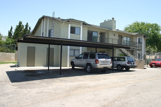
6008 Hill Dale Ct
439-100-12-00-2
TRACT 4621 , BLOCK , LOT 25
Quadruplex
Kern
X
California
06029C1841E
25
2024
0.30 AC
2025
Outer East Bakersfield
000914
Bakersfield
4,520 SF
Bakersfield, CA
DEMOGRAPHICS near 6008 Hill Dale Ct
1 Mile
3 Mile
5 Mile
2024 Total Population
10,153
71,002
152,519
2029 Population
10,175
71,085
152,574
Pop Growth 2024-2029
+ 0.22%
+ 0.12%
+ 0.04%
Average Age
35
35
34
2024 Total Households
3,488
21,776
45,869
HH Growth 2024-2029
+ 0.14%
+ 0.11%
+ 0.04%
Median Household Inc
$74,742
$59,698
$46,355
Avg Household Size
2.80
3.20
3.20
2024 Avg HH Vehicles
2.00
2.00
2.00
Median Home Value
$307,292
$263,212
$252,289
Median Year Built
1985
1973
1973
Nearby Places
Map Layers
Map Styles
 Street
 Aerial
- Restaurants
- Banks
- Shops
- Fitness
- Groceries
PUBLIC TRANSPORTATION
COMMUTER RAIL
Bakersfield (San Joaquins - Amtrak)
DRIVE
WALK
Distance
Bakersfield (San Joaquins - Amtrak)
12 min
6.6 mi
AIRPORT
Meadows Field
DRIVE
WALK
Distance
Meadows Field
22 min
11.7 mi
Freight Ports
The Port of Hueneme
DRIVE
WALK
Distance
The Port of Hueneme
163 min
130.4 mi
SALE & LEASE HISTORY
LISTING DATE
SALE/LEASE

May 05, 2017
For Sale
Apr 02, 2018
For Sale
Nearby Properties
Address
Land Use
TOTAL SIZE
Lot Size
Zoning
Address
Land Use
TOTAL SIZE
Lot Size
Zoning
1.38 AC
C-2
Address
Land Use
TOTAL SIZE
Lot Size
Zoning
11,267 SF
40 AC
Address
Land Use
TOTAL SIZE
Lot Size
Zoning
66,139 SF
4.48 AC
CO
Address
Land Use
TOTAL SIZE
Lot Size
Zoning
Address
Land Use
TOTAL SIZE
Lot Size
Zoning
66,139 SF
4.48 AC
CO
Address
Land Use
TOTAL SIZE
Lot Size
Zoning
161,946 SF
17.84 AC
C2 PD
Address
Land Use
TOTAL SIZE
Lot Size
Zoning
103,536 SF
6.31 AC
R-3
Address
Land Use
TOTAL SIZE
Lot Size
Zoning
102,262 SF
3.93 AC
Address
Land Use
TOTAL SIZE
Lot Size
Zoning
10.31 AC
Address
Land Use
TOTAL SIZE
Lot Size
Zoning
127,224 SF
7 AC
R-2/PUD
Address
Land Use
TOTAL SIZE
Lot Size
Zoning
137,900 SF
15.69 AC
C2
Address
Land Use
TOTAL SIZE
Lot Size
Zoning
115,058 SF
13.02 AC
C2
Address
Land Use
TOTAL SIZE
Lot Size
Zoning
1.06 AC
R-1
Address
Land Use
TOTAL SIZE
Lot Size
Zoning
0.41 AC
R1
Address
Land Use
TOTAL SIZE
Lot Size
Zoning
66,582 SF
3.36 AC
R-2
Address
Land Use
TOTAL SIZE
Lot Size
Zoning
179,460 SF
10.20 AC
R3
Address
Land Use
TOTAL SIZE
Lot Size
Zoning
68,264 SF
6.56 AC
C2
Address
Land Use
TOTAL SIZE
Lot Size
Zoning
4.94 AC
R-3
Address
Land Use
TOTAL SIZE
Lot Size
Zoning
74,038 SF
6.64 AC
C2
Address
Land Use
TOTAL SIZE
Lot Size
Zoning
46,522 SF
3.35 AC
R2
Address
Land Use
TOTAL SIZE
Lot Size
Zoning
34,733 SF
7.25 AC
C2
Address
Land Use
TOTAL SIZE
Lot Size
Zoning
29,440 SF
2.83 AC
C-2
Address
Land Use
TOTAL SIZE
Lot Size
Zoning
101,437 SF
9.05 AC
PCD
Address
Land Use
TOTAL SIZE
Lot Size
Zoning
96,952 SF
2.56 AC
R-2
Address
Land Use
TOTAL SIZE
Lot Size
Zoning
11.05 AC
C2/PCD
Address
Land Use
TOTAL SIZE
Lot Size
Zoning
127,050 SF
13.48 AC
M-1
Address
Land Use
TOTAL SIZE
Lot Size
Zoning
95,258 SF
5.34 AC
PUD
Address
Land Use
TOTAL SIZE
Lot Size
Zoning
132,044 SF
9.07 AC
R-3
Address
Land Use
TOTAL SIZE
Lot Size
Zoning
93,070 SF
7.98 AC
PUD
Address
Land Use
TOTAL SIZE
Lot Size
Zoning
The World's #1 Commercial Real Estate Marketplace
Connect with us
© 2025 CoStar Group
The information above has been obtained from sources believed reliable. While we do not doubt its accuracy we have not verified it and make no guarantee, warranty or representation about it. It is your responsibility to independently confirm its accuracy and completeness. Any projections, opinions, assumptions, or estimates used are for example only and do not represent the current or future performance of the property. The value of this transaction to you depends on tax and other factors which should be evaluated by your tax, financial, and legal advisors. You and your advisors should conduct a careful, independent investigation of the property to determine to your satisfaction the suitability of the property for your needs.