Property Record
6009 N Ridge Rd, Madison, OH 44057


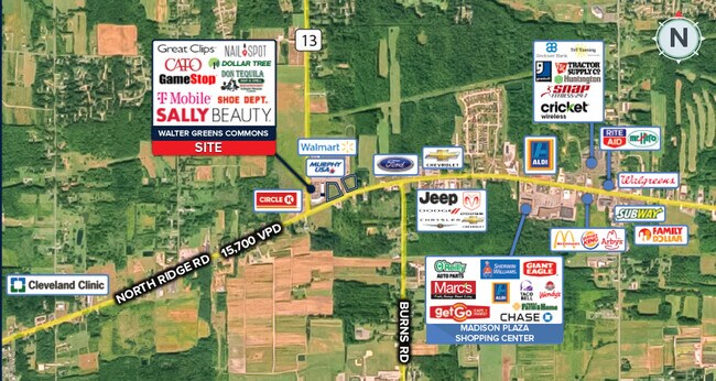
NEARBY LISTINGS FOR SALE OR LEASE
Property Detail
6009 N Ridge Rd
01-B-112-0-00-019
LOT 10 TRACT 3
Supermarket
Lake
X
Ohio
39007C0125E
10
0
35.07 AC
2024
Northeast
205701
Cleveland
219,369 SF
Cleveland-Elyria, OH
DEMOGRAPHICS near 6009 N Ridge Rd
1 Mile
3 Mile
5 Mile
2024 Total Population
1,055
15,657
23,607
2029 Population
1,050
15,622
23,600
Pop Growth 2024-2029
(0.47%)
(0.22%)
(0.03%)
Average Age
46
43
43
2024 Total Households
475
6,346
9,436
HH Growth 2024-2029
(0.42%)
(0.27%)
(0.07%)
Median Household Inc
$55,307
$65,340
$68,507
Avg Household Size
2.20
2.40
2.40
2024 Avg HH Vehicles
2.00
2.00
2.00
Median Home Value
$159,328
$158,554
$165,947
Median Year Built
1988
1973
1974
Nearby Places
Map Layers
Map Styles
 Street
 Aerial
- Restaurants
- Banks
- Shops
- Fitness
- Groceries
SALE & LEASE HISTORY
LISTING DATE
SALE/LEASE

Mar 09, 2021
For Sale
Dec 03, 2019
For Lease
Nearby Properties
Address
Land Use
TOTAL SIZE
Lot Size
Zoning
Address
Land Use
TOTAL SIZE
Lot Size
Zoning
98,985 SF
21.55 AC
B-1
Address
Land Use
TOTAL SIZE
Lot Size
Zoning
170,489 SF
46.25 AC
A1
Address
Land Use
TOTAL SIZE
Lot Size
Zoning
105,062 SF
43.85 AC
A-1
Address
Land Use
TOTAL SIZE
Lot Size
Zoning
36,697 SF
16.11 AC
B-1
Address
Land Use
TOTAL SIZE
Lot Size
Zoning
91,542 SF
20.54 AC
R
Address
Land Use
TOTAL SIZE
Lot Size
Zoning
50,451 SF
13.96 AC
B-1
Address
Land Use
TOTAL SIZE
Lot Size
Zoning
37,027 SF
5.78 AC
Address
Land Use
TOTAL SIZE
Lot Size
Zoning
70,268 SF
10.45 AC
Address
Land Use
TOTAL SIZE
Lot Size
Zoning
89,158 SF
6 AC
Address
Land Use
TOTAL SIZE
Lot Size
Zoning
36.49 AC
GBUS
Address
Land Use
TOTAL SIZE
Lot Size
Zoning
67,744 SF
7.03 AC
P1
Address
Land Use
TOTAL SIZE
Lot Size
Zoning
38,721 SF
20.66 AC
B-1
Address
Land Use
TOTAL SIZE
Lot Size
Zoning
67,234 SF
3.09 AC
B-2
Address
Land Use
TOTAL SIZE
Lot Size
Zoning
61,567 SF
8.35 AC
R2
Address
Land Use
TOTAL SIZE
Lot Size
Zoning
66,079 SF
6.49 AC
B-2
Address
Land Use
TOTAL SIZE
Lot Size
Zoning
5,872 SF
157.13 AC
Address
Land Use
TOTAL SIZE
Lot Size
Zoning
45,324 SF
5.45 AC
R5
Address
Land Use
TOTAL SIZE
Lot Size
Zoning
49,830 SF
8.57 AC
R4
Address
Land Use
TOTAL SIZE
Lot Size
Zoning
16,282 SF
0.89 AC
R-2
Address
Land Use
TOTAL SIZE
Lot Size
Zoning
37,800 SF
5.66 AC
Address
Land Use
TOTAL SIZE
Lot Size
Zoning
19,081 SF
4.99 AC
A-1
Address
Land Use
TOTAL SIZE
Lot Size
Zoning
36,280 SF
14.13 AC
SPEC
Address
Land Use
TOTAL SIZE
Lot Size
Zoning
56,299 SF
9.18 AC
LIND
Address
Land Use
TOTAL SIZE
Lot Size
Zoning
19,100 SF
13.27 AC
R-1
Address
Land Use
TOTAL SIZE
Lot Size
Zoning
25,176 SF
3.75 AC
A1
Address
Land Use
TOTAL SIZE
Lot Size
Zoning
7,074 SF
17.11 AC
R-1
Address
Land Use
TOTAL SIZE
Lot Size
Zoning
42,967 SF
4.23 AC
B-2
Address
Land Use
TOTAL SIZE
Lot Size
Zoning
12,280 SF
28.31 AC
R-2
Address
Land Use
TOTAL SIZE
Lot Size
Zoning
18,572 SF
10 AC
The World's #1 Commercial Real Estate Marketplace
Connect with us
© 2025 CoStar Group
The information above has been obtained from sources believed reliable. While we do not doubt its accuracy we have not verified it and make no guarantee, warranty or representation about it. It is your responsibility to independently confirm its accuracy and completeness. Any projections, opinions, assumptions, or estimates used are for example only and do not represent the current or future performance of the property. The value of this transaction to you depends on tax and other factors which should be evaluated by your tax, financial, and legal advisors. You and your advisors should conduct a careful, independent investigation of the property to determine to your satisfaction the suitability of the property for your needs.