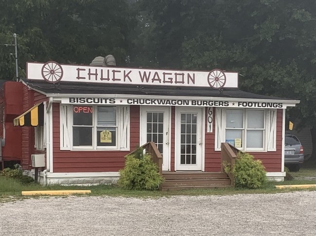
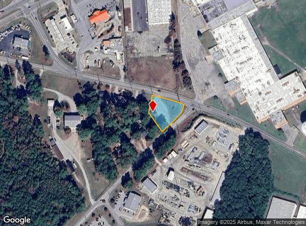
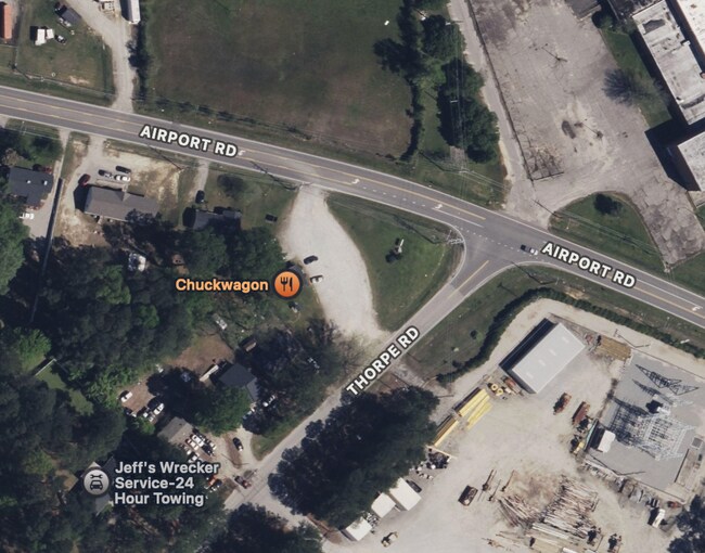
Property Record
601 Airport Rd, Rocky Mount, NC 27804
NEARBY LISTINGS FOR SALE OR LEASE
-
-
-
-
-
-
-
-
-
-
-
-
-
No Photo
-
View all Rocky Mount listings for sale on LoopNet.com
Property Detail
601 Airport Rd
3851-19-61-2245
Property Of J B W Overton
Restaurantdrivein
1 2 1, 1 00 A C, 4 J B W OVERTON AC 4 J B W OVERTON
X
Nash
3720385100K
North Carolina
2025
1 AC
2025
Rocky Mount/Wilson
010604
Other Market Areas
614 SF
Rocky Mount, NC
DEMOGRAPHICS near 601 Airport Rd
1 Mile
3 Mile
5 Mile
2024 Total Population
1,498
31,008
56,436
2029 Population
1,522
31,879
57,783
Pop Growth 2024-2029
+ 1.60%
+ 2.81%
+ 2.39%
Average Age
39
41
41
2024 Total Households
686
13,611
24,087
HH Growth 2024-2029
+ 1.46%
+ 2.85%
+ 2.42%
Median Household Inc
$51,667
$43,985
$45,842
Avg Household Size
2.10
2.20
2.30
2024 Avg HH Vehicles
2.00
2.00
2.00
Median Home Value
$156,985
$115,549
$133,731
Median Year Built
1984
1977
1978
Nearby Places
- Restaurants
- Banks
- Shops
- Fitness
- Groceries
PUBLIC TRANSPORTATION
COMMUTER RAIL
DRIVE
WALK
Distance
6 min
3.3 mi
AIRPORT
Pitt-Greenville
DRIVE
WALK
Distance
Pitt-Greenville
53 min
43.4 mi
SALE & LEASE HISTORY
LISTING DATE
SALE/LEASE

Sep 11, 2019
For Sale
Nearby Properties
Address
Land Use
TOTAL SIZE
Lot Size
Zoning
Address
Land Use
TOTAL SIZE
Lot Size
Zoning
7,020 SF
33.70 AC
R6
Address
Land Use
TOTAL SIZE
Lot Size
Zoning
2,500 SF
14.61 AC
R6
Address
Land Use
TOTAL SIZE
Lot Size
Zoning
129,595 SF
11.35 AC
B2CU
Address
Land Use
TOTAL SIZE
Lot Size
Zoning
104,995 SF
16.01 AC
Address
Land Use
TOTAL SIZE
Lot Size
Zoning
10,632 SF
16.61 AC
R6
Address
Land Use
TOTAL SIZE
Lot Size
Zoning
78,052 SF
122.10 AC
I2
Address
Land Use
TOTAL SIZE
Lot Size
Zoning
27,990 SF
5.75 AC
R10
Address
Land Use
TOTAL SIZE
Lot Size
Zoning
98,831 SF
5.40 AC
I
Address
Land Use
TOTAL SIZE
Lot Size
Zoning
165,000 SF
4.66 AC
Address
Land Use
TOTAL SIZE
Lot Size
Zoning
6,976 SF
15.97 AC
R6
Address
Land Use
TOTAL SIZE
Lot Size
Zoning
8,216 SF
4.21 AC
B4
Address
Land Use
TOTAL SIZE
Lot Size
Zoning
65,826 SF
16.77 AC
Address
Land Use
TOTAL SIZE
Lot Size
Zoning
204,903 SF
23.07 AC
Address
Land Use
TOTAL SIZE
Lot Size
Zoning
85,766 SF
4.61 AC
B5
Address
Land Use
TOTAL SIZE
Lot Size
Zoning
98,065 SF
6.14 AC
I
Address
Land Use
TOTAL SIZE
Lot Size
Zoning
73,338 SF
2.81 AC
B5CU
Address
Land Use
TOTAL SIZE
Lot Size
Zoning
8,822 SF
9.70 AC
R6
Address
Land Use
TOTAL SIZE
Lot Size
Zoning
8,020 SF
13.81 AC
R6
Address
Land Use
TOTAL SIZE
Lot Size
Zoning
59,236 SF
2.18 AC
B5M
Address
Land Use
TOTAL SIZE
Lot Size
Zoning
51,543 SF
9.61 AC
I
Address
Land Use
TOTAL SIZE
Lot Size
Zoning
47,968 SF
4.68 AC
I
Address
Land Use
TOTAL SIZE
Lot Size
Zoning
118,800 SF
5.51 AC
I
Address
Land Use
TOTAL SIZE
Lot Size
Zoning
13,075 SF
14.90 AC
Address
Land Use
TOTAL SIZE
Lot Size
Zoning
7,952 SF
8.59 AC
R6
Address
Land Use
TOTAL SIZE
Lot Size
Zoning
135,400 SF
21.45 AC
B2
Address
Land Use
TOTAL SIZE
Lot Size
Zoning
25,936 SF
22.35 AC
R15
Address
Land Use
TOTAL SIZE
Lot Size
Zoning
62,024 SF
5.39 AC
B5
Address
Land Use
TOTAL SIZE
Lot Size
Zoning
47,410 SF
2.58 AC
B5CU
Address
Land Use
TOTAL SIZE
Lot Size
Zoning
129,264 SF
31.28 AC
B3
Address
Land Use
TOTAL SIZE
Lot Size
Zoning
42,449 SF
2.49 AC
I2
The World's #1 Commercial Real Estate Marketplace
Connect with us
© 2025 CoStar Group
The information above has been obtained from sources believed reliable. While we do not doubt its accuracy we have not verified it and make no guarantee, warranty or representation about it. It is your responsibility to independently confirm its accuracy and completeness. Any projections, opinions, assumptions, or estimates used are for example only and do not represent the current or future performance of the property. The value of this transaction to you depends on tax and other factors which should be evaluated by your tax, financial, and legal advisors. You and your advisors should conduct a careful, independent investigation of the property to determine to your satisfaction the suitability of the property for your needs.