Property Record
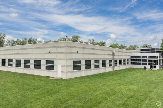
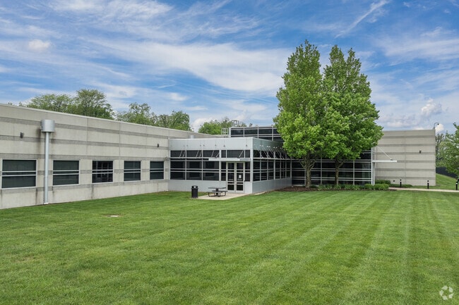
601 Benjamin Dr, Springfield, OH 45502

Property Detail
601 Benjamin Dr
Springfield, OH
PT NW QRS SEC 4 & PT NE QR SEC 10
33-00700-00400-0071
CLARK
Industrialgeneral
Ohio
B and X Area of moderate flood hazard, usually the area between the limits of the 100-year and 500-year floods.
71
2024
39.11 AC
2025
Northeast Dayton
002200
Cincinnati/Dayton
66,716 SF
NEARBY LISTINGS FOR SALE OR LEASE
-
-
View all Springfield listings for sale on LoopNet.com
DEMOGRAPHICS near 601 Benjamin Dr
1 mile
3 mile
5 mile
2025 Total Population
281
12,951
52,921
2030 Population
278
12,897
53,081
Pop Growth 2025-2030
(1.07%)
(0.42%)
+ 0.30%
Average Age
46
42
40
2025 Total Households
108
5,544
21,725
HH Growth 2025-2030
(0.93%)
(0.38%)
+ 0.25%
Median Household Inc
$97,684
$59,624
$50,109
Avg Household Size
2.60
2.30
2.30
2025 Avg HH Vehicles
2.00
2.00
2.00
Median Home Value
$321,739
$140,169
$144,024
Median Year Built
1959
1954
1953
Nearby Places
Map Layers
Map Styles
 Street
 Aerial
Layers
 Traffic
 Biking
Places
Listings with unknown addresses are not visible on the map
- Restaurants
- Banks
- Shops
- Fitness
- Groceries
PUBLIC TRANSPORTATION
AIRPORT
James M Cox Dayton International
Drive
Walk
Distance
James M Cox Dayton International
44 min
32.4 mi
SALE & LEASE HISTORY
LISTING DATE
SALE/LEASE

Apr 12, 2023
For Sale
Nearby Properties
Address
Land Use
TOTAL SIZE
Lot Size
Zoning
Address
Land Use
TOTAL SIZE
Lot Size
Zoning
878,848 SF
115.07 AC
Address
Land Use
TOTAL SIZE
Lot Size
Zoning
12,657 SF
8.17 AC
Address
Land Use
TOTAL SIZE
Lot Size
Zoning
516,191 SF
91.52 AC
A
Address
Land Use
TOTAL SIZE
Lot Size
Zoning
386,728 SF
34.66 AC
Address
Land Use
TOTAL SIZE
Lot Size
Zoning
375,053 SF
50.43 AC
Address
Land Use
TOTAL SIZE
Lot Size
Zoning
199,566 SF
109.96 AC
Address
Land Use
TOTAL SIZE
Lot Size
Zoning
229,125 SF
40.19 AC
Address
Land Use
TOTAL SIZE
Lot Size
Zoning
Address
Land Use
TOTAL SIZE
Lot Size
Zoning
878,588 SF
115.07 AC
Address
Land Use
TOTAL SIZE
Lot Size
Zoning
217,626 SF
17.85 AC
Address
Land Use
TOTAL SIZE
Lot Size
Zoning
Address
Land Use
TOTAL SIZE
Lot Size
Zoning
197,451 SF
9.49 AC
Address
Land Use
TOTAL SIZE
Lot Size
Zoning
Address
Land Use
TOTAL SIZE
Lot Size
Zoning
50,170 SF
7.09 AC
Address
Land Use
TOTAL SIZE
Lot Size
Zoning
149,240 SF
15.75 AC
Address
Land Use
TOTAL SIZE
Lot Size
Zoning
12,657 SF
8.17 AC
Address
Land Use
TOTAL SIZE
Lot Size
Zoning
55,584 SF
5.97 AC
Address
Land Use
TOTAL SIZE
Lot Size
Zoning
6,720 SF
17.36 AC
Address
Land Use
TOTAL SIZE
Lot Size
Zoning
145,140 SF
16.35 AC
Address
Land Use
TOTAL SIZE
Lot Size
Zoning
Address
Land Use
TOTAL SIZE
Lot Size
Zoning
40,855 SF
10.90 AC
R-6
Address
Land Use
TOTAL SIZE
Lot Size
Zoning
134,190 SF
23 AC
Address
Land Use
TOTAL SIZE
Lot Size
Zoning
95,964 SF
17.29 AC
Address
Land Use
TOTAL SIZE
Lot Size
Zoning
37,185 SF
9.13 AC
Address
Land Use
TOTAL SIZE
Lot Size
Zoning
89,958 SF
6 AC
Address
Land Use
TOTAL SIZE
Lot Size
Zoning
26,445 SF
21.03 AC
Address
Land Use
TOTAL SIZE
Lot Size
Zoning
Address
Land Use
TOTAL SIZE
Lot Size
Zoning
35,200 SF
3.73 AC
I-1
Address
Land Use
TOTAL SIZE
Lot Size
Zoning
23,642 SF
8.32 AC
R-6
Address
Land Use
TOTAL SIZE
Lot Size
Zoning
181,799 SF
1.52 AC
The World's #1 Commercial Real Estate Marketplace
Connect with us
© 2026 CoStar Group
The information above has been obtained from sources believed reliable. While we do not doubt its accuracy we have not verified it and make no guarantee, warranty or representation about it. It is your responsibility to independently confirm its accuracy and completeness. Any projections, opinions, assumptions, or estimates used are for example only and do not represent the current or future performance of the property. The value of this transaction to you depends on tax and other factors which should be evaluated by your tax, financial, and legal advisors. You and your advisors should conduct a careful, independent investigation of the property to determine to your satisfaction the suitability of the property for your needs.