Property Record
601 E 12Th Ave, Kansas City, MO 64116


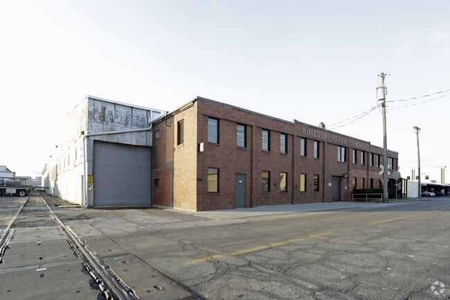
Property Detail
601 E 12Th Ave
Kansas City
MIDWAY LTS 1-7, N12.5 LT 16, 17-47, ADJ TR & VAC ALLEY BLK 9 EXC ROW
Kansas City, MO-KS
Clay
17-618-00-02-001.00
Missouri
Commercialnec
25-47
2024
1.77 AC
2025
City of North KC
022100
NEARBY LISTINGS FOR SALE OR LEASE
DEMOGRAPHICS near 601 E 12Th Ave
1 mile
3 mile
5 mile
2025 Total Population
1,686
67,654
217,478
2030 Population
1,815
70,180
225,418
Pop Growth 2025-2030
+ 7.65%
+ 3.73%
+ 3.65%
Average Age
36
37
37
2025 Total Households
1,135
31,354
91,052
HH Growth 2025-2030
+ 7.75%
+ 3.98%
+ 3.86%
Median Household Inc
$83,304
$59,658
$54,349
Avg Household Size
1.50
2.00
2.20
2025 Avg HH Vehicles
2.00
1.00
1.00
Median Home Value
$250,000
$203,263
$164,464
Median Year Built
2011
1963
1958
Nearby Places
Map Layers
Map Styles
 Street
 Aerial
Transit
 Traffic
 Biking
Places
Listings with unknown addresses are not visible on the map
- Restaurants
- Banks
- Shops
- Fitness
- Groceries
PUBLIC TRANSPORTATION
COMMUTER RAIL
Kansas City (Lincoln Service Missouri River Runner - Amtrak, Missouri River Runner - Amtrak, Southwest Chief - Amtrak)
Drive
Walk
Distance
Kansas City (Lincoln Service Missouri River Runner - Amtrak, Missouri River Runner - Amtrak, Southwest Chief - Amtrak)
9 min
4.1 mi
AIRPORT
Kansas City International
Drive
Walk
Distance
Kansas City International
25 min
17.4 mi
Freight Ports
Tulsa Port Of Catoosa
Drive
Walk
Distance
Tulsa Port Of Catoosa
273 min
241.2 mi
Nearby Properties
Address
Land Use
TOTAL SIZE
Lot Size
Zoning
Address
Land Use
TOTAL SIZE
Lot Size
Zoning
Address
Land Use
TOTAL SIZE
Lot Size
Zoning
172,810 SF
Address
Land Use
TOTAL SIZE
Lot Size
Zoning
568,235 SF
9.59 AC
Address
Land Use
TOTAL SIZE
Lot Size
Zoning
488,351 SF
8.34 AC
Address
Land Use
TOTAL SIZE
Lot Size
Zoning
132,304 SF
3.72 AC
KCD
Address
Land Use
TOTAL SIZE
Lot Size
Zoning
8.29 AC
Address
Land Use
TOTAL SIZE
Lot Size
Zoning
846,143 SF
51.25 AC
Address
Land Use
TOTAL SIZE
Lot Size
Zoning
63,748 SF
3.92 AC
Address
Land Use
TOTAL SIZE
Lot Size
Zoning
404,524 SF
5.51 AC
Address
Land Use
TOTAL SIZE
Lot Size
Zoning
277,042 SF
0.40 AC
Address
Land Use
TOTAL SIZE
Lot Size
Zoning
277,267 SF
4.18 AC
KCD
Address
Land Use
TOTAL SIZE
Lot Size
Zoning
81,578 SF
1.63 AC
Address
Land Use
TOTAL SIZE
Lot Size
Zoning
115,627 SF
1.56 AC
Address
Land Use
TOTAL SIZE
Lot Size
Zoning
261,570 SF
1.82 AC
Address
Land Use
TOTAL SIZE
Lot Size
Zoning
Address
Land Use
TOTAL SIZE
Lot Size
Zoning
157,488 SF
1.60 AC
Address
Land Use
TOTAL SIZE
Lot Size
Zoning
87,294 SF
0.70 AC
Address
Land Use
TOTAL SIZE
Lot Size
Zoning
4,012,734 SF
574.30 AC
KM3
Address
Land Use
TOTAL SIZE
Lot Size
Zoning
384,543 SF
5.40 AC
Address
Land Use
TOTAL SIZE
Lot Size
Zoning
342,989 SF
1.84 AC
Address
Land Use
TOTAL SIZE
Lot Size
Zoning
238,003 SF
1.74 AC
Address
Land Use
TOTAL SIZE
Lot Size
Zoning
191,753 SF
0.79 AC
M1
Address
Land Use
TOTAL SIZE
Lot Size
Zoning
131,115 SF
2.80 AC
Address
Land Use
TOTAL SIZE
Lot Size
Zoning
Address
Land Use
TOTAL SIZE
Lot Size
Zoning
50,504 SF
0.39 AC
Address
Land Use
TOTAL SIZE
Lot Size
Zoning
90,023 SF
1.18 AC
Address
Land Use
TOTAL SIZE
Lot Size
Zoning
99,060 SF
0.99 AC
Address
Land Use
TOTAL SIZE
Lot Size
Zoning
296,548 SF
5.09 AC
Address
Land Use
TOTAL SIZE
Lot Size
Zoning
276,233 SF
Address
Land Use
TOTAL SIZE
Lot Size
Zoning
48,224 SF
1.09 AC
The World's #1 Commercial Real Estate Marketplace
Connect with us
© 2026 CoStar Group
The information above has been obtained from sources believed reliable. While we do not doubt its accuracy we have not verified it and make no guarantee, warranty or representation about it. It is your responsibility to independently confirm its accuracy and completeness. Any projections, opinions, assumptions, or estimates used are for example only and do not represent the current or future performance of the property. The value of this transaction to you depends on tax and other factors which should be evaluated by your tax, financial, and legal advisors. You and your advisors should conduct a careful, independent investigation of the property to determine to your satisfaction the suitability of the property for your needs.