Property Record
601 E I65 Service Rd S, Mobile, AL 36606
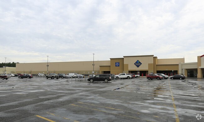
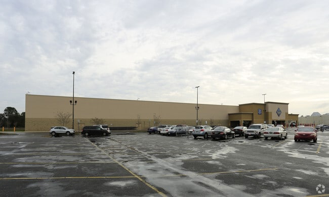
Property Detail
601 E I65 Service Rd S
Mobile, AL
THAT PART OF LOT 3 SPRINGDALE MALL REPLAT CORRECTED PLAT IN 2022012767 LYING IN SECTION 19 TOWNSHIP 4 SOUTH RANGE 1 WEST
29-08-19-3-003-080
Mobile
Storesoffices
Alabama
AE The base floodplain where base flood elevations are provided. AE Zones are now used on new format FIRMs instead of A1-A30 Zones.
3
2025
5.87 AC
2025
West Mobile
002800
Mobile
135,403 SF
NEARBY LISTINGS FOR SALE OR LEASE
DEMOGRAPHICS near 601 E I65 Service Rd S
1 mile
3 mile
5 mile
2024 Total Population
7,450
68,290
165,665
2029 Population
7,298
67,835
165,941
Pop Growth 2024-2029
(2.04%)
(0.67%)
+ 0.17%
Average Age
35
38
39
2024 Total Households
3,356
28,587
68,786
HH Growth 2024-2029
(2.21%)
(0.82%)
+ 0.09%
Median Household Inc
$43,469
$51,565
$45,870
Avg Household Size
2.10
2.30
2.30
2024 Avg HH Vehicles
1.00
2.00
2.00
Median Home Value
$149,038
$182,294
$168,415
Median Year Built
1970
1967
1970
Nearby Places
Map Layers
Map Styles
 Street
 Aerial
Transit
 Traffic
 Biking
Places
Listings with unknown addresses are not visible on the map
- Restaurants
- Banks
- Shops
- Fitness
- Groceries
PUBLIC TRANSPORTATION
AIRPORT
Mobile International
Drive
Walk
Distance
Mobile International
13 min
7.8 mi
Mobile Regional
Drive
Walk
Distance
Mobile Regional
20 min
8.8 mi
Freight Ports
Port of Mobile
Drive
Walk
Distance
Port of Mobile
14 min
5.8 mi
Nearby Properties
Address
Land Use
TOTAL SIZE
Lot Size
Zoning
Address
Land Use
TOTAL SIZE
Lot Size
Zoning
171,670 SF
20.19 AC
Address
Land Use
TOTAL SIZE
Lot Size
Zoning
296,060 SF
40.49 AC
Address
Land Use
TOTAL SIZE
Lot Size
Zoning
141,209 SF
10.20 AC
Address
Land Use
TOTAL SIZE
Lot Size
Zoning
148,656 SF
112.97 AC
Address
Land Use
TOTAL SIZE
Lot Size
Zoning
118,712 SF
9.90 AC
Address
Land Use
TOTAL SIZE
Lot Size
Zoning
359,478 SF
3.69 AC
Address
Land Use
TOTAL SIZE
Lot Size
Zoning
169,511 SF
44.42 AC
Address
Land Use
TOTAL SIZE
Lot Size
Zoning
139,460 SF
27.51 AC
Address
Land Use
TOTAL SIZE
Lot Size
Zoning
30,504 SF
16.45 AC
Address
Land Use
TOTAL SIZE
Lot Size
Zoning
91,391 SF
14.93 AC
Address
Land Use
TOTAL SIZE
Lot Size
Zoning
194,016 SF
10.74 AC
Address
Land Use
TOTAL SIZE
Lot Size
Zoning
102,380 SF
12.24 AC
Address
Land Use
TOTAL SIZE
Lot Size
Zoning
30,972 SF
4.75 AC
Address
Land Use
TOTAL SIZE
Lot Size
Zoning
228,018 SF
4.80 AC
Address
Land Use
TOTAL SIZE
Lot Size
Zoning
57,452 SF
14.58 AC
Address
Land Use
TOTAL SIZE
Lot Size
Zoning
34,200 SF
30.03 AC
Address
Land Use
TOTAL SIZE
Lot Size
Zoning
9,104 SF
13.52 AC
Address
Land Use
TOTAL SIZE
Lot Size
Zoning
208,683 SF
11.68 AC
Address
Land Use
TOTAL SIZE
Lot Size
Zoning
29,448 SF
7.64 AC
Address
Land Use
TOTAL SIZE
Lot Size
Zoning
12.97 AC
Address
Land Use
TOTAL SIZE
Lot Size
Zoning
143,067 SF
9.62 AC
Address
Land Use
TOTAL SIZE
Lot Size
Zoning
150,800 SF
15.39 AC
Address
Land Use
TOTAL SIZE
Lot Size
Zoning
16,584 SF
15.25 AC
Address
Land Use
TOTAL SIZE
Lot Size
Zoning
30,395 SF
44.92 AC
Address
Land Use
TOTAL SIZE
Lot Size
Zoning
45,648 SF
6.32 AC
Address
Land Use
TOTAL SIZE
Lot Size
Zoning
5,000 SF
95.29 AC
Address
Land Use
TOTAL SIZE
Lot Size
Zoning
142,431 SF
10.12 AC
Address
Land Use
TOTAL SIZE
Lot Size
Zoning
99,551 SF
8.16 AC
Address
Land Use
TOTAL SIZE
Lot Size
Zoning
207,036 SF
13.39 AC
Address
Land Use
TOTAL SIZE
Lot Size
Zoning
144,515 SF
8.50 AC
The World's #1 Commercial Real Estate Marketplace
Connect with us
© 2026 CoStar Group
The information above has been obtained from sources believed reliable. While we do not doubt its accuracy we have not verified it and make no guarantee, warranty or representation about it. It is your responsibility to independently confirm its accuracy and completeness. Any projections, opinions, assumptions, or estimates used are for example only and do not represent the current or future performance of the property. The value of this transaction to you depends on tax and other factors which should be evaluated by your tax, financial, and legal advisors. You and your advisors should conduct a careful, independent investigation of the property to determine to your satisfaction the suitability of the property for your needs.