Property Record
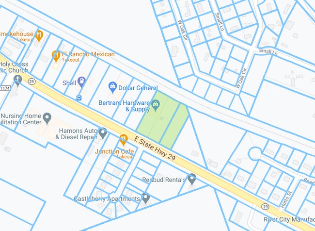
601 E State Highway 29, Bertram, TX 78605

Property Detail
601 E State Highway 29
23357
S5225 HUTTO ADDITION LOT 11A 1.608
Commercialnec
BURNET
B and X Area of moderate flood hazard, usually the area between the limits of the 100-year and 500-year floods.
Texas
2024
11a
2025
1.61 AC
960102
Bertram
5,950 SF
Other Market Areas
NEARBY LISTINGS FOR SALE OR LEASE
-
-
View all Bertram listings for sale on LoopNet.com
DEMOGRAPHICS near 601 E State Highway 29
1 mile
3 mile
5 mile
2025 Total Population
1,807
3,646
6,305
2030 Population
1,997
4,031
7,016
Pop Growth 2025-2030
+ 10.51%
+ 10.56%
+ 11.28%
Average Age
41
41
41
2025 Total Households
642
1,297
2,231
HH Growth 2025-2030
+ 10.44%
+ 10.64%
+ 11.39%
Median Household Inc
$70,178
$71,538
$78,657
Avg Household Size
2.80
2.70
2.80
2025 Avg HH Vehicles
2.00
2.00
2.00
Median Home Value
$266,326
$282,523
$365,550
Median Year Built
2002
2002
2003
Nearby Places
Map Layers
Map Styles
 Street
 Aerial
Transit
 Traffic
 Biking
Places
Listings with unknown addresses are not visible on the map
- Restaurants
- Banks
- Shops
- Fitness
- Groceries
PUBLIC TRANSPORTATION
AIRPORT
Robert Gray AAF
Drive
Walk
Distance
Robert Gray AAF
49 min
34.8 mi
Killeen Municipal
Drive
Walk
Distance
Killeen Municipal
55 min
43.8 mi
Nearby Properties
Address
Land Use
TOTAL SIZE
Lot Size
Zoning
Address
Land Use
TOTAL SIZE
Lot Size
Zoning
88,198 SF
7.81 AC
Address
Land Use
TOTAL SIZE
Lot Size
Zoning
214.12 AC
Address
Land Use
TOTAL SIZE
Lot Size
Zoning
18,403 SF
1.13 AC
Address
Land Use
TOTAL SIZE
Lot Size
Zoning
31,080 SF
15 AC
Address
Land Use
TOTAL SIZE
Lot Size
Zoning
25,500 SF
10.33 AC
Address
Land Use
TOTAL SIZE
Lot Size
Zoning
317.92 AC
Address
Land Use
TOTAL SIZE
Lot Size
Zoning
11,584 SF
4.47 AC
Address
Land Use
TOTAL SIZE
Lot Size
Zoning
29,340 SF
3 AC
Address
Land Use
TOTAL SIZE
Lot Size
Zoning
27,012 SF
3.39 AC
Address
Land Use
TOTAL SIZE
Lot Size
Zoning
4,177 SF
0.50 AC
Address
Land Use
TOTAL SIZE
Lot Size
Zoning
6,185 SF
1.12 AC
Address
Land Use
TOTAL SIZE
Lot Size
Zoning
84,102 SF
10.76 AC
Address
Land Use
TOTAL SIZE
Lot Size
Zoning
20,300 SF
5.03 AC
Address
Land Use
TOTAL SIZE
Lot Size
Zoning
1,064 SF
7 AC
Address
Land Use
TOTAL SIZE
Lot Size
Zoning
6,948 SF
1.40 AC
Address
Land Use
TOTAL SIZE
Lot Size
Zoning
6,000 SF
15.06 AC
Address
Land Use
TOTAL SIZE
Lot Size
Zoning
8,500 SF
0.25 AC
Address
Land Use
TOTAL SIZE
Lot Size
Zoning
8,656 SF
0.33 AC
Address
Land Use
TOTAL SIZE
Lot Size
Zoning
1,075 SF
9.64 AC
Address
Land Use
TOTAL SIZE
Lot Size
Zoning
9,060 SF
1.62 AC
Address
Land Use
TOTAL SIZE
Lot Size
Zoning
5,240 SF
8.56 AC
Address
Land Use
TOTAL SIZE
Lot Size
Zoning
Address
Land Use
TOTAL SIZE
Lot Size
Zoning
784 SF
10.50 AC
Address
Land Use
TOTAL SIZE
Lot Size
Zoning
7,200 SF
5.22 AC
Address
Land Use
TOTAL SIZE
Lot Size
Zoning
25,130 SF
5 AC
Address
Land Use
TOTAL SIZE
Lot Size
Zoning
55.98 AC
Address
Land Use
TOTAL SIZE
Lot Size
Zoning
6,300 SF
0.64 AC
Address
Land Use
TOTAL SIZE
Lot Size
Zoning
3,220 SF
0.33 AC
Address
Land Use
TOTAL SIZE
Lot Size
Zoning
5,453 SF
3.79 AC
The World's #1 Commercial Real Estate Marketplace
Connect with us
© 2026 CoStar Group
The information above has been obtained from sources believed reliable. While we do not doubt its accuracy we have not verified it and make no guarantee, warranty or representation about it. It is your responsibility to independently confirm its accuracy and completeness. Any projections, opinions, assumptions, or estimates used are for example only and do not represent the current or future performance of the property. The value of this transaction to you depends on tax and other factors which should be evaluated by your tax, financial, and legal advisors. You and your advisors should conduct a careful, independent investigation of the property to determine to your satisfaction the suitability of the property for your needs.