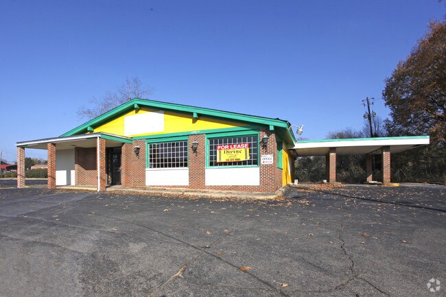
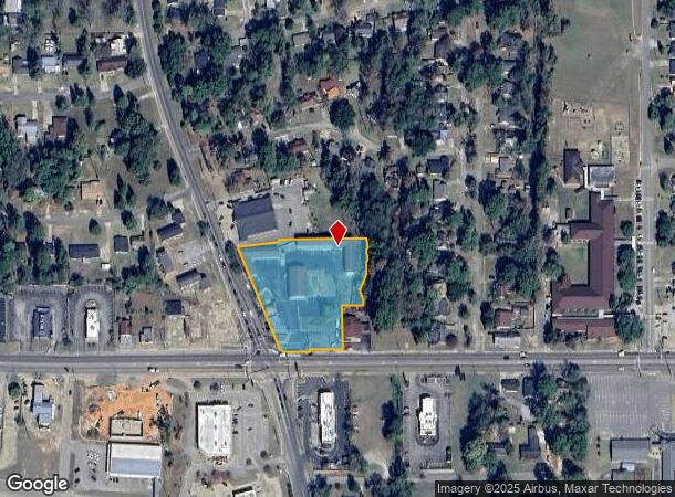
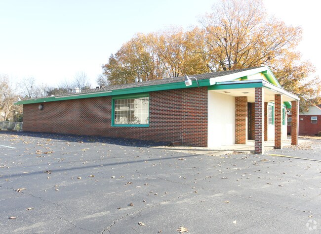
Property Record
601 Highland Ave, Selma, AL 36701
NEARBY LISTINGS FOR SALE OR LEASE
Property Detail
601 Highland Ave
11-06-23-4-007-019.0000
Pt Vacated Alley Edgewood Add
Motel
2.23 AC IN S23-T17N-R10E BEG INT N ROW HIGHLAND AVE & E ROW SUMMERFIELD RD; TH NW ALNG ROW SUMMERFIELD RD 332'; TH LEAVE ROW NE 125.45; N 13.06'; E 267' TO DITCH; TH SLY ALNG DITCH 207'; TH LEAVE DITCH W 64'; S 131.39' TO N ROW HIGHLAND AVE; TH W ALN
X
Dallas
01047C0191E
Alabama
2024
3-6,24
2024
2.23 AC
956300
Other Market Areas
7,910 SF
Selma, AL
DEMOGRAPHICS near 601 Highland Ave
1 Mile
3 Mile
5 Mile
2024 Total Population
5,314
17,862
23,833
2029 Population
4,968
16,861
22,395
Pop Growth 2024-2029
(6.51%)
(5.60%)
(6.03%)
Average Age
39
40
40
2024 Total Households
2,240
7,513
9,967
HH Growth 2024-2029
(6.12%)
(5.07%)
(5.46%)
Median Household Inc
$27,196
$30,150
$32,611
Avg Household Size
2.20
2.30
2.30
2024 Avg HH Vehicles
2.00
2.00
2.00
Median Home Value
$75,119
$84,107
$86,965
Median Year Built
1966
1968
1970
Nearby Places
Map Layers
Map Styles
 Street
 Aerial
- Restaurants
- Banks
- Shops
- Fitness
- Groceries
Nearby Properties
Address
Land Use
TOTAL SIZE
Lot Size
Zoning
Address
Land Use
TOTAL SIZE
Lot Size
Zoning
230,750 SF
7.34 AC
C
Address
Land Use
TOTAL SIZE
Lot Size
Zoning
180,393 SF
19.10 AC
C
Address
Land Use
TOTAL SIZE
Lot Size
Zoning
87,391 SF
2.66 AC
Address
Land Use
TOTAL SIZE
Lot Size
Zoning
27,185 SF
1.96 AC
C
Address
Land Use
TOTAL SIZE
Lot Size
Zoning
42,285 SF
0.53 AC
C
Address
Land Use
TOTAL SIZE
Lot Size
Zoning
112,856 SF
11.02 AC
I
Address
Land Use
TOTAL SIZE
Lot Size
Zoning
44,944 SF
0.17 AC
N
Address
Land Use
TOTAL SIZE
Lot Size
Zoning
18,260 SF
10 AC
N
Address
Land Use
TOTAL SIZE
Lot Size
Zoning
145,338 SF
6.82 AC
C
Address
Land Use
TOTAL SIZE
Lot Size
Zoning
4,814 SF
6 AC
M
Address
Land Use
TOTAL SIZE
Lot Size
Zoning
6,650 SF
10 AC
O
Address
Land Use
TOTAL SIZE
Lot Size
Zoning
64,854 SF
2.31 AC
O
Address
Land Use
TOTAL SIZE
Lot Size
Zoning
6,374 SF
3.18 AC
S
Address
Land Use
TOTAL SIZE
Lot Size
Zoning
62,913 SF
0.92 AC
Address
Land Use
TOTAL SIZE
Lot Size
Zoning
7,788 SF
8 AC
M
Address
Land Use
TOTAL SIZE
Lot Size
Zoning
1,494 SF
12 AC
S
Address
Land Use
TOTAL SIZE
Lot Size
Zoning
7,606 SF
4.80 AC
C
Address
Land Use
TOTAL SIZE
Lot Size
Zoning
53,100 SF
7.15 AC
O
Address
Land Use
TOTAL SIZE
Lot Size
Zoning
34,495 SF
5.68 AC
N
Address
Land Use
TOTAL SIZE
Lot Size
Zoning
8,034 SF
22 AC
S
Address
Land Use
TOTAL SIZE
Lot Size
Zoning
2,941 SF
22.98 AC
C
Address
Land Use
TOTAL SIZE
Lot Size
Zoning
2,608 SF
10 AC
M
Address
Land Use
TOTAL SIZE
Lot Size
Zoning
27,693 SF
1.22 AC
O
Address
Land Use
TOTAL SIZE
Lot Size
Zoning
12,051 SF
1.04 AC
C
Address
Land Use
TOTAL SIZE
Lot Size
Zoning
50,267 SF
5.77 AC
C
Address
Land Use
TOTAL SIZE
Lot Size
Zoning
24,657 SF
4.23 AC
N
Address
Land Use
TOTAL SIZE
Lot Size
Zoning
18,248 SF
16.02 AC
N
Address
Land Use
TOTAL SIZE
Lot Size
Zoning
4,002 SF
10 AC
S
Address
Land Use
TOTAL SIZE
Lot Size
Zoning
74,205 SF
2.50 AC
O
Address
Land Use
TOTAL SIZE
Lot Size
Zoning
8,359 SF
4 AC
C
The World's #1 Commercial Real Estate Marketplace
Connect with us
© 2025 CoStar Group
The information above has been obtained from sources believed reliable. While we do not doubt its accuracy we have not verified it and make no guarantee, warranty or representation about it. It is your responsibility to independently confirm its accuracy and completeness. Any projections, opinions, assumptions, or estimates used are for example only and do not represent the current or future performance of the property. The value of this transaction to you depends on tax and other factors which should be evaluated by your tax, financial, and legal advisors. You and your advisors should conduct a careful, independent investigation of the property to determine to your satisfaction the suitability of the property for your needs.