Property Record
29131 Girod St, New Orleans, LA 70113


This Property Is For Sale
NEARBY LISTINGS FOR SALE OR LEASE
Property Detail
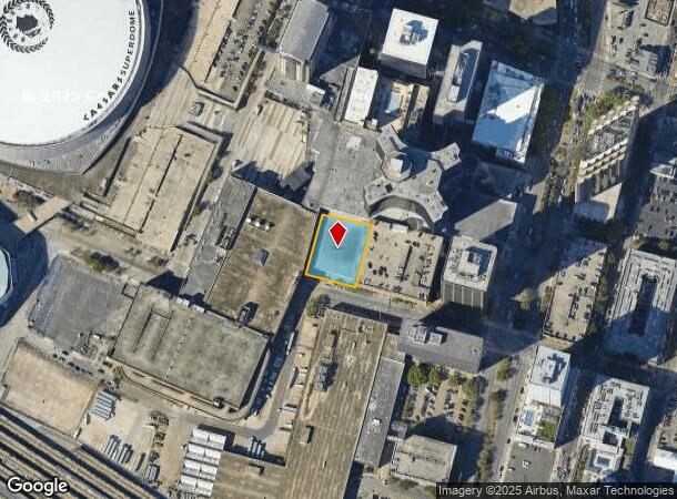
29131 Girod St
1-03-1-059-34
SQ 307A LOT D-2A 159X207
Taxexempt
Orleans
X
Louisiana
22051C0225F
d2a
2024
0.76 AC
2025
New Orleans CBD
014000
New Orleans/Metairie/Kenner
411,408 SF
New Orleans-Metairie, LA
DEMOGRAPHICS near 29131 Girod St
1 Mile
3 Mile
5 Mile
2024 Total Population
22,954
181,540
358,628
2029 Population
23,001
176,305
346,270
Pop Growth 2024-2029
+ 0.20%
(2.88%)
(3.45%)
Average Age
42
41
41
2024 Total Households
13,096
86,617
159,643
HH Growth 2024-2029
+ 0.79%
(2.83%)
(3.47%)
Median Household Inc
$41,426
$51,770
$50,180
Avg Household Size
1.70
1.90
2.10
2024 Avg HH Vehicles
1.00
1.00
1.00
Median Home Value
$405,435
$377,404
$294,208
Median Year Built
1951
1947
1954
Nearby Places
Map Layers
Map Styles
 Street
 Aerial
- Restaurants
- Banks
- Shops
- Fitness
- Groceries
PUBLIC TRANSPORTATION
TRANSIT/SUBWAY
Hyatt Regency Hotel (In) (UPT-Riverfront - NORTA)
DRIVE
WALK
Distance
Hyatt Regency Hotel (In) (UPT-Riverfront - NORTA)
1 min
3 min
0.2 mi
Julia Street Station (O) (UPT-Riverfront - NORTA)
DRIVE
WALK
Distance
Julia Street Station (O) (UPT-Riverfront - NORTA)
0 min
4 min
0.2 mi
Julia Street Station (N) (Rampart-Loyola Streetcar - NORTA, UPT-Riverfront - NORTA)
DRIVE
WALK
Distance
Julia Street Station (N) (Rampart-Loyola Streetcar - NORTA, UPT-Riverfront - NORTA)
1 min
5 min
0.3 mi
Poydras Street Station (N) (UPT-Riverfront - NORTA)
DRIVE
WALK
Distance
Poydras Street Station (N) (UPT-Riverfront - NORTA)
0 min
5 min
0.3 mi
Upt Streetcar Bay 1 (UPT-Riverfront - NORTA)
DRIVE
WALK
Distance
Upt Streetcar Bay 1 (UPT-Riverfront - NORTA)
1 min
8 min
0.4 mi
COMMUTER RAIL
New Orleans Union Passenger Terminal (City of New Orleans - Amtrak, Crescent - Amtrak, Sunset Limited - Amtrak)
DRIVE
WALK
Distance
New Orleans Union Passenger Terminal (City of New Orleans - Amtrak, Crescent - Amtrak, Sunset Limited - Amtrak)
1 min
7 min
0.4 mi
AIRPORT
Louis Armstrong New Orleans International
DRIVE
WALK
Distance
Louis Armstrong New Orleans International
21 min
14.5 mi
Freight Ports
Port of New Orleans
DRIVE
WALK
Distance
Port of New Orleans
10 min
2.8 mi
Nearby Properties
Address
Land Use
TOTAL SIZE
Lot Size
Zoning
Address
Land Use
TOTAL SIZE
Lot Size
Zoning
300 SF
2.19 AC
LS
Address
Land Use
TOTAL SIZE
Lot Size
Zoning
85,052 SF
2.19 AC
LS
Address
Land Use
TOTAL SIZE
Lot Size
Zoning
80.92 AC
EC
Address
Land Use
TOTAL SIZE
Lot Size
Zoning
44.43 AC
CBD-4
Address
Land Use
TOTAL SIZE
Lot Size
Zoning
66.23 AC
CBD-4
Address
Land Use
TOTAL SIZE
Lot Size
Zoning
3.66 AC
MC
Address
Land Use
TOTAL SIZE
Lot Size
Zoning
834,043 SF
1.40 AC
CBD-2
Address
Land Use
TOTAL SIZE
Lot Size
Zoning
18.31 AC
CBD-4
Address
Land Use
TOTAL SIZE
Lot Size
Zoning
1.87 AC
CBD-2
Address
Land Use
TOTAL SIZE
Lot Size
Zoning
6.64 AC
Address
Land Use
TOTAL SIZE
Lot Size
Zoning
844,362 SF
5.85 AC
CBD-4
Address
Land Use
TOTAL SIZE
Lot Size
Zoning
0.12 AC
Address
Land Use
TOTAL SIZE
Lot Size
Zoning
30.63 AC
Address
Land Use
TOTAL SIZE
Lot Size
Zoning
444,121 SF
1.46 AC
CBD-1
Address
Land Use
TOTAL SIZE
Lot Size
Zoning
0.88 AC
CBD-2
Address
Land Use
TOTAL SIZE
Lot Size
Zoning
22.17 AC
Address
Land Use
TOTAL SIZE
Lot Size
Zoning
1.91 AC
CBD-1
Address
Land Use
TOTAL SIZE
Lot Size
Zoning
576,962 SF
3.31 AC
CBD-4
Address
Land Use
TOTAL SIZE
Lot Size
Zoning
1.79 AC
Address
Land Use
TOTAL SIZE
Lot Size
Zoning
609,449 SF
2 AC
EC
Address
Land Use
TOTAL SIZE
Lot Size
Zoning
512,729 SF
6.60 AC
Address
Land Use
TOTAL SIZE
Lot Size
Zoning
1.24 AC
CBD-1
Address
Land Use
TOTAL SIZE
Lot Size
Zoning
190,708 SF
1.09 AC
CBD-2
Address
Land Use
TOTAL SIZE
Lot Size
Zoning
499,287 SF
1.44 AC
VCE
Address
Land Use
TOTAL SIZE
Lot Size
Zoning
0.67 AC
CBD-3
Address
Land Use
TOTAL SIZE
Lot Size
Zoning
202,291 SF
4.04 AC
HU-RD2
Address
Land Use
TOTAL SIZE
Lot Size
Zoning
162,382 SF
1.25 AC
CBD-2
Address
Land Use
TOTAL SIZE
Lot Size
Zoning
258,024 SF
0.63 AC
CBD-2
Address
Land Use
TOTAL SIZE
Lot Size
Zoning
2.94 AC
CBD-1
Address
Land Use
TOTAL SIZE
Lot Size
Zoning
3.36 AC
EC
The World's #1 Commercial Real Estate Marketplace
Connect with us
© 2025 CoStar Group
The information above has been obtained from sources believed reliable. While we do not doubt its accuracy we have not verified it and make no guarantee, warranty or representation about it. It is your responsibility to independently confirm its accuracy and completeness. Any projections, opinions, assumptions, or estimates used are for example only and do not represent the current or future performance of the property. The value of this transaction to you depends on tax and other factors which should be evaluated by your tax, financial, and legal advisors. You and your advisors should conduct a careful, independent investigation of the property to determine to your satisfaction the suitability of the property for your needs.