Property Record
601 Manning Rd E, Accokeek, MD 20607


Property Detail
601 Manning Rd E
Washington-Arlington-Alexandria, DC-VA-MD-WV
(FINAL W/CHANGE 7/1/02)
05-3439007
Prince Georges
Commercialnec
Maryland
RR
3
B and X Area of moderate flood hazard, usually the area between the limits of the 100-year and 500-year floods.
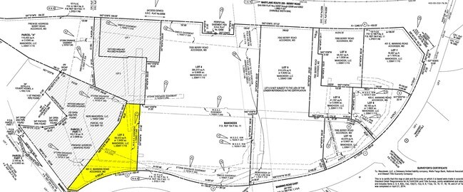
1.34 AC
2024
NatHbr/OxnHill/FtWash
2025
Washington, DC
801310
NEARBY LISTINGS FOR SALE OR LEASE
DEMOGRAPHICS near 601 Manning Rd E
1 mile
3 mile
5 mile
2025 Total Population
3,154
21,202
75,521
2030 Population
3,262
21,819
77,777
Pop Growth 2025-2030
+ 3.42%
+ 2.91%
+ 2.99%
Average Age
44
42
41
2025 Total Households
1,082
6,892
25,242
HH Growth 2025-2030
+ 3.51%
+ 2.95%
+ 3.02%
Median Household Inc
$142,847
$139,417
$139,067
Avg Household Size
2.90
3.00
3.00
2025 Avg HH Vehicles
3.00
3.00
2.00
Median Home Value
$609,854
$498,741
$478,731
Median Year Built
1995
1993
1991
Nearby Places
Map Layers
Map Styles
 Street
 Aerial
Layers
 Traffic
 Biking
Places
Listings with unknown addresses are not visible on the map
- Restaurants
- Banks
- Shops
- Fitness
- Groceries
PUBLIC TRANSPORTATION
AIRPORT
Ronald Reagan Washington Ntl
Drive
Walk
Distance
Ronald Reagan Washington Ntl
36 min
19.0 mi
Washington Dulles International
Drive
Walk
Distance
Washington Dulles International
70 min
45.7 mi
Freight Ports
Port of Baltimore
Drive
Walk
Distance
Port of Baltimore
80 min
52.8 mi
SALE & LEASE HISTORY
LISTING DATE
SALE/LEASE

Sep 24, 2016
For Sale
Nearby Properties
Address
Land Use
TOTAL SIZE
Lot Size
Zoning
Address
Land Use
TOTAL SIZE
Lot Size
Zoning
311,000 SF
79.06 AC
WCD
Address
Land Use
TOTAL SIZE
Lot Size
Zoning
134,542 SF
51.88 AC
WCD
Address
Land Use
TOTAL SIZE
Lot Size
Zoning
87,100 SF
22.22 AC
WCD
Address
Land Use
TOTAL SIZE
Lot Size
Zoning
79,219 SF
8.84 AC
CN
Address
Land Use
TOTAL SIZE
Lot Size
Zoning
114,696 SF
166.36 AC
ROS
Address
Land Use
TOTAL SIZE
Lot Size
Zoning
90,543 SF
2.99 AC
CS
Address
Land Use
TOTAL SIZE
Lot Size
Zoning
139,952 SF
19.27 AC
AR
Address
Land Use
TOTAL SIZE
Lot Size
Zoning
51,123 SF
6.20 AC
CGO
Address
Land Use
TOTAL SIZE
Lot Size
Zoning
151.11 AC
ROS
Address
Land Use
TOTAL SIZE
Lot Size
Zoning
85.40 AC
ROS
Address
Land Use
TOTAL SIZE
Lot Size
Zoning
80.78 AC
ROS
Address
Land Use
TOTAL SIZE
Lot Size
Zoning
9,420 SF
4.59 AC
AG
Address
Land Use
TOTAL SIZE
Lot Size
Zoning
3,162 SF
1.77 AC
CN
Address
Land Use
TOTAL SIZE
Lot Size
Zoning
99.65 AC
RE
Address
Land Use
TOTAL SIZE
Lot Size
Zoning
40,133 SF
3.30 AC
IE
Address
Land Use
TOTAL SIZE
Lot Size
Zoning
3,526 SF
1.23 AC
CGO
Address
Land Use
TOTAL SIZE
Lot Size
Zoning
13,986 SF
0.38 AC
RR
Address
Land Use
TOTAL SIZE
Lot Size
Zoning
57.39 AC
RE
Address
Land Use
TOTAL SIZE
Lot Size
Zoning
3,120 SF
2.21 AC
CS
Address
Land Use
TOTAL SIZE
Lot Size
Zoning
3,381 SF
0.98 AC
CGO
Address
Land Use
TOTAL SIZE
Lot Size
Zoning
18,280 SF
5 AC
WCD
Address
Land Use
TOTAL SIZE
Lot Size
Zoning
3,552 SF
1.23 AC
CN
Address
Land Use
TOTAL SIZE
Lot Size
Zoning
8,200 SF
0.96 AC
CN
Address
Land Use
TOTAL SIZE
Lot Size
Zoning
2,511 SF
1.29 AC
CN
Address
Land Use
TOTAL SIZE
Lot Size
Zoning
1,822 SF
121.48 AC
RE
Address
Land Use
TOTAL SIZE
Lot Size
Zoning
3,060 SF
1.06 AC
CN
Address
Land Use
TOTAL SIZE
Lot Size
Zoning
6,205 SF
50.83 AC
AG
Address
Land Use
TOTAL SIZE
Lot Size
Zoning
11,303 SF
4.77 AC
RR
Address
Land Use
TOTAL SIZE
Lot Size
Zoning
13.26 AC
RMF48
The World's #1 Commercial Real Estate Marketplace
Connect with us
© 2026 CoStar Group
The information above has been obtained from sources believed reliable. While we do not doubt its accuracy we have not verified it and make no guarantee, warranty or representation about it. It is your responsibility to independently confirm its accuracy and completeness. Any projections, opinions, assumptions, or estimates used are for example only and do not represent the current or future performance of the property. The value of this transaction to you depends on tax and other factors which should be evaluated by your tax, financial, and legal advisors. You and your advisors should conduct a careful, independent investigation of the property to determine to your satisfaction the suitability of the property for your needs.