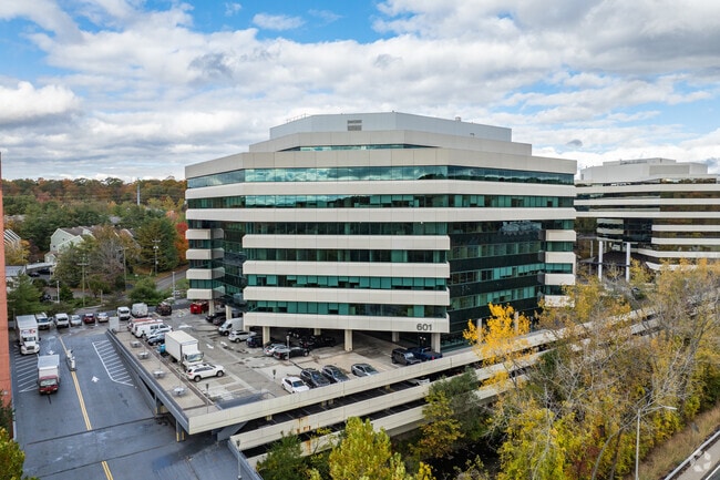
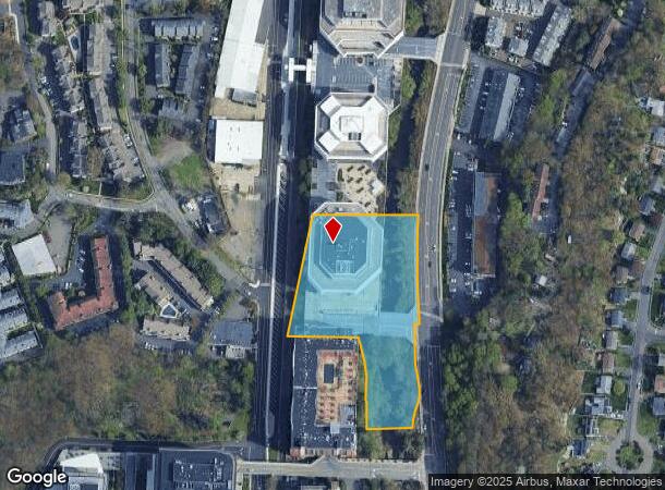
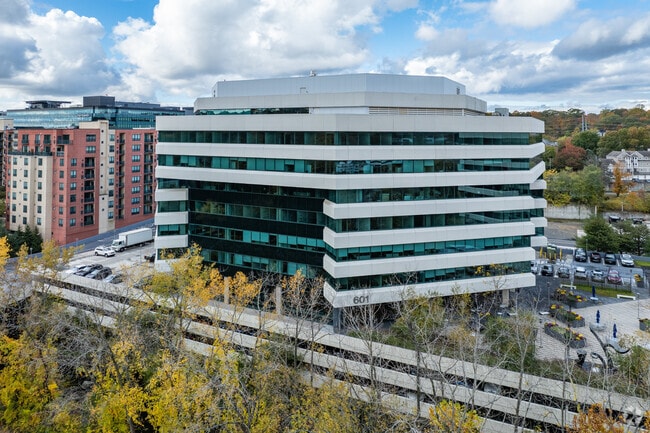
Property Record
601 Merritt 7, Norwalk, CT 06851
NEARBY LISTINGS FOR SALE OR LEASE
Property Detail
601 Merritt 7
NORW-000005-000037-000033
Fairfield
Commercialbuilding
Connecticut
AE
33
09001C0393G
3.09 AC
2025
Norwalk
2025
Westchester/So Connecticut
042700
Bridgeport-Stamford-Danbury, CT
249,779 SF
DEMOGRAPHICS near 601 Merritt 7
1 Mile
3 Mile
5 Mile
2024 Total Population
7,257
68,546
145,210
2029 Population
7,286
68,540
145,396
Pop Growth 2024-2029
+ 0.40%
(0.01%)
+ 0.13%
Average Age
41
41
40
2024 Total Households
3,228
26,698
54,334
HH Growth 2024-2029
+ 0.40%
(0.01%)
+ 0.10%
Median Household Inc
$117,826
$108,203
$120,387
Avg Household Size
2.10
2.50
2.60
2024 Avg HH Vehicles
2.00
2.00
2.00
Median Home Value
$452,744
$524,973
$711,128
Median Year Built
1980
1968
1966
Nearby Places
Map Layers
Map Styles
 Street
 Aerial
- Restaurants
- Banks
- Shops
- Fitness
- Groceries
PUBLIC TRANSPORTATION
COMMUTER RAIL
Merritt 7 Station (New Haven Line - Metro-North Commuter Railroad Company (Metro-North))
DRIVE
WALK
Distance
Merritt 7 Station (New Haven Line - Metro-North Commuter Railroad Company (Metro-North))
1 min
1 min
0.0 mi
East Norwalk Station (New Haven Line - Metro-North Commuter Railroad Company (Metro-North))
DRIVE
WALK
Distance
East Norwalk Station (New Haven Line - Metro-North Commuter Railroad Company (Metro-North))
7 min
3.6 mi
AIRPORT
Westchester County
DRIVE
WALK
Distance
Westchester County
40 min
24.1 mi
Tweed/New Haven
DRIVE
WALK
Distance
Tweed/New Haven
59 min
37.4 mi
Freight Ports
NY - Red Hook Container Terminal
DRIVE
WALK
Distance
NY - Red Hook Container Terminal
78 min
52.6 mi
SALE & LEASE HISTORY
LISTING DATE
SALE/LEASE

Sep 24, 2016
For Lease
Feb 16, 2017
For Lease
Nearby Properties
Address
Land Use
TOTAL SIZE
Lot Size
Zoning
Address
Land Use
TOTAL SIZE
Lot Size
Zoning
4.49 AC
CBDB
Address
Land Use
TOTAL SIZE
Lot Size
Zoning
749,988 SF
4.52 AC
CBDB
Address
Land Use
TOTAL SIZE
Lot Size
Zoning
339,272 SF
4.07 AC
EO
Address
Land Use
TOTAL SIZE
Lot Size
Zoning
6.80 AC
B2
Address
Land Use
TOTAL SIZE
Lot Size
Zoning
226,920 SF
24.75 AC
B
Address
Land Use
TOTAL SIZE
Lot Size
Zoning
28.64 AC
DE-10
Address
Land Use
TOTAL SIZE
Lot Size
Zoning
4.44 AC
CBDB
Address
Land Use
TOTAL SIZE
Lot Size
Zoning
248,486 SF
6.57 AC
EO
Address
Land Use
TOTAL SIZE
Lot Size
Zoning
292,852 SF
3.38 AC
EO
Address
Land Use
TOTAL SIZE
Lot Size
Zoning
254,126 SF
3.33 AC
EO
Address
Land Use
TOTAL SIZE
Lot Size
Zoning
320,588 SF
3.22 AC
EO
Address
Land Use
TOTAL SIZE
Lot Size
Zoning
254,126 SF
3.06 AC
EO
Address
Land Use
TOTAL SIZE
Lot Size
Zoning
252,316 SF
Address
Land Use
TOTAL SIZE
Lot Size
Zoning
271,344 SF
2.36 AC
EO
Address
Land Use
TOTAL SIZE
Lot Size
Zoning
196,084 SF
4.34 AC
DE-5
Address
Land Use
TOTAL SIZE
Lot Size
Zoning
21.34 AC
B2
Address
Land Use
TOTAL SIZE
Lot Size
Zoning
13.46 AC
RB
Address
Land Use
TOTAL SIZE
Lot Size
Zoning
24.67 AC
DE-10
Address
Land Use
TOTAL SIZE
Lot Size
Zoning
12.32 AC
CRA-1
Address
Land Use
TOTAL SIZE
Lot Size
Zoning
41.63 AC
A2
Address
Land Use
TOTAL SIZE
Lot Size
Zoning
29.26 AC
PRO
Address
Land Use
TOTAL SIZE
Lot Size
Zoning
175,791 SF
1.58 AC
CBDB
Address
Land Use
TOTAL SIZE
Lot Size
Zoning
9.12 AC
950
Address
Land Use
TOTAL SIZE
Lot Size
Zoning
34.16 AC
R-2
Address
Land Use
TOTAL SIZE
Lot Size
Zoning
165,384 SF
18.78 AC
B
Address
Land Use
TOTAL SIZE
Lot Size
Zoning
4.79 AC
EO
Address
Land Use
TOTAL SIZE
Lot Size
Zoning
248,782 SF
3.52 AC
EO
Address
Land Use
TOTAL SIZE
Lot Size
Zoning
119,531 SF
17.92 AC
D
Address
Land Use
TOTAL SIZE
Lot Size
Zoning
10.64 AC
HODD
Address
Land Use
TOTAL SIZE
Lot Size
Zoning
74,233 SF
4.26 AC
A2
The World's #1 Commercial Real Estate Marketplace
Connect with us
© 2026 CoStar Group
The information above has been obtained from sources believed reliable. While we do not doubt its accuracy we have not verified it and make no guarantee, warranty or representation about it. It is your responsibility to independently confirm its accuracy and completeness. Any projections, opinions, assumptions, or estimates used are for example only and do not represent the current or future performance of the property. The value of this transaction to you depends on tax and other factors which should be evaluated by your tax, financial, and legal advisors. You and your advisors should conduct a careful, independent investigation of the property to determine to your satisfaction the suitability of the property for your needs.