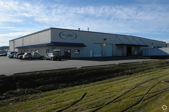
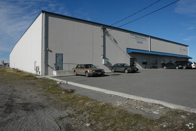
Property Record
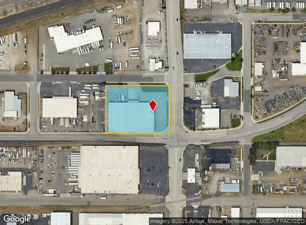
601 N Freya St, Spokane, WA 99202
NEARBY LISTINGS FOR SALE OR LEASE
Property Detail
601 N Freya St
Spokane-Spokane Valley, WA
East Side Syndicate
35153.0501
EAST SIDE SYNDICATE LTS 1TO12 BLK 49 & E37.5FT VAC FERRALL ST W OF & ADJ TO LTS L6&7
Wholesaleoutletdiscountstore
Spokane
X
Washington
53063C0561D
1t
2025
1.94 AC
2025
SE North Metro
014500
Spokane
41,380 SF
DEMOGRAPHICS near 601 N Freya St
1 Mile
3 Mile
5 Mile
2024 Total Population
5,250
96,550
245,336
2029 Population
5,571
102,886
261,050
Pop Growth 2024-2029
+ 6.11%
+ 6.56%
+ 6.41%
Average Age
37
39
40
2024 Total Households
2,008
38,317
102,783
HH Growth 2024-2029
+ 6.18%
+ 6.89%
+ 6.68%
Median Household Inc
$53,089
$56,257
$58,224
Avg Household Size
2.40
2.30
2.30
2024 Avg HH Vehicles
2.00
2.00
2.00
Median Home Value
$222,307
$286,081
$315,203
Median Year Built
1954
1964
1965
Nearby Places
Map Layers
Map Styles
 Street
 Aerial
- Restaurants
- Banks
- Shops
- Fitness
- Groceries
PUBLIC TRANSPORTATION
COMMUTER RAIL
Spokane (Empire Builder - Amtrak)
DRIVE
WALK
Distance
Spokane (Empire Builder - Amtrak)
7 min
3.6 mi
AIRPORT
Spokane International
DRIVE
WALK
Distance
Spokane International
14 min
9.4 mi
Freight Ports
Port of Everett
DRIVE
WALK
Distance
Port of Everett
342 min
305.0 mi
Nearby Properties
Address
Land Use
TOTAL SIZE
Lot Size
Zoning
Address
Land Use
TOTAL SIZE
Lot Size
Zoning
763,627 SF
12.44 AC
OR
Address
Land Use
TOTAL SIZE
Lot Size
Zoning
481,348 SF
17.09 AC
DTU
Address
Land Use
TOTAL SIZE
Lot Size
Zoning
629,722 SF
26.28 AC
RHD
Address
Land Use
TOTAL SIZE
Lot Size
Zoning
917,113 SF
100.67 AC
LI
Address
Land Use
TOTAL SIZE
Lot Size
Zoning
157,882 SF
42.70 AC
DTG
Address
Land Use
TOTAL SIZE
Lot Size
Zoning
123,047 SF
3.95 AC
DTG
Address
Land Use
TOTAL SIZE
Lot Size
Zoning
536,438 SF
1.70 AC
DTC
Address
Land Use
TOTAL SIZE
Lot Size
Zoning
365,804 SF
16.13 AC
RSF
Address
Land Use
TOTAL SIZE
Lot Size
Zoning
427,054 SF
16.60 AC
LI
Address
Land Use
TOTAL SIZE
Lot Size
Zoning
386,885 SF
22.81 AC
RSF
Address
Land Use
TOTAL SIZE
Lot Size
Zoning
251,542 SF
5.78 AC
DTG
Address
Land Use
TOTAL SIZE
Lot Size
Zoning
310,606 SF
27.56 AC
RMF
Address
Land Use
TOTAL SIZE
Lot Size
Zoning
180,822 SF
16.11 AC
CC1
Address
Land Use
TOTAL SIZE
Lot Size
Zoning
379,678 SF
20.64 AC
LI
Address
Land Use
TOTAL SIZE
Lot Size
Zoning
151,667 SF
7.45 AC
DTG
Address
Land Use
TOTAL SIZE
Lot Size
Zoning
112,634 SF
3.87 AC
OR
Address
Land Use
TOTAL SIZE
Lot Size
Zoning
137,503 SF
17.31 AC
GC
Address
Land Use
TOTAL SIZE
Lot Size
Zoning
290,380 SF
2.11 AC
CA3
Address
Land Use
TOTAL SIZE
Lot Size
Zoning
182,088 SF
0.37 AC
DTC
Address
Land Use
TOTAL SIZE
Lot Size
Zoning
107,240 SF
1.54 AC
CC1
Address
Land Use
TOTAL SIZE
Lot Size
Zoning
53,748 SF
1.26 AC
DTC
Address
Land Use
TOTAL SIZE
Lot Size
Zoning
289,573 SF
7.73 AC
RMF
Address
Land Use
TOTAL SIZE
Lot Size
Zoning
124,249 SF
15.45 AC
RHD
Address
Land Use
TOTAL SIZE
Lot Size
Zoning
67,831 SF
6.90 AC
DTG
Address
Land Use
TOTAL SIZE
Lot Size
Zoning
91,310 SF
2.34 AC
Address
Land Use
TOTAL SIZE
Lot Size
Zoning
108,237 SF
3.48 AC
LI
Address
Land Use
TOTAL SIZE
Lot Size
Zoning
58,522 SF
19.91 AC
HI
Address
Land Use
TOTAL SIZE
Lot Size
Zoning
91,048 SF
3.81 AC
OR
Address
Land Use
TOTAL SIZE
Lot Size
Zoning
127,826 SF
0.33 AC
DTG
Address
Land Use
TOTAL SIZE
Lot Size
Zoning
138,840 SF
2.79 AC
DTU
The World's #1 Commercial Real Estate Marketplace
Connect with us
© 2025 CoStar Group
The information above has been obtained from sources believed reliable. While we do not doubt its accuracy we have not verified it and make no guarantee, warranty or representation about it. It is your responsibility to independently confirm its accuracy and completeness. Any projections, opinions, assumptions, or estimates used are for example only and do not represent the current or future performance of the property. The value of this transaction to you depends on tax and other factors which should be evaluated by your tax, financial, and legal advisors. You and your advisors should conduct a careful, independent investigation of the property to determine to your satisfaction the suitability of the property for your needs.