Property Record
601 Ne 10Th St, Pompano Beach, FL 33060


Save to a Folder
{{folder.Name}}
{{folder.ListingIds.length}} Properties
{{folder.ListingIds.length}} Property
Create a New Folder
Property Detail
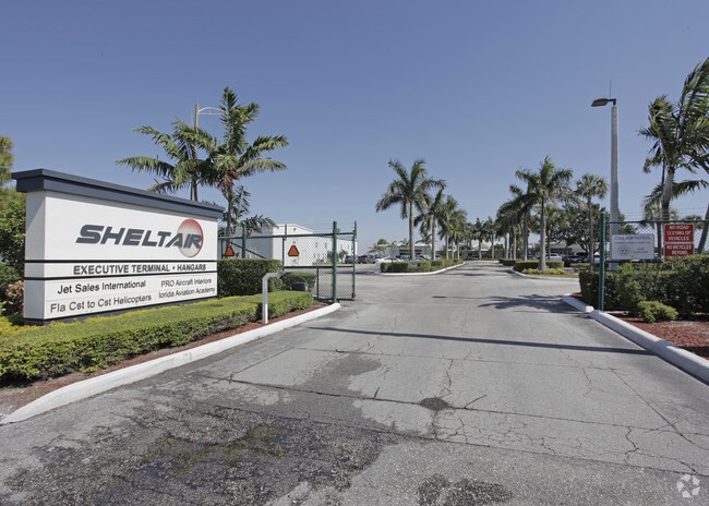
601 Ne 10Th St
48-42-36-25-0010
POMPANO BEACH AIR PARK FBO PHASE 1 171-189 B PARCEL A
Municipalproperty
BROWARD
T
Florida
AH Areas with a 1% annual chance of shallow flooding, usually in the form of a pond, withan average depth ranging from 1 to 3 feet. These areas have a 26% chance of flooding over the life of a 30-year mortgage.
137.82 AC
0
Pompano Beach
2026
South Florida
030202
Fort Lauderdale-Pompano Beach-Sunrise, FL
561,250 SF
NEARBY LISTINGS FOR SALE OR LEASE
DEMOGRAPHICS near 601 Ne 10Th St
1 mile
3 mile
5 mile
2025 Total Population
9,727
123,998
284,818
2030 Population
10,571
133,570
307,143
Pop Growth 2025-2030
+ 8.68%
+ 7.72%
+ 7.84%
Average Age
45
45
46
2025 Total Households
4,525
54,366
128,624
HH Growth 2025-2030
+ 8.18%
+ 7.98%
+ 8.11%
Median Household Inc
$64,556
$73,542
$68,898
Avg Household Size
2.10
2.20
2.10
2025 Avg HH Vehicles
1.00
2.00
1.00
Median Home Value
$582,789
$541,736
$442,574
Median Year Built
1969
1972
1974
Nearby Places
Map Layers
Map Styles
 Street
 Aerial
Layers
 Traffic
 Biking
Places
Listings with unknown addresses are not visible on the map
- Restaurants
- Banks
- Shops
- Fitness
- Groceries
PUBLIC TRANSPORTATION
COMMUTER RAIL
Pompano Beach (Tri-County Commuter - South Florida Regional Transportation Authority (Tri-Rail))
Drive
Walk
Distance
Pompano Beach (Tri-County Commuter - South Florida Regional Transportation Authority (Tri-Rail))
12 min
4.7 mi
Cypress Creek (Tri-County Commuter - South Florida Regional Transportation Authority (Tri-Rail))
Drive
Walk
Distance
Cypress Creek (Tri-County Commuter - South Florida Regional Transportation Authority (Tri-Rail))
11 min
4.9 mi
AIRPORT
Fort Lauderdale/Hollywood International
Drive
Walk
Distance
Fort Lauderdale/Hollywood International
26 min
16.2 mi
Freight Ports
Port Everglades
Drive
Walk
Distance
Port Everglades
25 min
14.9 mi
SALE & LEASE HISTORY
LISTING DATE
SALE/LEASE

Sep 25, 2016
For Lease
Mar 31, 2021
For Lease
Nearby Properties
Address
Land Use
TOTAL SIZE
Lot Size
Zoning
Address
Land Use
TOTAL SIZE
Lot Size
Zoning
1,030,211 SF
7.57 AC
RMH-60
Address
Land Use
TOTAL SIZE
Lot Size
Zoning
1,724,503 SF
64.97 AC
LAC
Address
Land Use
TOTAL SIZE
Lot Size
Zoning
696,020 SF
31.74 AC
OPC
Address
Land Use
TOTAL SIZE
Lot Size
Zoning
467,722 SF
36.71 AC
I-1
Address
Land Use
TOTAL SIZE
Lot Size
Zoning
489,065 SF
3.92 AC
PD-I
Address
Land Use
TOTAL SIZE
Lot Size
Zoning
513,748 SF
2.99 AC
TO-EOD
Address
Land Use
TOTAL SIZE
Lot Size
Zoning
667,120 SF
12.75 AC
PCD
Address
Land Use
TOTAL SIZE
Lot Size
Zoning
161,512 SF
16.39 AC
RPC
Address
Land Use
TOTAL SIZE
Lot Size
Zoning
457,033 SF
1.96 AC
TO-EOD
Address
Land Use
TOTAL SIZE
Lot Size
Zoning
380,866 SF
26.23 AC
O-IP/PCD
Address
Land Use
TOTAL SIZE
Lot Size
Zoning
470,786 SF
1.58 AC
B-1
Address
Land Use
TOTAL SIZE
Lot Size
Zoning
396,092 SF
1.81 AC
TO-DPOD
Address
Land Use
TOTAL SIZE
Lot Size
Zoning
256,158 SF
13.06 AC
RMH-60
Address
Land Use
TOTAL SIZE
Lot Size
Zoning
406,839 SF
1.61 AC
RPUD
Address
Land Use
TOTAL SIZE
Lot Size
Zoning
434,859 SF
38.72 AC
CF
Address
Land Use
TOTAL SIZE
Lot Size
Zoning
399,854 SF
1.60 AC
TO-EOD
Address
Land Use
TOTAL SIZE
Lot Size
Zoning
769,391 SF
51.52 AC
I-1
Address
Land Use
TOTAL SIZE
Lot Size
Zoning
192,214 SF
10.84 AC
B-3/PCD
Address
Land Use
TOTAL SIZE
Lot Size
Zoning
411,173 SF
4.21 AC
B-3
Address
Land Use
TOTAL SIZE
Lot Size
Zoning
374,776 SF
23.52 AC
I-1
Address
Land Use
TOTAL SIZE
Lot Size
Zoning
10,315 SF
37.74 AC
PCD
Address
Land Use
TOTAL SIZE
Lot Size
Zoning
418,713 SF
3.61 AC
B-1
Address
Land Use
TOTAL SIZE
Lot Size
Zoning
252,340 SF
18.36 AC
B-3
Address
Land Use
TOTAL SIZE
Lot Size
Zoning
304,201 SF
1.24 AC
TO-EOD
Address
Land Use
TOTAL SIZE
Lot Size
Zoning
210,299 SF
15.19 AC
B-3/PCD
Address
Land Use
TOTAL SIZE
Lot Size
Zoning
248,274 SF
13.10 AC
RM-20
Address
Land Use
TOTAL SIZE
Lot Size
Zoning
174,856 SF
5.44 AC
RMH-60
Address
Land Use
TOTAL SIZE
Lot Size
Zoning
171,306 SF
0.81 AC
TO-EOD
Address
Land Use
TOTAL SIZE
Lot Size
Zoning
389,735 SF
28.12 AC
CF
The World's #1 Commercial Real Estate Marketplace
Connect with us
© 2026 CoStar Group
The information above has been obtained from sources believed reliable. While we do not doubt its accuracy we have not verified it and make no guarantee, warranty or representation about it. It is your responsibility to independently confirm its accuracy and completeness. Any projections, opinions, assumptions, or estimates used are for example only and do not represent the current or future performance of the property. The value of this transaction to you depends on tax and other factors which should be evaluated by your tax, financial, and legal advisors. You and your advisors should conduct a careful, independent investigation of the property to determine to your satisfaction the suitability of the property for your needs.