Property Record
601 Shamburger Ln, Little Rock, AR 72206


NEARBY LISTINGS FOR SALE OR LEASE
Property Detail
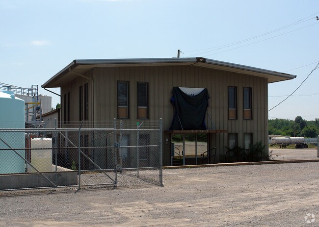
601 Shamburger Ln
34R-035-00-002-00
PT W1/2 NW NE BEG 326 95S OF NW COR E 659 8 S328 2W660 6 N326 95 TO BEG 35 1N 12W
Officebuilding
Pulaski
X
Arkansas
05119C0470G
4.71 AC
2025
Outlying Pulaski County
2025
Little Rock/N Little Rock
004001
Little Rock-North Little Rock-Conway, AR
2,464 SF
DEMOGRAPHICS near 601 Shamburger Ln
1 Mile
3 Mile
5 Mile
2024 Total Population
139
5,435
50,738
2029 Population
142
5,536
51,690
Pop Growth 2024-2029
+ 2.16%
+ 1.86%
+ 1.88%
Average Age
43
42
38
2024 Total Households
55
2,187
20,950
HH Growth 2024-2029
+ 1.82%
+ 1.92%
+ 2.00%
Median Household Inc
$44,999
$36,760
$35,800
Avg Household Size
2.40
2.40
2.20
2024 Avg HH Vehicles
2.00
1.00
1.00
Median Home Value
$120,833
$96,964
$95,158
Median Year Built
1981
1978
1969
Nearby Places
Map Layers
Map Styles
 Street
 Aerial
- Restaurants
- Banks
- Shops
- Fitness
- Groceries
PUBLIC TRANSPORTATION
COMMUTER RAIL
DRIVE
WALK
Distance
10 min
6.9 mi
AIRPORT
Bill and Hillary Clinton Ntl/Adams Field
DRIVE
WALK
Distance
Bill and Hillary Clinton Ntl/Adams Field
10 min
6.5 mi
Nearby Properties
Address
Land Use
TOTAL SIZE
Lot Size
Zoning
Address
Land Use
TOTAL SIZE
Lot Size
Zoning
50,433 SF
22.23 AC
Address
Land Use
TOTAL SIZE
Lot Size
Zoning
57,648 SF
389.29 AC
Address
Land Use
TOTAL SIZE
Lot Size
Zoning
35,069 SF
43.11 AC
Address
Land Use
TOTAL SIZE
Lot Size
Zoning
59,076 SF
22.27 AC
Address
Land Use
TOTAL SIZE
Lot Size
Zoning
345,000 SF
13.21 AC
Address
Land Use
TOTAL SIZE
Lot Size
Zoning
1,233 SF
6.19 AC
Address
Land Use
TOTAL SIZE
Lot Size
Zoning
70,281 SF
20.36 AC
Address
Land Use
TOTAL SIZE
Lot Size
Zoning
14,367 SF
1,257.41 AC
Address
Land Use
TOTAL SIZE
Lot Size
Zoning
Address
Land Use
TOTAL SIZE
Lot Size
Zoning
2,740 SF
2.07 AC
Address
Land Use
TOTAL SIZE
Lot Size
Zoning
25,177 SF
Address
Land Use
TOTAL SIZE
Lot Size
Zoning
2,046 SF
6.09 AC
Address
Land Use
TOTAL SIZE
Lot Size
Zoning
108,000 SF
7.46 AC
Address
Land Use
TOTAL SIZE
Lot Size
Zoning
137,159 SF
6.79 AC
Address
Land Use
TOTAL SIZE
Lot Size
Zoning
5,920 SF
4.69 AC
Address
Land Use
TOTAL SIZE
Lot Size
Zoning
10,175 SF
4.48 AC
Address
Land Use
TOTAL SIZE
Lot Size
Zoning
200,000 SF
7.90 AC
Address
Land Use
TOTAL SIZE
Lot Size
Zoning
22,908 SF
9.80 AC
Address
Land Use
TOTAL SIZE
Lot Size
Zoning
32,700 SF
9.90 AC
Address
Land Use
TOTAL SIZE
Lot Size
Zoning
28,889 SF
1.65 AC
Address
Land Use
TOTAL SIZE
Lot Size
Zoning
6,960 SF
2.18 AC
Address
Land Use
TOTAL SIZE
Lot Size
Zoning
9,235 SF
10.93 AC
Address
Land Use
TOTAL SIZE
Lot Size
Zoning
63,923 SF
10.49 AC
Address
Land Use
TOTAL SIZE
Lot Size
Zoning
37,703 SF
6.79 AC
Address
Land Use
TOTAL SIZE
Lot Size
Zoning
104,000 SF
14.13 AC
Address
Land Use
TOTAL SIZE
Lot Size
Zoning
23,948 SF
10.73 AC
Address
Land Use
TOTAL SIZE
Lot Size
Zoning
10 SF
7.70 AC
Address
Land Use
TOTAL SIZE
Lot Size
Zoning
110,003 SF
18.40 AC
Address
Land Use
TOTAL SIZE
Lot Size
Zoning
104,000 SF
9.18 AC
Address
Land Use
TOTAL SIZE
Lot Size
Zoning
4,487 SF
39.87 AC
The World's #1 Commercial Real Estate Marketplace
Connect with us
© 2026 CoStar Group
The information above has been obtained from sources believed reliable. While we do not doubt its accuracy we have not verified it and make no guarantee, warranty or representation about it. It is your responsibility to independently confirm its accuracy and completeness. Any projections, opinions, assumptions, or estimates used are for example only and do not represent the current or future performance of the property. The value of this transaction to you depends on tax and other factors which should be evaluated by your tax, financial, and legal advisors. You and your advisors should conduct a careful, independent investigation of the property to determine to your satisfaction the suitability of the property for your needs.