Property Record
601 Skyline Dr, New Smyrna Beach, FL 32168


NEARBY LISTINGS FOR SALE OR LEASE
-
-
View all New Smyrna Beach listings for sale on LoopNet.com
Property Detail
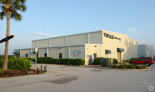
601 Skyline Dr
Deltona-Daytona Beach-Ormond Beach, FL
Inc In Smyrna Estate
7438-11-00-0010
38-17-34 LOT 4 & LOT 5 EXC N 210 FT OF S 849 FT OF E 210 FT W OF HWY & EXC PART & EXC LOTS 3 THRU 17 INC IN SMYRNA ESTATES & EXC PART LYING E OF HWY & S OF S/L OF LOT 2 SMYRNA ESTATES EXT & EXC S 986.6 FT OF N 3729.08 FT MEAS FROM NE CORNER TODD GRAN
Municipalproperty
Volusia
AE
Florida
12127C0540J
4,5
2025
2.32 AC
2026
South Beach Cities
082903
Deltona/Daytona Beach
75,166 SF
DEMOGRAPHICS near 601 Skyline Dr
1 Mile
3 Mile
5 Mile
2024 Total Population
1,487
22,191
56,945
2029 Population
1,651
25,028
64,177
Pop Growth 2024-2029
+ 11.03%
+ 12.78%
+ 12.70%
Average Age
52
53
50
2024 Total Households
749
10,929
26,191
HH Growth 2024-2029
+ 11.35%
+ 13.07%
+ 13.10%
Median Household Inc
$58,853
$61,764
$65,033
Avg Household Size
1.90
2.00
2.10
2024 Avg HH Vehicles
2.00
2.00
2.00
Median Home Value
$268,529
$319,512
$305,478
Median Year Built
1984
1984
1985
Nearby Places
Map Layers
Map Styles
 Street
 Aerial
- Restaurants
- Banks
- Shops
- Fitness
- Groceries
PUBLIC TRANSPORTATION
AIRPORT
Daytona Beach International
DRIVE
WALK
Distance
Daytona Beach International
25 min
14.5 mi
Orlando Sanford International
DRIVE
WALK
Distance
Orlando Sanford International
52 min
34.4 mi
Freight Ports
Port Canaveral
DRIVE
WALK
Distance
Port Canaveral
78 min
63.1 mi
Nearby Properties
Address
Land Use
TOTAL SIZE
Lot Size
Zoning
Address
Land Use
TOTAL SIZE
Lot Size
Zoning
177,619 SF
6.91 AC
10R2
Address
Land Use
TOTAL SIZE
Lot Size
Zoning
108,577 SF
20 AC
10R2
Address
Land Use
TOTAL SIZE
Lot Size
Zoning
Address
Land Use
TOTAL SIZE
Lot Size
Zoning
115,562 SF
1.40 AC
10B4
Address
Land Use
TOTAL SIZE
Lot Size
Zoning
70,564 SF
2.09 AC
10B1
Address
Land Use
TOTAL SIZE
Lot Size
Zoning
150,044 SF
19.80 AC
R4
Address
Land Use
TOTAL SIZE
Lot Size
Zoning
5,796 SF
71.96 AC
R
Address
Land Use
TOTAL SIZE
Lot Size
Zoning
0.20 AC
B46
Address
Land Use
TOTAL SIZE
Lot Size
Zoning
23,142 SF
7.98 AC
R
Address
Land Use
TOTAL SIZE
Lot Size
Zoning
91,509 SF
4.06 AC
I1
Address
Land Use
TOTAL SIZE
Lot Size
Zoning
7,345 SF
0.43 AC
MH1
Address
Land Use
TOTAL SIZE
Lot Size
Zoning
11.87 AC
10R2A
Address
Land Use
TOTAL SIZE
Lot Size
Zoning
91,759 SF
10.15 AC
10B2
Address
Land Use
TOTAL SIZE
Lot Size
Zoning
87,154 SF
1.08 AC
10R5
Address
Land Use
TOTAL SIZE
Lot Size
Zoning
51,507 SF
10.61 AC
B3C
Address
Land Use
TOTAL SIZE
Lot Size
Zoning
39,971 SF
281.65 AC
10I3
Address
Land Use
TOTAL SIZE
Lot Size
Zoning
43,852 SF
8.81 AC
RR
Address
Land Use
TOTAL SIZE
Lot Size
Zoning
18,884 SF
12.47 AC
R
Address
Land Use
TOTAL SIZE
Lot Size
Zoning
74,609 SF
12.67 AC
10B3
Address
Land Use
TOTAL SIZE
Lot Size
Zoning
119,537 SF
12.06 AC
PUD
Address
Land Use
TOTAL SIZE
Lot Size
Zoning
115,028 SF
16.51 AC
R4
Address
Land Use
TOTAL SIZE
Lot Size
Zoning
44,239 SF
2.31 AC
10B1
Address
Land Use
TOTAL SIZE
Lot Size
Zoning
27,477 SF
14.20 AC
Address
Land Use
TOTAL SIZE
Lot Size
Zoning
70,088 SF
0.30 AC
10R5
Address
Land Use
TOTAL SIZE
Lot Size
Zoning
41,310 SF
1.57 AC
10B1
Address
Land Use
TOTAL SIZE
Lot Size
Zoning
73,711 SF
7.06 AC
R2
Address
Land Use
TOTAL SIZE
Lot Size
Zoning
79,518 SF
8.69 AC
B3
Address
Land Use
TOTAL SIZE
Lot Size
Zoning
56,841 SF
8.81 AC
B4C
Address
Land Use
TOTAL SIZE
Lot Size
Zoning
29,657 SF
2.07 AC
10R2
Address
Land Use
TOTAL SIZE
Lot Size
Zoning
33,031 SF
0.55 AC
10R4
The World's #1 Commercial Real Estate Marketplace
Connect with us
© 2026 CoStar Group
The information above has been obtained from sources believed reliable. While we do not doubt its accuracy we have not verified it and make no guarantee, warranty or representation about it. It is your responsibility to independently confirm its accuracy and completeness. Any projections, opinions, assumptions, or estimates used are for example only and do not represent the current or future performance of the property. The value of this transaction to you depends on tax and other factors which should be evaluated by your tax, financial, and legal advisors. You and your advisors should conduct a careful, independent investigation of the property to determine to your satisfaction the suitability of the property for your needs.